
Namibia / Namib-Naukluft / Zones — Namib-Naukluft
Zones — Namib-Naukluft
This is not one park. It is four very different places under one name, spread across nearly fifty thousand square kilometres, and the one almost everybody means is the smallest corner of it.
One name, four places
Namib-Naukluft was assembled rather than designed. MEFT's own history says the Namib Desert Park was proclaimed in 1907 as Game Reserve number 3 by the German governor Friedrich von Lindequist, initially as a buffer zone to restrict English sovereignty to Walvis Bay; the Naukluft section was created separately as a sanctuary for Hartmann's mountain zebra; the two were amalgamated with state land and proclaimed as Namib-Naukluft Park in 1979; and in 1986 the old Diamond Area number 2 and part of Diamond Area number 1 were absorbed into it. Four origins, one boundary, and no single thing the name refers to.
What is actually inside the boundary
| Section | What it is | Who goes |
|---|---|---|
| Sossusvlei and Sesriem | The star dunes, Dead Pan, Sesriem Canyon and Elim Dune, reached down one road from one gate | The overwhelming majority of every visitor to the park |
| The Naukluft | A dolomite massif with hiking trails, rock pools and Hartmann's mountain zebra | Hikers, and almost nobody else |
| Sandwich Harbour and the coast | A lagoon and dune-and-sea coastline south of Walvis Bay, separately gazetted | Day-trippers out of Walvis Bay, almost all of them guided |
| The Namib section | Gravel plains, inselbergs, the Kuiseb Canyon, the Welwitschia Trail, the Central Namib campsites | Self-sufficient travellers with a permit |
NWR's own landing page names the key features of the park in this order: Sossusvlei, Sesriem, the Welwitschia Trail, Sandwich Harbour, the Naukluft Mountains and the Kuiseb Canyon. Only the first two are on the road most visitors drive.
The trap this page exists to avoid
If you booked "Namib-Naukluft" meaning Sossusvlei, the other three sections are not a short detour from your camp. Naukluft Camp is 100 km from Sossusvlei on NWR's own figure and considerably further by any road that exists. Sandwich Harbour is on the Atlantic, several hundred kilometres north-west. The Welwitschia route is north of the Kuiseb, in the Swakopmund half of the park. These are separate trips with separate driving days, not zones you drive between after breakfast.
MEFT — Namib-Naukluft Park park profile
Read 28 September 2026. The Ministry of Environment, Forestry and Tourism's own page for the park. It carries the proclamation history, the park area, the vegetation types and biomes, a short wildlife and bird list, a one-line summary of each accommodation area including the Central Namib, and the note that permits are required for camping there. It gives no gate names, no gate times, no fee figures and no map.
https://www.meft.gov.na/national-parks/namib-naukluft-park/224/NWR — Namib-Naukluft Park
Read 28 September 2026. Namibia Wildlife Resorts' own landing page for the park. It names the key features, gives the park area, describes the dunes and Dead Pan, and lists the Naukluft wildlife. It lists exactly three NWR properties in the park: Naukluft Camp, Sesriem Campsite and Sossus Dune Lodge.
https://www.nwr.com.na/namib-naukluft-park/Sossusvlei and Sesriem
This is the picture everyone has of Namibia and it occupies a very small part of the park. One gate at Sesriem, one road running west down the Tsauchab valley, and sixty kilometres of it to the vlei on NWR's own figure. Everything people come for — Dead Pan, the dune faces at first light, the canyon, Elim Dune — is strung along that one road or within a few kilometres of the gate.
- The dunes. NWR describes them as monumental, up to 325 m when measured from the base, star-shaped, formed by strong multi-directional winds, and at their highest and most spectacular where the west-flowing Tsauchab River empties into the vlei. That 325 m is the only dune height either MEFT or NWR publishes.
- Dead Pan, which MEFT spells Dead Vlei. NWR calls it a large ghostly expanse of dried white clay punctuated by skeletons of ancient camelthorn trees, carbon-dated as being between 500 and 600 years old.
- Sesriem Canyon. About 1 km in length, plunging 30 to 40 metres, with pools at the foot that are replenished after good rains. It is named for the six lengths of rawhide thong that pioneers tied together to draw water from them.
- Elim Dune, close to the campsite, and the object of NWR's cheapest drive at Sesriem.
- The colours. NWR describes the sand as ranging from apricot to orange, red and maroon, contrasting with the dazzling white clay pans at the dune bases — which is the whole photographic argument in one departmental sentence.
Neither Dune 45 nor Big Daddy appears in any official source we could find
Those two names are on every itinerary sold for this park and on none of the pages MEFT or NWR publish. The official vocabulary is Sossusvlei, Dead Pan or Dead Vlei, Sesriem Canyon, Elim Dune and the Namib Sand Sea. We are not going to attach a height or a roadside kilometre marking to a dune whose name we cannot source, so this page names the dunes the ministry names and leaves the rest to the map you buy at the gate.
NWR — Namib-Naukluft Park
Read 28 September 2026. Namibia Wildlife Resorts' own landing page for the park. It names the key features, gives the park area, describes the dunes and Dead Pan, and lists the Naukluft wildlife. It lists exactly three NWR properties in the park: Naukluft Camp, Sesriem Campsite and Sossus Dune Lodge.
https://www.nwr.com.na/namib-naukluft-park/NWR — Sesriem Campsite
Read 28 September 2026. Each resort page carries its own rate table in Namibian dollars, split into two seasons — July 2026 to October 2026, and November 2026 to June 2027 — together with unit counts, an activity price list, facilities, contact numbers and distances from key areas. Accommodation rates are per person sharing unless the row says single.
https://www.nwr.com.na/resorts/sesriem-campsite/MEFT — Namib-Naukluft Park park profile
Read 28 September 2026. The Ministry of Environment, Forestry and Tourism's own page for the park. It carries the proclamation history, the park area, the vegetation types and biomes, a short wildlife and bird list, a one-line summary of each accommodation area including the Central Namib, and the note that permits are required for camping there. It gives no gate names, no gate times, no fee figures and no map.
https://www.meft.gov.na/national-parks/namib-naukluft-park/224/The Naukluft
A completely different landscape and a completely different reason to come. The Naukluft is a mountain massif of folded rock, and NWR's own description is geological rather than scenic: intermittent layers of horizontally folded igneous rock, quartzite, dolomite and shale in giant symmetrical patterns. Naukluft Camp's page goes further and claims it is the only place in the world where a solo dolomite, also known as a gritty dolomite, can be found.
It exists as a protected area because of one animal. MEFT records that the Naukluft section was created to serve as a sanctuary for Hartmann's mountain zebra, endemic to Namibia, and NWR repeats it. The zebra are still the reason the section is on a map, and they are one of the few large mammals in this park that a visitor has a realistic chance of seeing without a guide.
What you can walk, as NWR publishes it
| Trail | Length | Time | Price |
|---|---|---|---|
| Self-guided short walk | Not published | Not published | Nil, plus park entry |
| Olive Trail | 10 km | 4 hours | Not separately priced |
| Waterkluft Trail | 17 km | 6 to 7 hours | Not separately priced |
| Guided Kluft Walk | Not published | Not published | N$400 per person |
| Naukluft Hiking Trail | Not published | 4 days | N$400 per person |
| Naukluft Hiking Trail | Not published | 8 days | N$800 per person |
The multi-day trail requires a minimum of three people and allows a maximum of twelve. NWR's website says the Waterkluft and multi-day trails are "Payment and Reservation only at Naukluft"; its 2024 fact sheet says the multi-day trail can be reserved "at any Reservation Office". The same NWR page spells the trail both "Waterkluft" and "Waterklooft". MEFT, for its part, calls the Naukluft hiking trail one of the toughest in the world.
Two NWR documents disagree about the camp itself
Naukluft Camp's overview paragraph says the site has "a restaurant, bar, and natural rock pools". The facilities list immediately below it, on the same page, gives "Kiosk" and "Bar" and no restaurant. We print both because we cannot tell which is current, and because turning up at a mountain camp expecting dinner is the kind of assumption that ends with two days of tinned food.
NWR — Naukluft Camp
Read 28 September 2026. Each resort page carries its own rate table in Namibian dollars, split into two seasons — July 2026 to October 2026, and November 2026 to June 2027 — together with unit counts, an activity price list, facilities, contact numbers and distances from key areas. Accommodation rates are per person sharing unless the row says single.
https://www.nwr.com.na/resorts/naukluft-camp/NWR — Fact Sheets 2024
Read 28 September 2026. A single PDF with a page for every NWR property, linked from the "Fact Sheets" button on each resort page. It repeats most of what the website says and adds GPS coordinates and, in places, a different phone number and a different booking rule from the live page. It is dated 2024 and the website is not, so where the two disagree we print both rather than choosing.
https://www.nwr.com.na/wp-content/uploads/2024/07/NWR-Fact-Sheets-2024.pdfMEFT — Namib-Naukluft Park park profile
Read 28 September 2026. The Ministry of Environment, Forestry and Tourism's own page for the park. It carries the proclamation history, the park area, the vegetation types and biomes, a short wildlife and bird list, a one-line summary of each accommodation area including the Central Namib, and the note that permits are required for camping there. It gives no gate names, no gate times, no fee figures and no map.
https://www.meft.gov.na/national-parks/namib-naukluft-park/224/Sandwich Harbour and the coast
The park reaches the Atlantic, and the coastal strip is a different country again: fog, cold water, and a lagoon behind a dune wall. MEFT records that Sandwich Harbour thrived as a harbour and a guano collection station, and that several settlements were established along this coast after the discovery of diamonds in 1908. The wreck of the Eagle lies at Sandwich Harbour; the Otavi is at Spencer Bay and the Eduard Bohlen at Conception.
The administrative signal that this is a separate place is in the fee table. The 2026 gazette pulls Sandwich Harbour out of the main park group and gives it a tariff of its own — N$150 for a foreign adult against N$280 everywhere else, and a lower vehicle scale. No other Namibian park is split that way in the notice. MEFT's own accommodation summary lists Sandwich Harbour under "Central Namib" as a day-trip destination rather than a place you stay.
MEFT — Namib-Naukluft Park park profile
Read 28 September 2026. The Ministry of Environment, Forestry and Tourism's own page for the park. It carries the proclamation history, the park area, the vegetation types and biomes, a short wildlife and bird list, a one-line summary of each accommodation area including the Central Namib, and the note that permits are required for camping there. It gives no gate names, no gate times, no fee figures and no map.
https://www.meft.gov.na/national-parks/namib-naukluft-park/224/Government Gazette of the Republic of Namibia No. 8877, 1 April 2026 — Government Notice No. 115, Amendment of Regulations Relating to Nature Conservation
Read 28 September 2026. Four pages, signed by Indileni N. Daniel, Minister of Environment, Forestry and Tourism, on 26 March 2026 and in force from 1 April 2026. It substitutes regulation 1 of the Regulations Relating to Nature Conservation of 1976 with a new fee table in three groups. Namib-Naukluft appears twice: once in the first and most expensive group as "Namib Naukluft Park (except Sandwich Harbour)", alongside /Ai-/Ais, Cape Cross Seal Reserve, Dorob, Etosha, Tsau //Khaeb, Skeleton Coast and Waterberg Plateau, and once in a group of its own as "Namib Naukluft Park (Sandwich Harbour)". The notice states no VAT treatment and sets no validity period.
https://www.lac.org.na/laws/2026/8877.pdfThe Namib section, the Welwitschia Trail and the Kuiseb
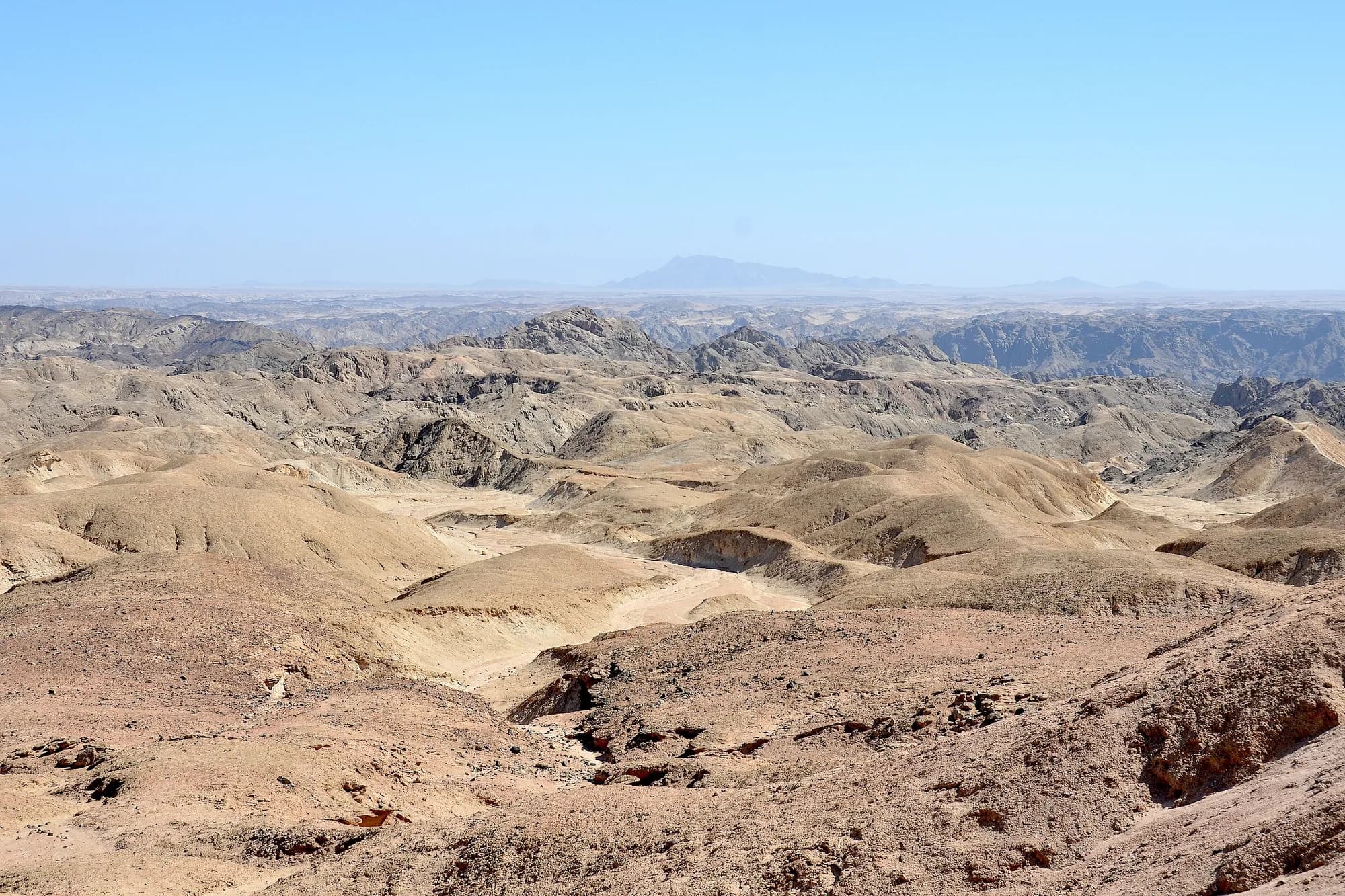
The biggest and least visited part of the park is the gravel between the dunes and the coast: lichen-encrusted plains, inselbergs, ephemeral rivers and the Kuiseb Canyon. MEFT calls out lichen-encrusted gravel plains and stark inselbergs in the same sentence as the Sossusvlei dunes, which is a fair signal of how the ministry weights them and how differently visitors do.
- The Welwitschia Trail is named by NWR as one of the park's six key features, alongside Sossusvlei and Sandwich Harbour. It is the route across the plains to stands of Welwitschia mirabilis, which MEFT names among the park's plants.
- The Kuiseb River is the park's spine and its archaeological record. MEFT says evidence of Stone Age life in the Kuiseb dates back 200,000 years.
- The Topnaar people still live along the Kuiseb inside the park. MEFT records that they were guaranteed rights of residence by Queen Victoria more than a century ago. This is a park with residents, which is not true of Etosha.
- The Gobabeb Training and Research Centre sits on the banks of the Kuiseb, and MEFT credits it with the amount of desert research done here. It is the institutional reason the Namib is one of the best-studied deserts on earth.
- Fifty-two campsites are scattered across the Central Namib. MEFT states that permits are required for camping at them. They are the only way to sleep in this section and they are not NWR beds.
There are uranium mines inside this park
MEFT states plainly that the discovery of uranium has resulted in exclusive prospecting licences being issued across most of the western part of the park north of the Kuiseb River, and that a number of uranium mines have been established within the park. It is an unusual thing for a ministry to publish on a tourism page and it is worth knowing before you picture the Namib section as untouched wilderness.
MEFT — Namib-Naukluft Park park profile
Read 28 September 2026. The Ministry of Environment, Forestry and Tourism's own page for the park. It carries the proclamation history, the park area, the vegetation types and biomes, a short wildlife and bird list, a one-line summary of each accommodation area including the Central Namib, and the note that permits are required for camping there. It gives no gate names, no gate times, no fee figures and no map.
https://www.meft.gov.na/national-parks/namib-naukluft-park/224/NWR — Namib-Naukluft Park
Read 28 September 2026. Namibia Wildlife Resorts' own landing page for the park. It names the key features, gives the park area, describes the dunes and Dead Pan, and lists the Naukluft wildlife. It lists exactly three NWR properties in the park: Naukluft Camp, Sesriem Campsite and Sossus Dune Lodge.
https://www.nwr.com.na/namib-naukluft-park/How far apart these really are
The only distances either organisation publishes for this park are on NWR's three resort pages, and they are distances to key areas rather than between sections. They are worth tabulating anyway, because they are the only official numbers that exist and because they do not entirely agree with each other.
Kilometres by road, as NWR publishes them
| From | Sesriem Campsite | Sossus Dune Lodge | Naukluft Camp |
|---|---|---|---|
| Windhoek | 334 km | 340 km | 253 km |
| Sossusvlei | 60 km | Not listed | 100 km |
| Etosha National Park | 750 km | 756 km | 669 km |
| /Ai-/Ais Hot Springs | Not listed | 619 km | Not listed |
"Not listed" means NWR does not publish that pairing, not that no road exists. Note that Naukluft Camp is 81 km closer to Windhoek than Sesriem is, which makes it the more natural first night out of the capital and almost nobody uses it that way.
NWR's figures do not reconcile, and we are not going to correct them
Two examples. NWR gives Naukluft Camp as 100 km from Sossusvlei and Sesriem Campsite as 60 km from Sossusvlei, which would put Naukluft 40 km from Sesriem by road; but the GPS coordinates NWR publishes for the two camps in its own fact sheet are about 51 km apart in a straight line, by our arithmetic, and a road cannot be shorter than that. Separately, NWR gives Sesriem as 750 km from Etosha and, on its Okaukuejo page, gives Okaukuejo as 774 km from Sossusvlei — but Sossusvlei is 60 km beyond Sesriem, so those two figures are about 36 km apart on the same journey. We found the same problem at Etosha. Treat every figure in the table as indicative.
NWR — Sesriem Campsite
Read 28 September 2026. Each resort page carries its own rate table in Namibian dollars, split into two seasons — July 2026 to October 2026, and November 2026 to June 2027 — together with unit counts, an activity price list, facilities, contact numbers and distances from key areas. Accommodation rates are per person sharing unless the row says single.
https://www.nwr.com.na/resorts/sesriem-campsite/NWR — Sossus Dune Lodge
Read 28 September 2026. Each resort page carries its own rate table in Namibian dollars, split into two seasons — July 2026 to October 2026, and November 2026 to June 2027 — together with unit counts, an activity price list, facilities, contact numbers and distances from key areas. Accommodation rates are per person sharing unless the row says single.
https://www.nwr.com.na/resorts/sossus-dune-lodge/NWR — Naukluft Camp
Read 28 September 2026. Each resort page carries its own rate table in Namibian dollars, split into two seasons — July 2026 to October 2026, and November 2026 to June 2027 — together with unit counts, an activity price list, facilities, contact numbers and distances from key areas. Accommodation rates are per person sharing unless the row says single.
https://www.nwr.com.na/resorts/naukluft-camp/NWR — Fact Sheets 2024
Read 28 September 2026. A single PDF with a page for every NWR property, linked from the "Fact Sheets" button on each resort page. It repeats most of what the website says and adds GPS coordinates and, in places, a different phone number and a different booking rule from the live page. It is dated 2024 and the website is not, so where the two disagree we print both rather than choosing.
https://www.nwr.com.na/wp-content/uploads/2024/07/NWR-Fact-Sheets-2024.pdfWhat we could not verify
No map, no boundaries, no section names on paper
MEFT publishes no map of Namib-Naukluft, no management plan for it — there are published Management Plan 2 documents for eight other Namibian parks and none for this one — and no formal list of its sections. The four-part division on this page is how the park is universally described and how its own two authorities describe its features, but it is our organisation of their material rather than a departmental structure. There are no numbered zones, no gate names in any official source, and no road numbers we could cite.
MEFT — Namib-Naukluft Park park profile
Read 28 September 2026. The Ministry of Environment, Forestry and Tourism's own page for the park. It carries the proclamation history, the park area, the vegetation types and biomes, a short wildlife and bird list, a one-line summary of each accommodation area including the Central Namib, and the note that permits are required for camping there. It gives no gate names, no gate times, no fee figures and no map.
https://www.meft.gov.na/national-parks/namib-naukluft-park/224/NWR — Namib-Naukluft Park
Read 28 September 2026. Namibia Wildlife Resorts' own landing page for the park. It names the key features, gives the park area, describes the dunes and Dead Pan, and lists the Naukluft wildlife. It lists exactly three NWR properties in the park: Naukluft Camp, Sesriem Campsite and Sossus Dune Lodge.
https://www.nwr.com.na/namib-naukluft-park/