
Sri Lanka / Minneriya / Zones — Minneriya
Zones — Minneriya
There are no numbered blocks here and no zone to choose between. Minneriya is one reservoir, the ground that emerges as it empties, and the dry-zone forest that ring-fences it — and almost everything you came for happens on the first two.
There are no blocks to book
Readers arriving from this site's Yala pages should put the whole idea aside. Yala is administered as five numbered blocks with separate gates, and which one you are in is settled before you leave town. Minneriya has nothing of the sort. There is one park, one main entrance, and a track network that all vehicles share. You do not choose a zone, you are not allocated one, and no operator can sell you a better one.
What does vary, enormously, is where within the park the drive spends its time, and that is decided by the water. The reservoir's edge moves through the year by hundreds of metres, and the productive ground moves with it. A driver who knows this landscape is not choosing a zone; he is choosing where the shoreline is this week.
What this changes about planning
It removes an entire category of decision, and replaces it with a different one. At Yala the question is which block. At Minneriya the question is which park — Minneriya, Kaudulla or Hurulu — and that is a question about the whole landscape rather than about this reserve's internal geography. Everything on the permits and booking pages about the second gate is the Minneriya equivalent of Yala's block choice.
The tank bed and the shoreline
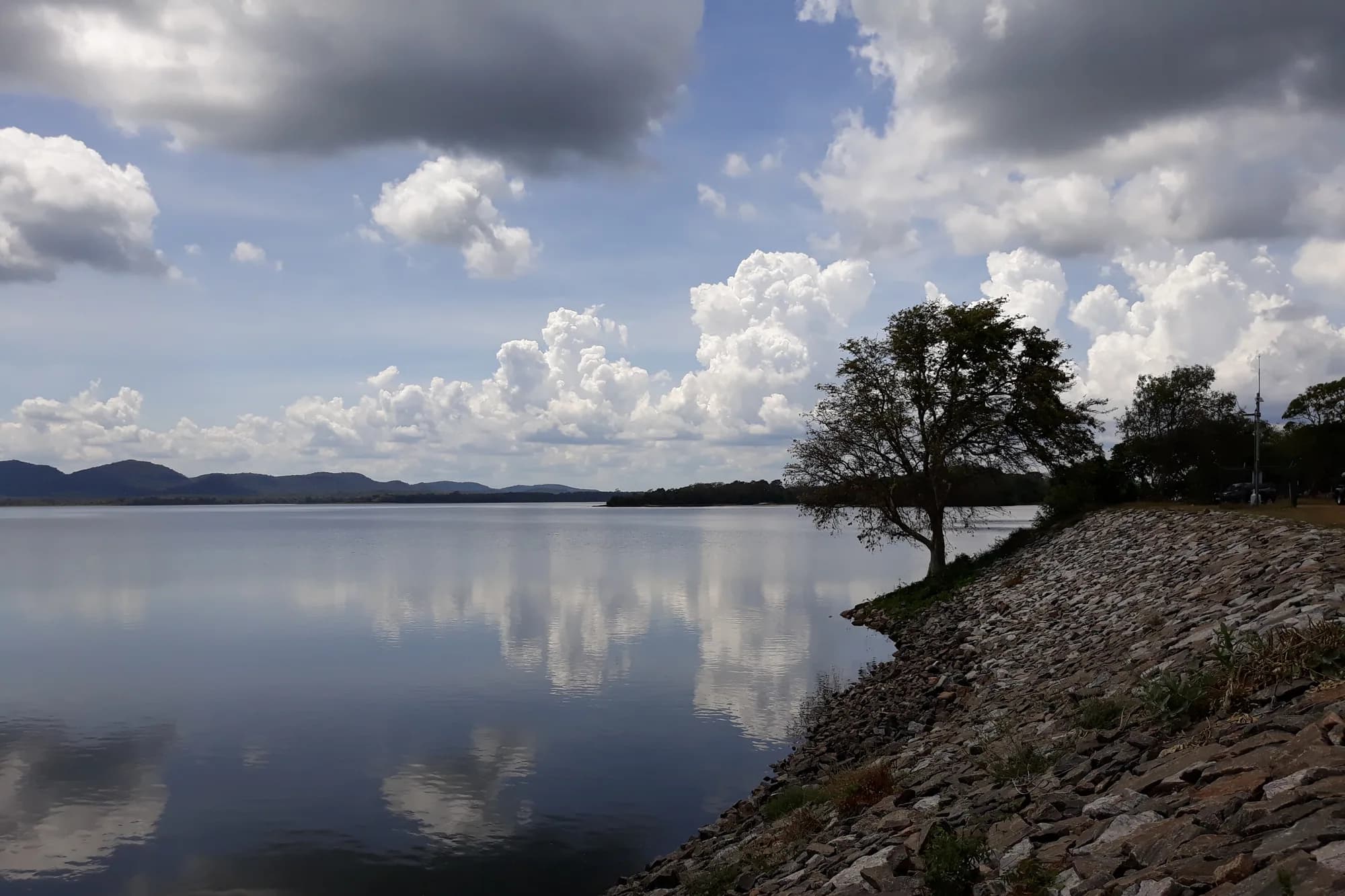
The Minneriya tank is the park. As the dry season deepens and the water is drawn down, a broad expanse of the bed is exposed, and grass comes up on the silt — fresh, green, nutritious and in enormous quantity, at exactly the time of year when there is nothing to eat anywhere else in the dry zone. That grass is the reason hundreds of elephants walk in from the surrounding forest, and it is why the Gathering is an event with a location rather than a season with a mood.
The two halves of a Minneriya drive
| Ground | What it is | What happens there |
|---|---|---|
| The exposed tank bed | Reservoir floor, uncovered as the water falls, greened with new grass | The Gathering itself — feeding herds, in the open, in the late afternoon |
| The shoreline and shallows | The moving water's edge | Drinking, bathing, mud, and most of the waterbirds |
| The scrub and grassland fringe | Between bed and forest | Chital, buffalo, and elephants moving between cover and feed |
| The dry-zone forest | The bulk of the park's area | Where the elephants spend the day, and where you mostly will not see them |
Editorial geography describing how the park is driven. We could not obtain a departmental zoning map or a track map, and no distances are given.
The bed is the whole show, and it moves
In a good year the water is low, the grass is wide and the herds are out on it at four in the afternoon. In a bad year the bed is under water, the grass is drowned, and the elephants are somewhere else. That is not weather; as the best-time page sets out at length, it has been a question of upstream water management since 2019. The geography of this park is only half natural.
The forest, and what the park is made of
Most of Minneriya's area is not tank bed. The park runs to 8,889.4 hectares, roughly 89 square kilometres, and the great majority of it is dry-zone vegetation of several kinds: secondary forest of varying canopy height, scrub, grassland, rocky outcrops, wetland, and abandoned chena — shifting-cultivation clearings that have gone back to bush. There are also teak and eucalyptus plantations inside the boundary, a reminder that this was a working landscape long before it was a national park.
Minneriya National Park, the basic facts
| Figure | Source | |
|---|---|---|
| Declared a wildlife sanctuary | 1938 | Wikipedia, read 28 September 2026 |
| Declared a national park | 12 August 1997 | Wikipedia, read 28 September 2026 |
| Area | 8,889.4 hectares (about 88.9 sq km) | Wikipedia, read 28 September 2026 |
| Annual rainfall | 1,500 to 2,000 mm | Wikipedia, read 28 September 2026 |
| Temperature range | 20.6 to 34.5 degrees C | Wikipedia, read 28 September 2026 |
| Distance from Colombo | 182 km | Wikipedia, read 28 September 2026 |
Every figure in this table comes from Wikipedia rather than from the Department of Wildlife Conservation, because the department publishes nothing we could reach. They are printed with that provenance attached rather than laundered into unattributed fact.
The named trees of the dry-zone forest here include palu, Manilkara hexandra, the same species whose fruiting drives sloth bear behaviour at Yala; kumbuk, Terminalia arjuna, along the water; satinwood, neem and the sacred fig. None of that is why anyone books Minneriya, and all of it is what you are driving through for the first half of the afternoon.
Minneriya National Park, English Wikipedia
Read 28 September 2026. Used for the park's designation dates, its area, its species counts and its climate figures, none of which we could obtain from the Department of Wildlife Conservation itself. Its own elephant figures are contradictory — it gives around 150 to 200 in one place and reports of as high as 700, attributed to Amaranayake 2007, in another — and both are printed in the wildlife page's table of counts rather than reconciled.
https://en.wikipedia.org/wiki/Minneriya_National_ParkThe tank is a third-century irrigation work
The reservoir the elephants come to is not a natural lake and it is not a modern dam. It was built by King Mahasen, who ruled at Anuradhapura between 276 and 303, as the largest of the sixteen great tanks the Mahavamsa credits him with. It is still in use, as irrigation infrastructure, seventeen centuries later. Very few wildlife spectacles anywhere in the world happen on a piece of working engineering that old.
The Minneriya tank
| Figure | |
|---|---|
| Built by | King Mahasen, who ruled 276 to 303 |
| Water area | 4,670 acres (18.9 sq km) |
| Storage capacity | 20,000,000,000 imperial gallons |
| Dam | 13 metres tall, 2 kilometres long |
| Fed from | The Amban River, a Mahaveli tributary 48 km away, via the Elahera canal |
| Elahera canal built by | King Vasabha, who ruled 65 to 109 |
From the English Wikipedia article on the Minneriya Tank, read 28 September 2026, which rests in turn on the Mahavamsa — a sixth-century monastic chronicle, not an engineering survey. Ancient dimensions of this kind are attributions rather than measurements, and the modern reservoir has been worked on repeatedly since.
This matters to a visitor for a reason beyond interest. The tank is an irrigation asset first and a wildlife spectacle second, and it is managed by people whose statutory job is water for farms. Everything that has gone wrong with the Gathering since 2019 follows from that single fact, and a reader who understands the tank as infrastructure will understand the rest of this park immediately.
Minneriya Tank, English Wikipedia
Read 28 September 2026. Used for the tank's construction, dimensions and capacity, and for the Elahera canal. The chronicle behind these claims is the Mahavamsa, which is a sixth-century monastic history rather than an engineering record, and the article says so.
https://en.wikipedia.org/wiki/Minneriya_TankOne landscape, three gates
The elephants do not treat Minneriya as a unit and neither should you. The functional habitat is a block of dry-zone country containing at least three reservoirs and the forest between them, and the herds move around it through the year. The administration is less joined up than the ecology: Minneriya and Kaudulla are national parks under the Department of Wildlife Conservation, Hurulu Eco Park sits inside a biosphere reserve under the Department of Forest Conservation, and each has its own gate and its own money.
The three places an operator may take you
| Place | Status and authority | Key facts |
|---|---|---|
| Minneriya National Park | National park, Department of Wildlife Conservation | Declared 12 August 1997; 8,889.4 ha; the Mahasen tank at its centre |
| Kaudulla National Park | National park, Department of Wildlife Conservation | Declared 1 April 2002, the island's 15th; 6,900 ha; also one of Mahasen's sixteen tanks, rebuilt in 1959 |
| Hurulu Eco Park | Carved from Hurulu Forest Reserve, Department of Forest Conservation | Biosphere reserve designated January 1977; entrance about 2.7 km from Habarana Junction on the Trincomalee road |
Areas and dates are from the English Wikipedia articles on each, read 28 September 2026; the Hurulu distance is from a third-party travel site, AmazingLanka, and is unconfirmed. Wikipedia gives the Hurulu forest reserve as 25.50 sq km while AmazingLanka gives 19,500 hectares for the reserve; they do not agree and we have not chosen between them.
The connection between the first two is formal as well as ecological: the Kaudulla–Minneriya jungle corridor was declared a wildlife sanctuary in 2004, which is the state acknowledging in law what the elephants had been doing anyway. Wasgamuwa, further south, is the third point of the wider movement that older accounts describe, with elephants moving up from there in the dry season.
Kaudulla National Park, English Wikipedia
Read 28 September 2026. Used for Kaudulla's designation date and area, for the 2004 declaration of the Kaudulla–Minneriya jungle corridor as a wildlife sanctuary, and for the count of 211 elephants at Kaudulla attributed to Bandara 2008. Cited because Kaudulla is the park a Minneriya visitor is most often taken to instead, so its facts belong on a Minneriya page.
https://en.wikipedia.org/wiki/Kaudulla_National_ParkHurulu Forest Reserve, English Wikipedia
Read 28 September 2026. Used for the reserve's biosphere designation in January 1977, its area of 25.50 square kilometres and — the point that matters — its managing authority, the Department of Forest Conservation rather than the Department of Wildlife Conservation.
https://en.wikipedia.org/wiki/Hurulu_Forest_ReserveWhere a drive actually goes
A typical afternoon is two movements. The first is a transit through scrub and forest from the entrance towards the tank, which takes a while and shows you chital, peafowl, perhaps buffalo, and a great deal of dry bush. The second is the tank bed, where the vehicles converge and the afternoon actually happens. Most visitors' memory of Minneriya is entirely the second part and most of the clock is the first.
- The transit is not wasted. It is where the park's smaller mammals and much of the bird list live, and where a tracker will point out things nobody else in the jeep noticed.
- The productive shoreline moves through the season, so the route changes from week to week. A driver going straight to last month's spot is a driver who has not asked anyone.
- Late is better than early. If you have any say over the timing, spend the last of the light on the bed rather than starting the transit out.
- There are no hides, no towers and no walking. You watch from the vehicle.