
Sri Lanka / Wilpattu / Zones — Wilpattu
Zones — Wilpattu
The name means the land of lakes, and that is the whole organising fact. There are no numbered visitor blocks here and no circuit; there are villus, there is forest between them, and a drive is a decision about which water to visit.
Why Wilpattu has no visitor blocks
Yala is administered and visited as numbered blocks, and the first question a Yala visitor asks is which one they are going to. Wilpattu is administratively divided too — the department's 2018 guide records that the park consists of five blocks gazetted between 1938 and 1973 — but that division is a history of how the park was assembled rather than a menu you choose from. No operator sells you Wilpattu Block 3. The unit of a Wilpattu visit is the villu.
That is not a quirk of marketing. It follows from the ground. Around seventy per cent of the park is dry evergreen forest and deciduous thorn scrub, which is to say that most of Wilpattu is trees you cannot see into. The open ground — the places where an animal is visible and where animals therefore go — is the villus and the narrow grassy margins around them. A drive is a route from one piece of open ground to the next, through a great deal of closed ground.
What this changes about planning
At Yala you choose a block and a session and the rest follows. At Wilpattu you choose a gate and a length of day, and then the day itself is decided in the park, by which villus are holding water and what the tracker heard on the way in. It is a more improvisational park and it rewards a driver who knows it, which is why the advice on our booking page is to ask for someone who works Wilpattu rather than someone who works Sri Lanka.
Wilpattu National Park Information Guide — published by the Wilpattu National Park & Influence Zone Management Project, Department of Wildlife Conservation and GIZ Sri Lanka, author GOPA / Dr Nishanthi Perera, copyright 2018
Read in full on 28 September 2026. This is the closest thing to an official Wilpattu visitor document we could obtain: the Department of Wildlife Conservation co-published it and its Battaramulla address and telephone number are on the imprint alongside GIZ's. It carries no fee schedule. It is dated 2018, so facilities, counts and seasonal statements in it are eight years old and are labelled as 2018 figures wherever they appear on these pages.
https://snrd-asia.org/wp-content/uploads/2021/08/Visitor-information-guide-ENG.pdfWhat a villu actually is
A villu is not a tank and not a pond. The department's own guide defines it precisely: a flat, shallow depression containing rain water, usually with no water inlet or outlet, rimmed by sand dunes or sandy plains. That last clause is the one that matters. A tank in the Sri Lankan dry zone is an ancient irrigation reservoir, built by people, fed by a channel. A villu is a natural basin that fills when it rains and empties when it does not, with nothing running into it and nothing running out.
Villus, as the department's 2018 guide describes them
| Property | As stated | Why it matters on a drive |
|---|---|---|
| Formation | Flat, shallow depressions containing rain water, usually with no inlet or outlet | Each one rises and falls on its own. Two villus a few kilometres apart can be in completely different conditions |
| Rim | Rimmed by sand dunes or sandy plains | The sand rim is the open margin animals cross, and it holds tracks beautifully |
| Size | From less than 10 ha to 160 ha | A sixteen-fold range. Some are a puddle in a clearing, some are a lake you cannot see across |
| Water chemistry | Freshwater, brackish or saline, depending on the villu | Which animals use which water differs accordingly; this is not one habitat repeated sixty times |
| Where they are | In the centre and north-west of the national park | They are not spread evenly, and they are not near the gate |
All five properties are stated in the Department of Wildlife Conservation and GIZ visitor guide of 2018.
Fresh, brackish and saline, with names attached
The guide gives worked examples rather than leaving the distinction abstract: Kumbuk Vila as a freshwater villu, Kali Villu as a brackish one and Kokkari Villu as a saline one. That is the kind of detail that changes a drive. A saline villu and a freshwater villu a short way apart will hold different birds and draw different mammals, and if your tracker is taking you from one to another rather than round a loop, this is why.
Wilpattu National Park Information Guide — published by the Wilpattu National Park & Influence Zone Management Project, Department of Wildlife Conservation and GIZ Sri Lanka, author GOPA / Dr Nishanthi Perera, copyright 2018
Read in full on 28 September 2026. This is the closest thing to an official Wilpattu visitor document we could obtain: the Department of Wildlife Conservation co-published it and its Battaramulla address and telephone number are on the imprint alongside GIZ's. It carries no fee schedule. It is dated 2018, so facilities, counts and seasonal statements in it are eight years old and are labelled as 2018 figures wherever they appear on these pages.
https://snrd-asia.org/wp-content/uploads/2021/08/Visitor-information-guide-ENG.pdfHow many villus there are — the sources disagree
Almost every account of Wilpattu opens with a number of villus, and almost none of them agree. We are not going to pick the most attractive one. Here is what each source we read actually says, with what it is counting, because the discrepancy is mostly about that.
Published counts of Wilpattu's waterbodies
| Count | Source | What is being counted |
|---|---|---|
| More than 40 | Department of Wildlife Conservation and GIZ visitor guide, 2018, summary page | Described as "unique villu ecosystems" |
| Some 40, seasonal or permanent | The same guide, main text | Lakes known as villu, rimmed by sand dunes or sandy plains |
| Nearly 106 lakes and tanks | English Wikipedia, read 28 September 2026 | Lakes (willu) and tanks together — which would include the man-made irrigation tanks, not only the natural villus |
| Around 60 | The figure in general circulation, including in this site's own summary of the park | Usually given as villus, with no count method attached |
The department's own document is the lowest and the most specific about what it counts; the highest figure explicitly lumps natural villus in with man-made tanks, of which Wilpattu has a great many — the same guide notes irrigation tanks in the park up to 2,000 years old. That probably accounts for most of the gap. We have not found a source that reconciles them and we are not going to state a single number as fact.
The number is the least interesting thing about them anyway
Whether there are forty or a hundred, you will visit somewhere between two and eight of them in a day. What decides your drive is not the total but which ones are holding water in the month you are there, and that is a question for your tracker on the morning rather than for a guidebook.
Wilpattu National Park Information Guide — published by the Wilpattu National Park & Influence Zone Management Project, Department of Wildlife Conservation and GIZ Sri Lanka, author GOPA / Dr Nishanthi Perera, copyright 2018
Read in full on 28 September 2026. This is the closest thing to an official Wilpattu visitor document we could obtain: the Department of Wildlife Conservation co-published it and its Battaramulla address and telephone number are on the imprint alongside GIZ's. It carries no fee schedule. It is dated 2018, so facilities, counts and seasonal statements in it are eight years old and are labelled as 2018 figures wherever they appear on these pages.
https://snrd-asia.org/wp-content/uploads/2021/08/Visitor-information-guide-ENG.pdfWilpattu National Park, English Wikipedia
Read 28 September 2026. Cited here only for figures it attributes to a named survey or study, and always labelled as such, because we could not reach the primary source: the journal paper behind the leopard density figure returned HTTP 403 on the same day. Where Wikipedia and the department's own 2018 guide disagree — and on the number of villus and the closure dates they do — both are printed and the disagreement is stated.
https://en.wikipedia.org/wiki/Wilpattu_National_ParkThe villus and places drivers name
A handful of names come up on every Wilpattu day, and knowing them makes the driver's route legible rather than random. These are the ones that recur in the department's guide and in the naming used inside the park.
Named places inside Wilpattu
| Place | What it is | Why it comes up |
|---|---|---|
| Hunuwilagama | The main entrance, on the Anuradhapura side | Where the ticket is bought and where the museum is |
| Eluwankulama | The second ticketing counter, on the Puttalam side | The other way in, and the one almost nobody mentions |
| Kali Villu | A brackish villu | Named in the department's guide as the worked example of brackish water; one of the best-known villus in the park |
| Kumbuk Vila | A freshwater villu | Named twice in the guide — as the freshwater example and as a designated place where you may leave the vehicle |
| Kokkari Villu | A saline villu | The guide's example of saline water; a different bird list from the freshwater villus |
| Borupan Wila | An open wila in the villu country | One of the open locations used for game viewing; a name you will hear on the radio and from the tracker |
| Maradanmaduwa | A tank, with Galbendi Neeravia to its north-east | A landmark in the park's interior and a point of historical reference in the department's guide |
| Periyamaduwa | A named locality in the park's interior | Used as a reference point on the track network rather than as a viewing stop in its own right |
| Kudiramale Point | The coastal headland on the western edge | The other designated place in the guide where you may get out of the vehicle |
Hunuwilagama, Eluwankulama, Kali Villu, Kumbuk Vila, Kokkari Villu, Maradanmaduwa and Kudiramale Point are all named in the Department of Wildlife Conservation and GIZ guide of 2018. Borupan Wila and Periyamaduwa are names in local use inside the park which we could not find in that document; they are marked as such below. No distance or drive time between any of these places is given, because we could not source one.
Wilpattu National Park Information Guide — published by the Wilpattu National Park & Influence Zone Management Project, Department of Wildlife Conservation and GIZ Sri Lanka, author GOPA / Dr Nishanthi Perera, copyright 2018
Read in full on 28 September 2026. This is the closest thing to an official Wilpattu visitor document we could obtain: the Department of Wildlife Conservation co-published it and its Battaramulla address and telephone number are on the imprint alongside GIZ's. It carries no fee schedule. It is dated 2018, so facilities, counts and seasonal statements in it are eight years old and are labelled as 2018 figures wherever they appear on these pages.
https://snrd-asia.org/wp-content/uploads/2021/08/Visitor-information-guide-ENG.pdfThe forest between them
Most of a Wilpattu day is spent in the seventy per cent that is not villu. Dry evergreen forest of differing heights and deciduous thorn scrub, on flat ground from sea level to a maximum of 240 metres, with 621 recorded plant species and the large palu tree conspicuous through it. It is beautiful and it is nearly opaque. You will drive for half an hour seeing nothing but trunks, and then arrive at an open sand-rimmed lake with everything in the neighbourhood standing at the edge of it.
That rhythm — long closed stretches punctuated by short open ones — is the single biggest difference between a Wilpattu drive and a Yala drive, and it is the mechanism behind everything else on these pages. It is why the sightings are harder. It is why the park feels empty even when it is not. It is why the tracker matters. And it is why people who came expecting Yala with fewer jeeps come away describing a different activity altogether.
The track network is not a circuit
There is no signed loop to complete. The tracks connect villus, and a day is assembled from them on the morning. This is worth saying because visitors who have driven Etosha's waterhole circuit or an Indian reserve's numbered routes expect a route to exist. Here the route is a decision, and a good driver's day looks nothing like a poor one's.
Wilpattu National Park Information Guide — published by the Wilpattu National Park & Influence Zone Management Project, Department of Wildlife Conservation and GIZ Sri Lanka, author GOPA / Dr Nishanthi Perera, copyright 2018
Read in full on 28 September 2026. This is the closest thing to an official Wilpattu visitor document we could obtain: the Department of Wildlife Conservation co-published it and its Battaramulla address and telephone number are on the imprint alongside GIZ's. It carries no fee schedule. It is dated 2018, so facilities, counts and seasonal statements in it are eight years old and are labelled as 2018 figures wherever they appear on these pages.
https://snrd-asia.org/wp-content/uploads/2021/08/Visitor-information-guide-ENG.pdfThe edges — rivers, coast and the neighbours
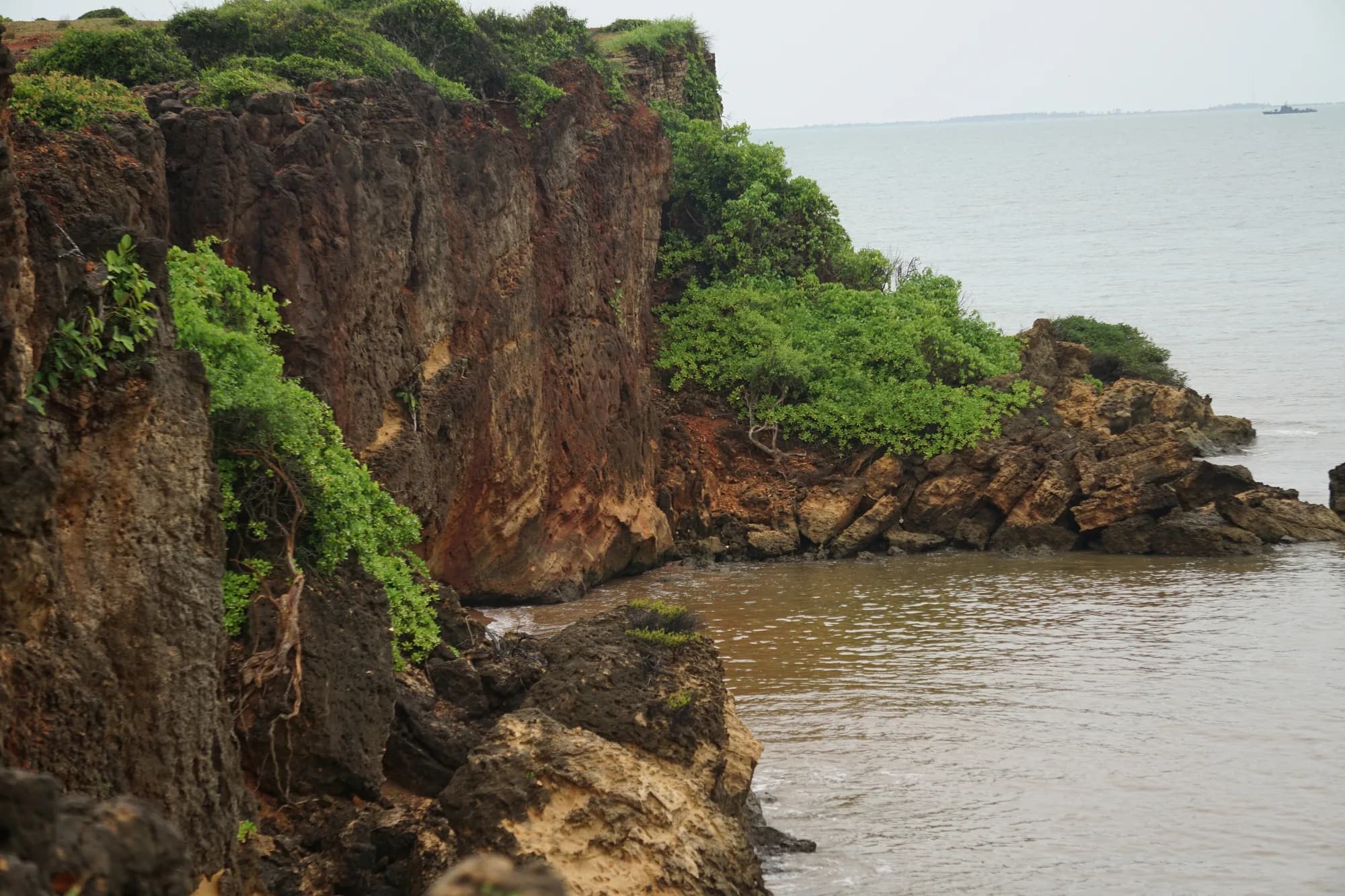
Wilpattu is not a fenced island of habitat. The department's guide sets out its boundaries precisely, and they explain a good deal about why the park holds what it holds: the Modaragam Aru and Aravi Aru rivers to the north, the Kala Oya to the south, and Portugal Bay, Dutch Bay and the open sea to the west. It is a park with a coastline.
What Wilpattu adjoins, as stated in the 2018 guide
| Edge | Boundary | Note |
|---|---|---|
| North | Modaragam Aru and Aravi Aru | Wilpattu West Sanctuary and the 40,000 ha Mavillu Conservation Forest lie along this side |
| South | Kala Oya | The 21,933 ha Thabbowa Sanctuary adjoins here; the Kala Oya estuary holds one of Sri Lanka's largest mangrove forests |
| West | Portugal Bay, Dutch Bay and the open sea | Shallow, productive water with sea grass beds; Kudiramale Point is on this edge |
| Districts | Puttalam and Anuradhapura, bordering Mannar and Vavuniya | Which is why the two ticket counters sit in two different districts |
From the Department of Wildlife Conservation and GIZ visitor guide, 2018. The park and its bordering sea and islands within 10 km offshore, together with the Mahavilachchiya tank, were declared a wetland of international importance under the Ramsar Convention in 2013.
The practical consequence of those neighbours is that Wilpattu is the core of a much larger protected landscape rather than a reserve on its own. Animals move across the boundary, particularly elephants, and the guide describes this area as one of the most important elephant habitats in the country. It is also why the park can be as large as it is and still feel like the middle of something bigger.
Wilpattu National Park Information Guide — published by the Wilpattu National Park & Influence Zone Management Project, Department of Wildlife Conservation and GIZ Sri Lanka, author GOPA / Dr Nishanthi Perera, copyright 2018
Read in full on 28 September 2026. This is the closest thing to an official Wilpattu visitor document we could obtain: the Department of Wildlife Conservation co-published it and its Battaramulla address and telephone number are on the imprint alongside GIZ's. It carries no fee schedule. It is dated 2018, so facilities, counts and seasonal statements in it are eight years old and are labelled as 2018 figures wherever they appear on these pages.
https://snrd-asia.org/wp-content/uploads/2021/08/Visitor-information-guide-ENG.pdfWhere visitors actually go, and the rest of it
Visitor use is concentrated in a fraction of the park. Almost everyone enters at Hunuwilagama, works the villu country in the centre and north-west, and comes back the same way. Kudiramale Point on the west coast is a longer commitment. The northern and southern extremities, the coastal strip and the areas towards the Mannar side see very little tourism.
Matching the day to the visitor
| If you are | Ask for | Because |
|---|---|---|
| On one day at Wilpattu | A full day through Hunuwilagama, working the villus | It is the highest concentration of open ground and the best odds the park offers in one entry |
| Here mainly for birds | A day weighted to the villus, with time sat still at two or three of them | 253 bird species are recorded for the park and the water is where they are |
| Here for sloth bear | June or July, and a driver who will work the palu trees | The palu is conspicuous through the forest and the fruiting season is the window |
| Staying inside the park | A bungalow or campsite booked in advance with the department | It removes the transit from both ends of the day, which is the main cost of a Wilpattu visit |
| Coming from the west coast | Eluwankulama, and confirm it is open and staffed | It is the other ticketing counter and it saves the run round to Anuradhapura |
| Expecting Yala with fewer jeeps | To reconsider what you want | This is a forest park with hard sightings, not a quieter version of an open one |