
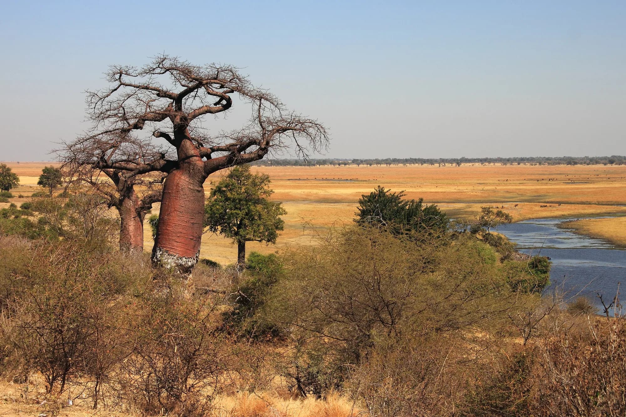
Botswana / Chobe / Zones — Chobe
Zones — Chobe
Chobe is not one park with a busy end. It is four areas separated by hours of sand track, and the one everybody sees is a strip along the northern edge.
The four areas, and whose division this is
The division is not ours. Botswana Tourism Organisation's own park page says Chobe comprises four distinct geographical areas: the Chobe riverfront, the Ngwezumba pans, Savute and Linyanti. Botswana's UNESCO tentative-list submission of 2010 divides it the same four ways in different words — the Serondela area or Chobe riverfront in the extreme north-east, the Savuti Marsh, the Linyanti Marsh in the north-west corner, and a hot dry hinterland of Nogatsaa grass woodland between the two marshes, which it says retains water well into the harsh dry season and so attracts a profusion of game between August and October.
Basic facts about the park, and the sources that disagree
| Item | What each source says |
|---|---|
| Area | 11,000.0 km2 reported in the World Database on Protected Areas, against approximately 11,700 sq.km on both Botswana Tourism Organisation pages and in Botswana's UNESCO submission |
| Year established | 1968 in the protected areas database, 1968 on the tourism body's park page, and 1967 on the tourism body's other Chobe page, where it is also called the first national park established in Botswana |
| IUCN management category | Ib, Wilderness Area, per the protected areas database. Not the category II most national parks carry |
| Management authority | Department of Wildlife and National Parks, per the protected areas database |
| Management plan | 'Not Reported' in the protected areas database |
The 700 square kilometre gap between the database and the tourism body is not resolvable from anything we could read, and we publish both. The management-plan line is the one worth pausing on: the global register of protected areas holds no record that this park has a published management plan, which is consistent with everything else on this site's Chobe pages.
The four areas at a glance
| Area | Character | Vehicle | Public campsite |
|---|---|---|---|
| Chobe riverfront | Permanent river, floodplain and riverine woodland along the northern boundary | Any vehicle on the main track in the dry season | Ihaha |
| Savute, or Savuti | Marsh, a channel that starts and stops, and open country; the predator ground | 4x4, and deep sand | Savuti |
| Linyanti | Swamp and river on the western boundary, shared with the Kwando system | 4x4 | Linyanti |
| Ngwezumba pans, including Nogatsaa | Dry interior woodland with clay pans and pumped water points | 4x4 | None |
The three campsites are named in a February 2025 parliamentary answer and are operated under lease by private companies rather than by the wildlife department. The Ngwezumba interior has no public campsite in that answer, which is part of why it stays as empty as it does.
There is also a real zoning scheme, and almost nobody cites it. The Chobe District Integrated Land Use Plan of 2017 — a UNDP-funded plan prepared for Botswana, written in anticipation of a revision of the park's management plan that the protected areas database still records as not reported — divides the national park into six zones with areas and use intensities attached.
The park's six planning zones, from the 2017 district land use plan
| Code | Zone | Area | Land use designation |
|---|---|---|---|
| CH3-R | CNP River Front | 400 km2 | Conservation and tourism, intensive |
| CH3-SAV | Savuti Marsh and plains | 2,591 km2 | Conservation and tourism, intensive |
| CH3-NG | CNP Ngwezumba valley | 2,070 km2 | Conservation and tourism, intermediate |
| CH3-CHAN | CNP Savuti West and Channel | 1,490 km2 | Conservation and tourism, intermediate |
| CH3-SE | CNP South-East | 2,239 km2 | Conservation and tourism, low |
| CH3-M | CNP Maku Pan | 342 km2 | Conservation and tourism, low |
Areas converted from the plan's hectares. The plan also zones the Chobe Enclave separately, at 886 km2 north and 805 km2 south, and the Chobe Forest Reserve at 1,372 km2, all outside the park.
The number that reframes the whole park
The Chobe River Front zone is 400 square kilometres. The park is 11,000. And the same plan states that roughly 90 per cent of the tourism facilities in the Chobe district — lodges, jeep and boat safaris, roads — are located in and around the Chobe riverfront. Ninety per cent of the tourism is in under four per cent of the park. That single ratio explains the crowding on the river, the emptiness of the interior, and why Chobe feels simultaneously overrun and deserted depending on where you stand.
Treat these as four reserves that share a fee
They are hours apart on sand, they hold different animals, and a trip that covers two of them is two trips. Nobody drives from the riverfront to Savuti for the afternoon. This is the single most common planning mistake on Chobe and it comes from looking at the park as one shape on a map rather than as four places with tracks between them.
Van der Sluis et al. — Chobe District Integrated Land Use Plan, Wageningen Environmental Research report 2813, July 2017
Downloaded and read 28 September 2026. A 182-page UNDP-funded plan prepared for Botswana by Wageningen Environmental Research with the Okavango Research Institute, and the only detailed public planning document for this park. It is not a DWNP publication and it is nine years old — but it carries a full zoning scheme with areas in hectares, tourism-use classifications, road and facility inventories and management recommendations, and it explicitly anticipates the upcoming revision of the Chobe National Park management plan. Its protected-areas table independently confirms the 11,000 square kilometre area and the IUCN Ib category, and identifies the other protected area also named Chobe as the 1,432 square kilometre Chobe Forest Reserve.
https://edepot.wur.nl/419817UNEP-WCMC, Protected Planet — Chobe, World Database on Protected Areas site 600
Read 28 September 2026, the live page and a capture of 4 December 2024 together, because the live page now renders only part of the record. It gives a reported area of 11,000.0 square kilometres, designation National Park, IUCN management category Ib, status Designated with a status year of 1968, governance by a federal or national ministry or agency, and management authority the Department of Wildlife and National Parks. Its management-plan field reads 'Not Reported'. The live citation is dated September 2026. A separate site also named Chobe, number 7450, has a reported area of 1,432 square kilometres and is a different protected area.
https://www.protectedplanet.net/600Botswana Tourism Organisation — Chobe National Park
Read 28 September 2026. The national tourism parastatal's own park page. Source for the 1968 establishment date, the approximately 11,700 square kilometre area, the division of the park into four geographical areas — the Chobe riverfront, the Ngwezumba pans, Savute and Linyanti — and the figure of over 460 bird species recorded. It publishes no entry fee, no gate names, no opening hours and no booking procedure.
https://botswanatourism.co.bw/explore/chobe-national-parkBotswana Tourism Organisation — Chobe
Read 28 September 2026. The organisation's second Chobe page, and it does not agree with its first. It calls Chobe the first national park to be established in Botswana, in 1967, where the park page says 1968; it gives the area as 11,700 sq.km; it says the park is known as the area where four countries meet and then lists five, including Angola, which does not border here; and it puts the largest population of African elephant at an estimated 120,000, which is a national-scale figure attached to one park. We cite it for one thing only: its statement that the water source starts in the Angolan highlands and ends in the Zambezi, and that depending on which tributary fills up first the Chobe River either flows south or north.
https://botswanatourism.co.bw/explore/chobeUNESCO World Heritage Centre — Chobe Linyanti System, Botswana tentative list submission (Ref. 5556, submitted 27 May 2010)
Read 28 September 2026, through a text proxy after the direct URL returned a Cloudflare 403. Botswana's own submission by the Department of National Museum and Monuments, and the traceable origin of two figures repeated everywhere: that Chobe is 'probably known for its spectacular elephant population of over 50 000 today which is actually the highest elephant concentration in Africa', and that about 450 bird species are represented — a figure the same document later gives as about 440. UNESCO's own disclaimer states that sole responsibility for the content of a tentative list lies with the State Party. It is a government assertion from 2010 with no survey attached, not a count.
https://whc.unesco.org/en/tentativelists/5556/Botswana Daily News (BOPA) — 'Ministry awards three campsites', 16 February 2025
Read 28 September 2026. The Minister of Environment and Tourism answering the Chobe MP, Mr Simasiku Mapulanga, in Parliament. Source for the fact that the public campsites at Linyanti, Savuti and Ihaha were advertised and awarded to local companies in 2008 — Linyanti and Savuti to Savuti Khwai Linyanti Group (Pty) Ltd, Ihaha to IT Comms trading as Kwalate — on five-year leases with an option to renew, and that the Linyanti and Savuti leases were renewed for fifteen years in 2024.
https://dailynews.gov.bw/news-detail/84605The Chobe riverfront — the strip everybody means
The river forms the park's northern boundary, and Botswana Tourism Organisation describes it as supporting a diversity and concentration of wildlife unmatched in Botswana. This is the area with a town at one end, a gate ten kilometres from that town, and a boat for every lodge. It is also the area the KAZA survey found about 7,072 elephants on at the start of October 2022, over roughly 1,520 square kilometres.
- Sedudu gate is the riverfront entrance from the Kasane end, and the point at which an electronic ticketing system was proposed in 2019 to control congestion. We have found no evidence it was built.
- Ngoma is the gate at the far, western end of the riverfront, on the Namibian border, open 07h00 to 18h00 as a border post.
- Ihaha is the public campsite on this stretch, and its entrance gate was among the two in Chobe the minister named as recently rethatched in April 2026.
- Serondela is the old settlement area towards the eastern end and the name attached to the riverfront's most-driven ground. Before it was a national park this was trophy-hunting country and a source of teak for the timber industry, both since outlawed. The 2017 district plan dates the timber extraction to 1935 to 1956, and cites work finding the area recovering from it since 1994 — and separately finding, from aerial photographs between 1962 and 1998, that riverine forest had almost completely disappeared west of Serondela by 1998.
- The planners' own name for this zone is the Kasane-Serondela-Ihaha area, and its listed problems are crowding and overuse by tour operators, and riparian vegetation degraded by large numbers of elephants. The plan recommends that the park's decongestion plan for the zone be implemented and further developed, and raises establishing an alternative entrance gate or setting a carrying-capacity limit.
- The floodplain is where the puku are. Botswana's only puku population is a narrow band along this river and nowhere else in the country.
- The riverine thicket is where the Chobe bushbuck are, and there are about 39 of them along roughly 50 km of this frontage on the only objective count ever made.
Kasikili, or Sedudu, and why the boats fly two flags
The island in the river below Kasane is called Kasikili in Namibia and Sedudu in Botswana, and the International Court of Justice awarded it to Botswana on 13 December 1999 after deciding that the northern of the two channels around it is the main channel of the Chobe. The Court recorded the island as approximately 3.5 square kilometres and subject to flooding of several months' duration beginning around March — which is why it looks like a different place depending on when you see it. The Court also recorded the Kasane Communique of May 1992, under which both states undertook that craft of their nationals and flags should have unimpeded navigation in the channels around the island. The boats you see from both banks are there by treaty.
The river itself is stranger than it looks. Botswana's Department of Water Affairs traces the system from the Cuando, rising in the central plateau of Angola, across the Caprivi in a swampy corridor five to ten kilometres wide, into Botswana as the Kwando, terminating into the Linyanti, diverting east to Lake Liambezi — and only from that point is it called the Chobe, which joins the Zambezi at Kazungula. The same paper records that the Linyanti was dry in its terminal section up to Lake Liambezi from the 1980s.
The river that runs both ways
Botswana Tourism Organisation states plainly that depending on which tributary fills up first, the Chobe either flows south or north. The peer-reviewed mechanism is more specific: the Chobe widens as it flows east through the park, then narrows and deepens where it cuts across the Mambova fault to join the Zambezi, and during the annual flood water builds up behind that fault line and spreads outwards across the floodplain, reaching as far upstream as Lake Liambezi in high flood years. The flooded plain you watch elephants crossing is water that has been pushed back up the valley by a geological constriction downstream.
International Court of Justice — Kasikili/Sedudu Island (Botswana/Namibia), judgment of 13 December 1999
Read 28 September 2026. The Court's own overview of the case. Source for the island being approximately 3.5 square kilometres, sitting in the Chobe River which divides around it to north and south, and flooding for several months from about March; for the ruling that the northern channel is the main channel and the island is Botswana's; and for the May 1992 Kasane Communique, under which both states undertook that there should be unimpeded navigation for craft of their nationals and flags in the channels around the island.
https://www.icj-cij.org/case/98Van der Sluis et al. — Chobe District Integrated Land Use Plan, Wageningen Environmental Research report 2813, July 2017
Downloaded and read 28 September 2026. A 182-page UNDP-funded plan prepared for Botswana by Wageningen Environmental Research with the Okavango Research Institute, and the only detailed public planning document for this park. It is not a DWNP publication and it is nine years old — but it carries a full zoning scheme with areas in hectares, tourism-use classifications, road and facility inventories and management recommendations, and it explicitly anticipates the upcoming revision of the Chobe National Park management plan. Its protected-areas table independently confirms the 11,000 square kilometre area and the IUCN Ib category, and identifies the other protected area also named Chobe as the 1,432 square kilometre Chobe Forest Reserve.
https://edepot.wur.nl/419817Kurugundla, Dikgola, Kalaote & Mpho, Department of Water Affairs — 'Restoration and Rehabilitation of Zibadianja Lagoon in Kwando-Linyanti River System in Botswana', Botswana Notes and Records vol. 42, 2010
Read 28 September 2026 from the Department of Water Affairs' own website. Source for the course of the system: the Cuando rises in the central plateau of Angola, crosses the Caprivi in a swampy corridor five to ten kilometres wide, becomes the Kwando at the border, terminates into the Linyanti, diverts east to Lake Liambezi and from that point is called the Chobe, joining the Zambezi at Kazungula. It records that the Linyanti had been dry since the 1980s in its terminal section up to Lake Liambezi, and that the Zibadianja Lagoon last flowed out into the Savuti channel in 1992 — a date that does not agree with Botswana's own UNESCO submission.
https://www.water.gov.bw/images/kwando.pdfFox & Alexander — 'Spatial Distribution and Population Densities of Elephants in a Semi-Arid Savanna', PLoS ONE, 13 October 2015
Read 28 September 2026. Peer-reviewed, and the source for the statement that Chobe National Park provides critical habitat for the largest elephant population in Africa and that elephant numbers in the park have grown at a mean annual rate of between 5.5 and 7 per cent over the past forty years. Its density figures are given in livestock standard units per square kilometre, not elephants per square kilometre — seven LSU per square kilometre across the park, rising to thirteen within five kilometres of the Chobe River — and we quote them only as the ratio between the two, which is the point. The same paper is also the source for the hydrology quoted here: the Chobe widens as it flows east through the park before narrowing and deepening across the Mambova fault to join the Zambezi, and during the annual flood water builds up behind that fault line and spreads outwards across the floodplain, reaching as far upstream as Lake Liambezi in high flood years.
https://journals.plos.org/plosone/article?id=10.1371/journal.pone.0139936Botswana Tourism Organisation — Chobe
Read 28 September 2026. The organisation's second Chobe page, and it does not agree with its first. It calls Chobe the first national park to be established in Botswana, in 1967, where the park page says 1968; it gives the area as 11,700 sq.km; it says the park is known as the area where four countries meet and then lists five, including Angola, which does not border here; and it puts the largest population of African elephant at an estimated 120,000, which is a national-scale figure attached to one park. We cite it for one thing only: its statement that the water source starts in the Angolan highlands and ends in the Zambezi, and that depending on which tributary fills up first the Chobe River either flows south or north.
https://botswanatourism.co.bw/explore/chobeBotswana Daily News (BOPA) — 'Stakeholders call for the increase of protected areas fees', 13 October 2019
Read 28 September 2026. A report of a DWNP consultative meeting in Kasane. Operators quoted in it discuss a non-resident park entry fee of P120 and argue for P150, and one contributor proposes electronic ticketing at Sedudu gate to control congestion. The P120 is the figure the industry was working to in 2019 as reported by the government's own news agency; it is not a tariff either, and it does not reconcile with the P380 the same agency reported in 2026.
https://dailynews.gov.bw/news-detail/52302Botswana Daily News (BOPA) — 'Tourism Levy Not for Park Maintenance', 6 April 2026
Read 28 September 2026. A report of the Minister of Environment and Tourism answering a parliamentary question. Source for the P19,334,200 collected from the tourism bed levy in 2024/25, its ring-fencing into the Tourism Development Fund under paragraph 7 of the Public Finance Management (Tourism Development) Fund Order of 2022, the statement that about P20 million a year has gone into protected-area infrastructure for the past decade, the age of the gate houses, and the rethatching of the Linyanti and Ihaha entrance gates.
https://dailynews.gov.bw/news-detail/90884Savuti, and the channel that turns itself on and off
Savuti is the reason people who have already seen the riverfront come back. It is a marsh in the park's southern interior, fed by a channel from the Linyanti, and the channel is one of the odder pieces of hydrology in Africa.
Botswana Tourism Organisation puts the Savuti channel at about 100 kilometres, running from the Linyanti River into the Savuti Marsh and on towards the Mababe Depression, which the same page says is fed by the Ngwezumba River from the north-east. Over the past hundred years, it says, the channel has inexplicably dried up and recommenced its flow several times, a behaviour it attributes to plate tectonics. The dead trees standing along the channel grew while it was dry and drowned when it flowed again.
What Savuti holds, on the 2022 aerial survey
| Stratum | Area | Flown | Elephants | Sable | Buffalo |
|---|---|---|---|---|---|
| Savuti North | 1,914 km2 | 4 October 2022 | 5,705 | 254 estimated, 20 seen | 773, very wide interval |
| Savuti Marsh | 2,128 km2 | 30 September 2022 | 2,425 | Not quoted | None seen |
| Savuti East | 834 km2 | 30 September 2022 | 1,848 | Not quoted | None seen |
One day's flying per stratum, so an absence is an absence on that day rather than an absence full stop. The elephant intervals are wide — Savuti Marsh is somewhere between 291 and 4,559 — and the survey publishes no park total.
The 2017 district plan is the only source we found that inventories what is actually there. It puts the Savuti Marsh and plains zone at 2,591 square kilometres, 50 km north of Mababe Gate, with 170 kilometres of game viewing roads. The northern part of the zone has two lodges, five mobile sites and one public campsite; there is also a Department of Wildlife and National Parks staff camp, an airstrip, and three artificial watering points near the campsite, at Marabou pan and at Rhino Vlei. The plan describes the area as known for its large packs of lions and wild dog, with cheetah possible, birdlife especially rich in the wet season, and a reputation for an annual zebra migration.
The planners say Savuti is already full
In the plan's own words, the current tourism activity around the marsh and near the channel is at maximum carrying capacity, and it recommends that no new lodges be built there and no further campsites developed. For the zone west of the marsh it recommends that no further development of infrastructure be permitted at all. Savuti feels empty next to the riverfront; the people who planned it in 2017 did not think it had room to grow.
The lions, and what is actually documented
Peer-reviewed fieldwork records Savuti lions switching to hunting elephant in the late dry season from August to November, with the frequency increasing over 1985 to 2005, and a pride of thirty killing one elephant every three days. The authors attribute it to conventional prey thinning out when the migration leaves and to artificial water keeping the elephants sedentary. Real, remarkable, and twenty-year-old fieldwork on a particular pride — go for the predators and treat that behaviour as the thing that might happen.
When the channel last flowed — two Botswana government sources, two answers
| Source | What it says |
|---|---|
| Botswana's UNESCO tentative-list submission, Department of National Museum and Monuments, 27 May 2010 | The channel only began filling with water again in 2008; before that it last flowed from 1967 to 1981, so until recently the resident animals experienced it only as dry grassland |
| Department of Water Affairs, Botswana Notes and Records vol. 42, 2010 | The Zibadianja Lagoon last flowed out into the Savuti channel in 1992, with an aerial photograph of that year showing the outflow |
Both were published by Botswana in the same year and they are eleven years apart on the same event. We publish both and pick neither. The wider hydrology in the water affairs paper is worth knowing alongside it: the Okavango and Zambezi basins were connected by floods down the Selinda Spillway in the 2008/09 and 2009/10 hydrological years, after some thirty years without.
Botswana Tourism Organisation — Savuti and Linyanti
Read 28 September 2026. Source for the Savuti channel running about 100 km from the Linyanti River into the Savuti Marsh and on towards the Mababe Depression, which the page says is fed by the Ngwezumba River from the north-east; for the statement that the channel has inexplicably dried up and recommenced its flow several times over the past hundred years, which the page attributes to plate tectonics; and for the dead trees left standing along it. Also the source for the Linyanti concession being about 1,250 square kilometres.
https://botswanatourism.co.bw/explore/savuti-and-linyantiVan der Sluis et al. — Chobe District Integrated Land Use Plan, Wageningen Environmental Research report 2813, July 2017
Downloaded and read 28 September 2026. A 182-page UNDP-funded plan prepared for Botswana by Wageningen Environmental Research with the Okavango Research Institute, and the only detailed public planning document for this park. It is not a DWNP publication and it is nine years old — but it carries a full zoning scheme with areas in hectares, tourism-use classifications, road and facility inventories and management recommendations, and it explicitly anticipates the upcoming revision of the Chobe National Park management plan. Its protected-areas table independently confirms the 11,000 square kilometre area and the IUCN Ib category, and identifies the other protected area also named Chobe as the 1,432 square kilometre Chobe Forest Reserve.
https://edepot.wur.nl/419817UNESCO World Heritage Centre — Chobe Linyanti System, Botswana tentative list submission (Ref. 5556, submitted 27 May 2010)
Read 28 September 2026, through a text proxy after the direct URL returned a Cloudflare 403. Botswana's own submission by the Department of National Museum and Monuments, and the traceable origin of two figures repeated everywhere: that Chobe is 'probably known for its spectacular elephant population of over 50 000 today which is actually the highest elephant concentration in Africa', and that about 450 bird species are represented — a figure the same document later gives as about 440. UNESCO's own disclaimer states that sole responsibility for the content of a tentative list lies with the State Party. It is a government assertion from 2010 with no survey attached, not a count.
https://whc.unesco.org/en/tentativelists/5556/Kurugundla, Dikgola, Kalaote & Mpho, Department of Water Affairs — 'Restoration and Rehabilitation of Zibadianja Lagoon in Kwando-Linyanti River System in Botswana', Botswana Notes and Records vol. 42, 2010
Read 28 September 2026 from the Department of Water Affairs' own website. Source for the course of the system: the Cuando rises in the central plateau of Angola, crosses the Caprivi in a swampy corridor five to ten kilometres wide, becomes the Kwando at the border, terminates into the Linyanti, diverts east to Lake Liambezi and from that point is called the Chobe, joining the Zambezi at Kazungula. It records that the Linyanti had been dry since the 1980s in its terminal section up to Lake Liambezi, and that the Zibadianja Lagoon last flowed out into the Savuti channel in 1992 — a date that does not agree with Botswana's own UNESCO submission.
https://www.water.gov.bw/images/kwando.pdfKAZA Elephant Survey 2022, Volume II: stratum results
Read 28 September 2026. The volume that carries results stratum by stratum. Source for the Chobe River North-East Botswana stratum — 1,519.74 square kilometres, flown in a single four-hour flight on 1 October 2022 from Kasane, 7,072 elephants with a 95 per cent interval of 4,022 to 10,122 and a density of 4.653 per square kilometre — and for the Nogatsaa, Savuti North, Savuti Marsh and Savuti East strata quoted here. Survey strata are not park boundaries and the volume publishes no Chobe National Park total; we have not added strata together to make one.
https://kavangozambezi.org/wp-content/uploads/2024/11/KAZA-Elephant-Survey-Volume-II-part-1.pdfPower & Compion — 'Lion Predation on Elephants in the Savuti, Chobe National Park, Botswana', African Zoology 44(1), 2009
Read 28 September 2026. The peer-reviewed account of the Savuti lions hunting elephant. It reports that Botswana's Savuti lions switch to preying on elephants during the late dry season from August to November, that the frequency of this increased over 1985 to 2005, that a pride of thirty lions killed one elephant every three days, and that seven of eight elephants killed were aged between four and eleven. It attributes the behaviour to reduced conventional prey during the annual migration and to artificial water making the elephant population more sedentary.
https://doi.org/10.3377/004.044.0104Linyanti, the enclave, and the system the park is only part of
Linyanti is the park's western water, where the Kwando becomes the Linyanti and the Linyanti eventually becomes the Chobe. It is the quietest of the three areas with water in it, and it is the one where the park's boundary stops mattering, because the interesting land runs on past it.
- Botswana Tourism Organisation puts the Linyanti concession, outside the park, at about 1,250 square kilometres, and describes its private camps as small — perhaps twenty or so guests present at one time.
- The Linyanti public campsite inside the park is held on lease by the same company that holds Savuti, renewed for fifteen years in 2024, and its entrance gate was rethatched in the recent maintenance the minister named to Parliament.
- The ministry's own Bio-Chobe project treated this as one unit, describing the Chobe-Kwando-Linyanti matrix as a protected-area system with a buffer zone, and set out to make land use in sensitive areas adjacent to the park and the forest reserves compatible with conservation.
- Administratively the area is split in ways that surprise people. Parliament was told in 2014 that land allocations in Savuti fall to the Department of Lands and those in Linyanti to Tawana Land Board — not to Chobe Land Board.
- The Chobe Enclave itself covers 1,690 square kilometres on peer-reviewed measurement, sits at about 930 metres, is separated from Namibia by the Linyanti River, and holds five villages in its north-east with roughly 3,400 inhabitants and an estimated 4,800 cattle within ten kilometres of them. Its protection status is lower than the adjacent national park's.
- The 2017 district plan describes the northern enclave as within one hour's drive on tarmac from Kasane, with riverine and open woodlands, lagoons and floodplains, and the rarer red lechwe and sitatunga among the wildlife — features it considers quite similar to the Chobe riverfront in the east, at a fraction of the use.
- The elephant damage literature for this landscape is largely Linyanti work: riparian canopy composition there shifted over more than two decades from dominance by two Acacia species to those species making up under 5 per cent of the canopy, with dead trees strongly associated with severe elephant damage.
The community trust, and what the hunting ban did to it
The five western villages are grouped in the Chobe Enclave Conservation Trust, which the 2017 plan records as the first community-based natural resource management organisation formed in Botswana, starting in 1993. Its revenue grew from BWP 464,000 in 1997 to BWP 4,600,000 in 2012, mostly from sub-leasing hunting and photographic tourism rights to commercial operators — and since 2014, after the end of the hunting industry, it has dropped dramatically. The trust also owns its own lodge at Ngoma. This is the economics behind Botswana's hunting debate, in one community, and it sits directly on the park's western boundary.
Why the enclave matters to a visitor
Because the communities living in the Chobe enclave are inside the same system as the park, and the park's problem-animal numbers are their numbers. Statistics Botswana records 641 elephant and 309 lion problem-animal incidents in Chobe district between 2020 and 2024 on DWNP's own count. The elephants you watch from a boat are the same elephants somebody a few kilometres inland is reporting.
Vittoz, Pellacani, Romanens, Mainga, Verrecchia & Fynn — 'Plant community diversity in the Chobe Enclave, Botswana', Koedoe 62(1), 21 October 2020
Read 28 September 2026, open access. Source for the Chobe Enclave covering 1,690 square kilometres at about 930 metres above sea level, being separated from Namibia by the Linyanti River, being managed by the Chobe Enclave Community Trust with a lower protection status than the adjacent national park, holding five villages in its north-east with a total of approximately 3,400 inhabitants, and having an estimated 4,800 cattle kept within a ten-kilometre radius of those villages.
https://doi.org/10.4102/koedoe.v62i1.1604Van der Sluis et al. — Chobe District Integrated Land Use Plan, Wageningen Environmental Research report 2813, July 2017
Downloaded and read 28 September 2026. A 182-page UNDP-funded plan prepared for Botswana by Wageningen Environmental Research with the Okavango Research Institute, and the only detailed public planning document for this park. It is not a DWNP publication and it is nine years old — but it carries a full zoning scheme with areas in hectares, tourism-use classifications, road and facility inventories and management recommendations, and it explicitly anticipates the upcoming revision of the Chobe National Park management plan. Its protected-areas table independently confirms the 11,000 square kilometre area and the IUCN Ib category, and identifies the other protected area also named Chobe as the 1,432 square kilometre Chobe Forest Reserve.
https://edepot.wur.nl/419817Botswana Tourism Organisation — Savuti and Linyanti
Read 28 September 2026. Source for the Savuti channel running about 100 km from the Linyanti River into the Savuti Marsh and on towards the Mababe Depression, which the page says is fed by the Ngwezumba River from the north-east; for the statement that the channel has inexplicably dried up and recommenced its flow several times over the past hundred years, which the page attributes to plate tectonics; and for the dead trees left standing along it. Also the source for the Linyanti concession being about 1,250 square kilometres.
https://botswanatourism.co.bw/explore/savuti-and-linyantiBotswana Daily News (BOPA) — 'Environment ministry launches Bio-Chobe project', 13 July 2014
Read 28 September 2026. Source for the ministry's own framing of the Chobe-Kwando-Linyanti matrix as one protected-area system with a buffer zone, and for the named threats to it — high elephant populations, habitat conversion, sand and gravel mining, fuelwood and thatching-grass harvesting, and fires between May and November. A 2014 project document; treat the diagnosis as informative and the project itself as finished.
https://dailynews.gov.bw/news-detail/12863Statistics Botswana — Botswana Selected Environmental Indicators 2024 (published August 2026)
Read 28 September 2026. The fourth edition in the national five-yearly environmental statistics series, ISBN 978-99968-81-82-4, published August 2026, with the wildlife chapter sourced throughout to the Department of Wildlife and National Parks. It carries district-level tables for Chobe on poaching, problem-animal incidents and wildlife mortality. It is the one current, downloadable, government-published dataset on Chobe wildlife we found, and it is worth noting that DWNP data reaches the public through the statistics office rather than through DWNP.
https://www.statsbots.org.bw/sites/default/files/Botswana%20Selected%20Environmental%20Indicators%202024.pdfNogatsaa and the Ngwezumba pans — the area nobody sells
The interior is the fourth area and the one with no public campsite, no water frontage and no reputation. It is worth understanding properly, because the reasons to go there are real and they are not the reasons it is usually sold on.
A peer-reviewed comparison of four northern Botswana sites describes Nogatsaa as lying about 70 kilometres south of the Chobe River, a typical dry woodland area lacking natural perennial water, with surface water limited to seasonal pans and eight artificial water points pumped during the dry season. On the data it collected in 1998 it classed Nogatsaa as low tourism potential: five to six species seen commonly and regularly, against ten to twelve at the high-potential Okavango sites, and a significantly lower mean number of species per kilometre.
The 2017 district plan is more specific about the geography and more enthusiastic about the place. Its Ngwezumba valley zone covers 2,070 square kilometres and runs some 15 kilometres wide along a dry valley with clusters of pans, the biggest being Nogatsaa Pan, and the valley ends in the area of Zwei Zwei Pan. The plan calls this valley the core of the national park during the rainy season, when a large elephant population and other game move into it, and describes its conservation as crucial. Across the whole park it counts eleven artificial water points, with dry-season surface water otherwise limited to the Chobe riverfront, the Khwai River, the ephemeral Savuti Channel and Ngwezumba river system, and seasonal pans.
The plan would rather you did not self-drive here
Its stated aim for the Ngwezumba valley is to have mobile safari operators working the area rather than to promote self-drives, both for the ecological integrity of the area and for safety reasons given how isolated it is. It lists challenging driving conditions as a key issue and recommends improving the road network and signage. One lodge was operational when the plan was written, with some bush camps, and it recommends a maximum of five more operator sites along the valley. If you are weighing an interior self-drive, that recommendation is the most authoritative discouragement you will find.
Nogatsaa on the 2022 aerial survey, 3,091 km2 flown on 10 September
| Species | Estimate | Animals actually seen |
|---|---|---|
| Elephant | 5,853, interval 1,605 to 10,102 | Not quoted |
| Roan | 18 | 1 |
| Sable | None recorded | 0 |
| Buffalo | 128 | Not quoted |
| Impala | 110 | Not quoted |
An aerial count undercounts animals in woodland, so none seen is not none there. But across 3,091 square kilometres on one September day the survey found one roan and no sable, which does not support the received idea of Nogatsaa as sable-and-roan country.
Go for the pans and the emptiness
The clay pans hold water into the dry season when the rest of the interior has nothing, and the area carried an estimated 5,853 elephants in September 2022 — more than the Savuti Marsh and Savuti East strata combined. You will have it to yourself. That is a genuine proposition for a second or third visit, and it is a poor one for a first.
Winterbach, Whitesell & Somers — 'Wildlife Abundance and Diversity as Indicators of Tourism Potential in Northern Botswana', PLoS ONE, 26 August 2015
Read 28 September 2026. Compares four northern Botswana sites including Nogatsaa, using data collected in 1998. Source for Nogatsaa sitting about 70 km south of the Chobe River, for it being a typical dry woodland area lacking natural perennial water with surface water limited to seasonal pans and eight artificial water points pumped during the dry season, and for its classification as a low-tourism-potential site where five to six species were seen commonly and regularly against ten to twelve at the high-potential Okavango sites.
https://journals.plos.org/plosone/article?id=10.1371/journal.pone.0135595Van der Sluis et al. — Chobe District Integrated Land Use Plan, Wageningen Environmental Research report 2813, July 2017
Downloaded and read 28 September 2026. A 182-page UNDP-funded plan prepared for Botswana by Wageningen Environmental Research with the Okavango Research Institute, and the only detailed public planning document for this park. It is not a DWNP publication and it is nine years old — but it carries a full zoning scheme with areas in hectares, tourism-use classifications, road and facility inventories and management recommendations, and it explicitly anticipates the upcoming revision of the Chobe National Park management plan. Its protected-areas table independently confirms the 11,000 square kilometre area and the IUCN Ib category, and identifies the other protected area also named Chobe as the 1,432 square kilometre Chobe Forest Reserve.
https://edepot.wur.nl/419817KAZA Elephant Survey 2022, Volume II: stratum results
Read 28 September 2026. The volume that carries results stratum by stratum. Source for the Chobe River North-East Botswana stratum — 1,519.74 square kilometres, flown in a single four-hour flight on 1 October 2022 from Kasane, 7,072 elephants with a 95 per cent interval of 4,022 to 10,122 and a density of 4.653 per square kilometre — and for the Nogatsaa, Savuti North, Savuti Marsh and Savuti East strata quoted here. Survey strata are not park boundaries and the volume publishes no Chobe National Park total; we have not added strata together to make one.
https://kavangozambezi.org/wp-content/uploads/2024/11/KAZA-Elephant-Survey-Volume-II-part-1.pdfMoving between them, and what the park does not publish
Everything below the riverfront needs a 4x4. No Botswana source states that as a requirement — the strongest official wording we found is Botswana Tourism Organisation's, that only 4x4 vehicles are recommended and that you should drive with a 4x4 engaged at all times. Combine that with the 2017 plan's advice that the Ngwezumba valley be worked by mobile operators rather than self-drivers for safety reasons, and the practical position is clear enough.
- The speed limit inside Botswana's national parks is under 40 km/h, and on sand you will rarely reach it anyway. The tourism body also says to keep within beaten tracks, not to drive on pans or valley floors, not to drive in long grass because of fire risk, and to carry plenty of water, extra fuel, a tool kit, a high-lift jack and a puncture repair kit.
- The A33 is the main tarmac road between Maun and Kasane and it crosses the district; the interior park zones are the ones off it. Mababe Gate is the southern entrance named in the planning document, with the Savuti marsh 50 km north of it.
- There is no fuel inside the park, and none between Kasane and Maun on the interior route.
- We publish no distance between the riverfront and Savuti, and none for the Maun crossing. We could not source either, the routing engine we used elsewhere will not treat the park tracks as through roads, and a guessed figure in a place with no fuel is a hazard rather than a convenience.
- Gate hours are not published by anyone we could reach. Border post hours are, and they are a different thing. The gate times in circulation come from commercial booking sites quoting regulations we could not obtain from any official repository, and we have not reproduced them.
And the park's own size is not settled
The World Database on Protected Areas reports 11,000.0 square kilometres, and the 2017 district land use plan's protected areas table independently gives 11,000 including a small extension to the Okavango system. Both Botswana Tourism Organisation pages, and Botswana's own UNESCO submission, say approximately 11,700. We publish both. Where the smaller figures of 10,566 and 10,590 that circulate online come from we could not establish — they appear in none of the sources we read.
Two maps exist in public, and neither is the park's
One is the 2017 district land use plan's zoning, drawn for planning and now nine years old. The other is the KAZA Elephant Survey's stratum boundaries, drawn for counting elephants from an aircraft. Between them they are the most precise published description of this landscape, and neither is the wildlife department's own zoning, because the department has not published one — the global protected areas register still records the park's management plan as 'Not Reported'.
Botswana Tourism Organisation — self-drive and camping
Read 28 September 2026, undated. Source for the national speed limits quoted here — 120 km/h on tarred roads, 60 km/h in towns and villages and under 40 km/h in parks — for driving on the left, and for the statement that fishing permits are obtained from Department of Wildlife and National Parks offices in Gaborone, Maun or Kasane. The companion entry-formalities page adds that a valid driving licence must be carried at all times, that international licences are accepted, and that a non-resident importing a vehicle from outside the Southern African Common Customs Area needs a carnet or bill of entry.
https://www.botswanatourism.co.bw/travel-info/self-drive-campingVan der Sluis et al. — Chobe District Integrated Land Use Plan, Wageningen Environmental Research report 2813, July 2017
Downloaded and read 28 September 2026. A 182-page UNDP-funded plan prepared for Botswana by Wageningen Environmental Research with the Okavango Research Institute, and the only detailed public planning document for this park. It is not a DWNP publication and it is nine years old — but it carries a full zoning scheme with areas in hectares, tourism-use classifications, road and facility inventories and management recommendations, and it explicitly anticipates the upcoming revision of the Chobe National Park management plan. Its protected-areas table independently confirms the 11,000 square kilometre area and the IUCN Ib category, and identifies the other protected area also named Chobe as the 1,432 square kilometre Chobe Forest Reserve.
https://edepot.wur.nl/419817UNEP-WCMC, Protected Planet — Chobe, World Database on Protected Areas site 600
Read 28 September 2026, the live page and a capture of 4 December 2024 together, because the live page now renders only part of the record. It gives a reported area of 11,000.0 square kilometres, designation National Park, IUCN management category Ib, status Designated with a status year of 1968, governance by a federal or national ministry or agency, and management authority the Department of Wildlife and National Parks. Its management-plan field reads 'Not Reported'. The live citation is dated September 2026. A separate site also named Chobe, number 7450, has a reported area of 1,432 square kilometres and is a different protected area.
https://www.protectedplanet.net/600KAZA Elephant Survey 2022, Volume II: stratum results
Read 28 September 2026. The volume that carries results stratum by stratum. Source for the Chobe River North-East Botswana stratum — 1,519.74 square kilometres, flown in a single four-hour flight on 1 October 2022 from Kasane, 7,072 elephants with a 95 per cent interval of 4,022 to 10,122 and a density of 4.653 per square kilometre — and for the Nogatsaa, Savuti North, Savuti Marsh and Savuti East strata quoted here. Survey strata are not park boundaries and the volume publishes no Chobe National Park total; we have not added strata together to make one.
https://kavangozambezi.org/wp-content/uploads/2024/11/KAZA-Elephant-Survey-Volume-II-part-1.pdf