
Namibia / Etosha / Zones — Etosha
Zones — Etosha
Etosha is not divided into numbered zones with a gate and a daily vehicle allocation. It is one road network strung between waterholes, and the only division that matters is east, central and west.
Why there are no zones here
In India a zone is an administrative unit: a numbered block, a named gate, a fixed number of jeeps admitted twice a day, and a booking that names which one you are in. None of that exists in Etosha. You buy entry at a gate, you drive where the road signs allow, and you stop where you like for as long as you like. Nothing is allocated to you and nothing is drawn by ballot.
So the question that matters is not which zone to book. It is which waterholes you can reach and return from between sunrise and sunset from the camp you are sleeping in. That is a function of the road network and the legal day, not of a permit.
The trap this page exists to avoid
A reader arriving from the Indian parks on this site will look for a zone map with vehicle numbers on it. There isn't one, and an Etosha page that printed an empty jeep-quota heading would read as broken data rather than as a different country. The equivalent decision here is which camp you sleep in on which night.
The method: park and wait
This is the practical difference from a game drive in East Africa, and it is worth understanding before you arrive because it feels wrong for the first day. In the dry season the animals have no water other than the waterholes. The productive technique is therefore to choose one, switch the engine off, and stay — for an hour, for two, for the morning. Driving between waterholes looking for animals covers ground and sees less.
- Arrive at a waterhole early and let it fill up around you rather than pulling in on top of something already there.
- Position for the light before the animals arrive. You cannot reposition politely once twelve cars are there.
- Engine off. In an open, quiet park an idling diesel carries a long way and you are the one who loses.
- Give it longer than feels reasonable. The interval between a waterhole being empty and a hundred zebra walking in can be forty minutes.
- Two good waterholes in a morning is a full morning. Six is a driving day with photographs of the road.
East, central and west
The four practical sections
| Section | Camps | Character |
|---|---|---|
| East | Namutoni, Onkoshi | Fisher's Pan and the 1897 fort; the birding corner, and the greenest-looking end of the park |
| Central | Halali | At the base of a dolomite hill among shady mopane; thick cover, and the leopard and rhino end |
| West-central | Okaukuejo | 17 km inside the southern entrance; open plains and the busiest waterhole in the park |
| Far west | Dolomite, Olifantsrus | A previously restricted area, hilly, and far less driven than anywhere else |
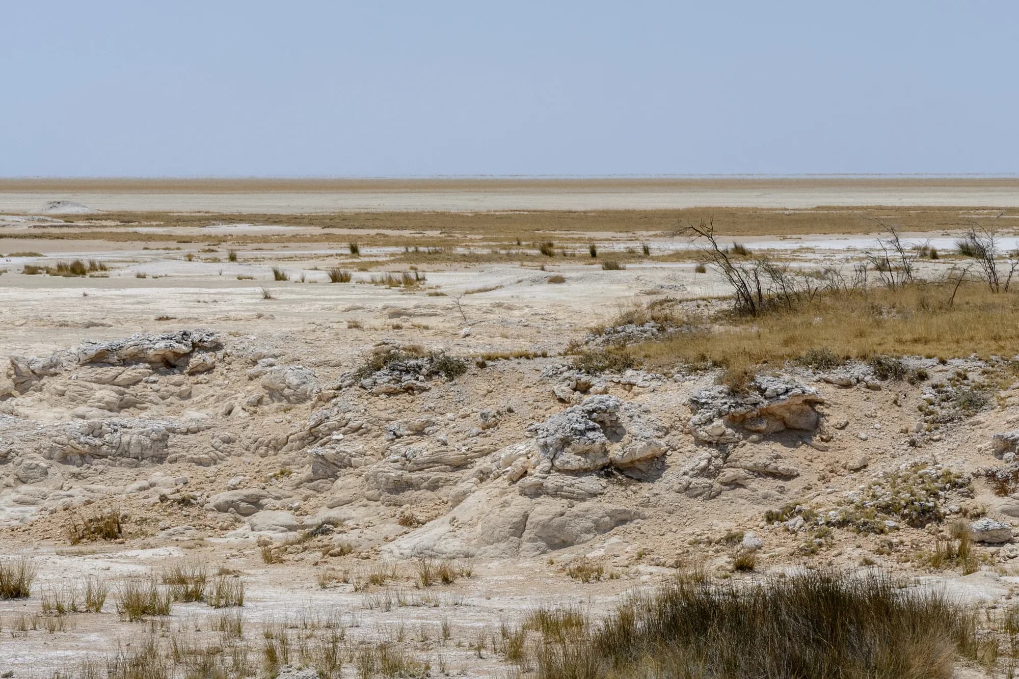
MEFT describes the veld as flat and open with hills only around Halali and in the extreme west, which is the clearest one-line description of the park's terrain we have found in an official document. Camp-to-camp distances are on the how to reach page.
MEFT — Etosha National Park park profile
Read 28 September 2026. The Ministry of Environment, Forestry and Tourism's own page for the park. It carries the park area, the proclamation year, species counts, named bird and plant species and a camp-by-camp summary. It gives no gate names, no gate times and no rhino population figure.
https://www.meft.gov.na/national-parks/etosha-national-park/217/NWR — Okaukuejo Resort
Read 28 September 2026. Each resort page carries its own rate table in Namibian dollars, split into two seasons — July 2026 to October 2026, and November 2026 to June 2027 — together with unit counts, facilities, contact numbers and distances from Windhoek, Swakopmund, Sossusvlei or Tsumeb. Rates are per person sharing unless the row says single.
https://www.nwr.com.na/resorts/okaukuejo-resort/NWR — Halali Resort
Read 28 September 2026. Each resort page carries its own rate table in Namibian dollars, split into two seasons — July 2026 to October 2026, and November 2026 to June 2027 — together with unit counts, facilities, contact numbers and distances from Windhoek, Swakopmund, Sossusvlei or Tsumeb. Rates are per person sharing unless the row says single.
https://www.nwr.com.na/resorts/halali-resort/The western section and Galton Gate
The western end is the one part of Etosha that behaves differently from the rest. NWR describes Dolomite as sitting in a previously restricted scenic area that the resort opened to a limited number of visitors, rich in biodiversity because mainstream tourism has not been there. It lists no fewer than fifteen waterholes around the camp and says black and white rhino are often spotted at Klippan. Olifantsrus, between Okaukuejo and Dolomite, is the only camping-only facility in the park.
Olifantsrus, as NWR positions it
| From | Distance |
|---|---|
| Galton Gate | 70 km |
| Dolomite | 50 km |
| Okaukuejo | 130 km |
| Windhoek | 565 km |
These are NWR's published figures for the campsite and they are the only camp-to-camp distances inside Etosha we found on an official page. Olifantsrus opens at sunrise and closes at sunset like everything else, and NWR states that day visitors may use the picnic facilities only until 16h00.
NWR — Dolomite Resort
Read 28 September 2026. Each resort page carries its own rate table in Namibian dollars, split into two seasons — July 2026 to October 2026, and November 2026 to June 2027 — together with unit counts, facilities, contact numbers and distances from Windhoek, Swakopmund, Sossusvlei or Tsumeb. Rates are per person sharing unless the row says single.
https://www.nwr.com.na/resorts/dolomite-resort/NWR — Olifantsrus Campsite
Read 28 September 2026. Each resort page carries its own rate table in Namibian dollars, split into two seasons — July 2026 to October 2026, and November 2026 to June 2027 — together with unit counts, facilities, contact numbers and distances from Windhoek, Swakopmund, Sossusvlei or Tsumeb. Rates are per person sharing unless the row says single.
https://www.nwr.com.na/resorts/olifantsrus-campsite/Onkoshi, the camp that is not on the network
Onkoshi is the outlier. NWR places it in seclusion on the rim of the Etosha Pan and explicitly far away from the public self-drive routes: fifteen freestanding chalets, thirty beds, overlooking the pan itself. It has a restaurant, a bar, a pool and a souvenir shop, and it does not have a floodlit waterhole.
That makes it a different product from the other five. You are not using Onkoshi as a base for a self-drive day around waterholes; you are using it for the pan, the light on it, and the fact that nobody else is there. NWR notes flamingos on the pan and four of the Big Five in the rainy season, which is the season the view is at its best and the general game viewing at its worst.
NWR — Onkoshi Resort
Read 28 September 2026. Each resort page carries its own rate table in Namibian dollars, split into two seasons — July 2026 to October 2026, and November 2026 to June 2027 — together with unit counts, facilities, contact numbers and distances from Windhoek, Swakopmund, Sossusvlei or Tsumeb. Rates are per person sharing unless the row says single.
https://www.nwr.com.na/resorts/onkoshi-resort/Choosing between the sections
Which end suits which trip
| If you want | Go | Because |
|---|---|---|
| One camp, three nights, maximum game | Okaukuejo | The largest camp, the most-watched waterhole, and the shortest drive in |
| Birds | Namutoni | Fisher's Pan is the birding hotspot NWR names, and the east is the wettest-looking end |
| Rhino and leopard odds | Halali | Thick mopane and a dolomite hill; NWR says the cover draws leopard, rhino and elephant |
| Nobody else | Dolomite or Olifantsrus | The western section has no mainstream tourism, on NWR's own description |
| The pan as a landscape | Onkoshi | On the rim, off the self-drive routes, and the only camp that faces the pan itself |
The honest answer for a first visit of three nights is east to west across the three main camps, which gets you all three floodlit waterholes and does not require you to choose.
What we could not verify
The waterhole names
Etosha's waterholes are the substance of the park and they all have names, but we could find only three of them stated on an official page: King Nehale at Namutoni, Klippan near Dolomite, and Fisher's Pan by Namutoni, which is a pan rather than a waterhole. MEFT names the Fairytale Forest for its moringa trees. The rest of the names that appear on every travel blog — including the one usually given for Halali's floodlit waterhole — we could not source, so they are not on this page. Buy the park map at the gate; it carries them.