
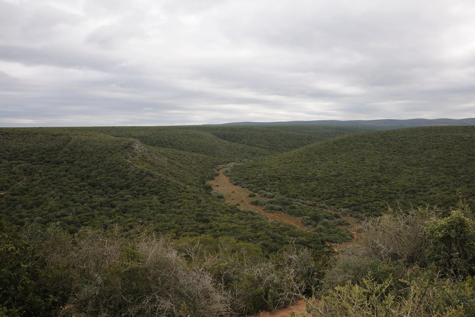
South Africa / Addo Elephant / Zones — Addo Elephant
Zones — Addo Elephant
Addo is not one park with zones in it. It is a set of separate blocks of land assembled over ninety years, joined on the map and not on the ground, and the single most useful thing this page can tell you is which of them your car can enter.
Sections, not zones — and not contiguous
In India a zone is an administrative unit with a gate and a daily jeep quota. In Etosha it is a stretch of one road network. At Addo it is neither: a section is a discrete block of land, acquired at a different time, with its own character, its own access rules and in several cases its own fence. You do not drive from one to another inside the park. You drive out, along a public road, and in again — if there is an entrance at all.
The assembly history is why. The park was proclaimed in 1931 on 2,270 hectares to save a remnant elephant population. The Zuurberg National Park was amalgamated into it in 1995, and the provincial Woody Cape Nature Reserve together with the St Croix and Bird island groups were added in 2001. By the end of the GEF-funded expansion project in 2010 the land area had grown from 140,000 to just over 170,000 hectares and the marine component from nothing to 7,414 hectares. The result is a park of about 180,000 hectares on the GEF's figure and 1,538 square kilometres on the World Database on Protected Areas record — and a park shaped like a collection rather than a block.
The mistake this page exists to prevent
A reader books three nights at Addo Main Camp, reads that the park has a mountain section, a karoo section, a forest section and a marine section, and plans a day in each. Kabouga is 45 km from Main Camp and is a 4x4 trail. Woody Cape's office is 105 km away. The marine section is not open to visitors. What is actually available to a hire car for three days is the Main Game Area and the drive south to Matyholweni, and that is a good three days — but it is not five biomes in a week.
Global Environment Facility — Addo Elephant National Park: From Planning to the Implementation of a Successful Conservation and Socio-Economic Model
Read 28 September 2026. A retrospective on the GEF-funded Greater Addo project, written with SANParks and the World Bank and reporting results to the project's end in March 2010. The publication carries no cover date; internally it describes the park as "originally proclaimed 80 years ago", which places the writing around 2011 or 2012. Every figure taken from it on this page is labelled with that vintage, because a 2012 number about a growing park is not a 2026 number.
https://www.thegef.org/sites/default/files/publications/AENP-web_0.pdfProtected Planet — Addo Elephant National Park, WDPA record 875
Read 28 September 2026. The World Database on Protected Areas record gives a reported area of 1,538.28 square kilometres for the terrestrial and inland waters protected area. The record we read carried no establishment year, IUCN category or marine area, so we have not taken any of those from it.
https://www.protectedplanet.net/875The sections, and what each one needs from you
Every section, with the access condition the park's own map prints
| Section | What it is | Access |
|---|---|---|
| Addo Main Camp area | The elephant section: the game viewing area, the camp, the restaurant, the hide | Ordinary self-drive on tourist roads, through Main Gate |
| Colchester | The southern end of the game area, reached from Matyholweni | Ordinary self-drive; no buses or ordinary caravans through that gate |
| Nyathi | Riverine thicket north of the main area, with cottages above a waterhole | Accommodation section; the map shows it as a rest camp, and flags a new camp in progress |
| Zuurberg | Mountain grassland and fynbos, horse trails and hiking | Trails rather than game drives; Narina Bush Camp is the base |
| Kabouga | Wild interior, a river, Mvubu campsite and Kabouga Cottage | 4x4 trail booked at Main Camp reception; the cottage needs high clearance |
| Darlington | Nama karoo around Darlington Dam, in the far north | 4x4 trail and basic camping, both booked at Main Camp reception |
| Woody Cape | Alexandria dunefield and forest, on the coast; Langebos Forest Huts | Hiking; the section office is 105 km from Main Camp |
| Marine | The Bird Island and St Croix island groups and the bay | Not open to visitors; boat trips are run by private operators from the city |
Read the third column before the second. Two of the eight are ordinary self-drive, two are 4x4, two are trail sections, one is an accommodation section and one cannot be visited. The GEF publication names Darlington, Kabouga, Zuurberg, Nyathi and Colchester as five terrestrial management sections holding 133,000 hectares of wildlife inside predator-proof fencing, which is the formal version of the same picture.
SANParks — Addo Elephant National Park visitor's map
Read 28 September 2026. The park's own printed visitor map, hosted by Nelson Mandela Bay Tourism because sanparks.org was unreachable. The file's embedded metadata gives a creation date of 12 August 2016, so it is a decade old and everything on it — gate times, distances, contact numbers, what exists at which camp — should be treated as needing confirmation. It is nonetheless the only document we could reach that carries game gate times by month, the internal speed limit, the park rules, the section-by-section activity lists and the camp-to-camp distances, and it is the park's own. It describes the larger marine protected area as proposed, which is consistent with a 2016 date; the area was declared in 2019.
https://www.nmbt.co.za/uploads/1/files/doc_addo_elephant_national_park_map.pdfGlobal Environment Facility — Addo Elephant National Park: From Planning to the Implementation of a Successful Conservation and Socio-Economic Model
Read 28 September 2026. A retrospective on the GEF-funded Greater Addo project, written with SANParks and the World Bank and reporting results to the project's end in March 2010. The publication carries no cover date; internally it describes the park as "originally proclaimed 80 years ago", which places the writing around 2011 or 2012. Every figure taken from it on this page is labelled with that vintage, because a 2012 number about a growing park is not a 2026 number.
https://www.thegef.org/sites/default/files/publications/AENP-web_0.pdfThe Main Game Area, which is the one you came for
This is the elephant section and it is where a normal Addo trip happens. It is a compact network of tarred and gravel game roads at a 40 km/h limit, threaded between waterholes, with Addo Main Camp at the northern end and the road down to Matyholweni running 39 km to the southern gate. The GEF project alone built 154 km of all-season roads in the Main Camp zone of the Colchester section, which gives a sense of how dense the network is relative to the ground it covers.
- Five designated lookout points where you may leave the vehicle, named on the map: Domkrag, Zuurkop, Kadouw, Spekboom and Algoa Bay. Everywhere else, you stay in the car.
- An underground viewing hide at the waterhole opposite the Main Camp restaurant — eye-level with the water, and the most distinctive thing in the section.
- The Sasol Bird Hide, and the PPC Discovery Trail, which the map describes as wheelchair friendly.
- Jack's Picnic Site, inside a 500-hectare botanical reserve set aside to monitor what elephants do to subtropical thicket. Plant species and vegetation structure inside the reserve are compared with similar areas outside it.
- Picnic and braai sites in the wildlife area and in front of the waterhole opposite the restaurant, plus a shop, a restaurant and a fuel station at Main Camp.
- The Ulwazi Interpretive Centre, which is the place to settle what the marine section is and why it exists before you go looking for it.
SANParks — Addo Elephant National Park visitor's map
Read 28 September 2026. The park's own printed visitor map, hosted by Nelson Mandela Bay Tourism because sanparks.org was unreachable. The file's embedded metadata gives a creation date of 12 August 2016, so it is a decade old and everything on it — gate times, distances, contact numbers, what exists at which camp — should be treated as needing confirmation. It is nonetheless the only document we could reach that carries game gate times by month, the internal speed limit, the park rules, the section-by-section activity lists and the camp-to-camp distances, and it is the park's own. It describes the larger marine protected area as proposed, which is consistent with a 2016 date; the area was declared in 2019.
https://www.nmbt.co.za/uploads/1/files/doc_addo_elephant_national_park_map.pdfGlobal Environment Facility — Addo Elephant National Park: From Planning to the Implementation of a Successful Conservation and Socio-Economic Model
Read 28 September 2026. A retrospective on the GEF-funded Greater Addo project, written with SANParks and the World Bank and reporting results to the project's end in March 2010. The publication carries no cover date; internally it describes the park as "originally proclaimed 80 years ago", which places the writing around 2011 or 2012. Every figure taken from it on this page is labelled with that vintage, because a 2012 number about a growing park is not a 2026 number.
https://www.thegef.org/sites/default/files/publications/AENP-web_0.pdfKabouga and Darlington, where the 4x4 requirement is real
These are the two northern sections and they are the ones a reader is most likely to get wrong, because they appear on the same park map as the elephant section and behave nothing like it. Both carry a 4x4 trail. Both have their bookings handled at Addo Main Camp reception, 45 km away in Kabouga's case and further for Darlington. Neither is a place to arrive at speculatively.
What each of the two offers, as the map lists it
| Section | Activities | Accommodation |
|---|---|---|
| Kabouga | 4x4 trail; birding across the park's biomes | Mvubu Campsite, rustic, alongside the river; Kabouga Cottage, high clearance vehicle required |
| Darlington | 4x4 trail; fishing in Darlington Dam; birding | Basic camping facilities |
"High clearance vehicle required to access the cottage" is the map's own wording for Kabouga Cottage, and it is a condition rather than a suggestion. A booking you cannot reach is worse than no booking.
The honest position on trail grading and difficulty
We found no departmental statement of how these trails are graded, how long they take, whether low range is required, whether a second vehicle is needed, or what happens if you are on one at closing time. Those are exactly the questions that decide whether a hired soft-roader is enough, and we are not answering them from a tour operator's page. Ask Main Camp reception when you book, and ask specifically about the vehicle rather than about the route.
SANParks — Addo Elephant National Park visitor's map
Read 28 September 2026. The park's own printed visitor map, hosted by Nelson Mandela Bay Tourism because sanparks.org was unreachable. The file's embedded metadata gives a creation date of 12 August 2016, so it is a decade old and everything on it — gate times, distances, contact numbers, what exists at which camp — should be treated as needing confirmation. It is nonetheless the only document we could reach that carries game gate times by month, the internal speed limit, the park rules, the section-by-section activity lists and the camp-to-camp distances, and it is the park's own. It describes the larger marine protected area as proposed, which is consistent with a 2016 date; the area was declared in 2019.
https://www.nmbt.co.za/uploads/1/files/doc_addo_elephant_national_park_map.pdfZuurberg, Nyathi and Woody Cape
Three sections that are not game drives. Zuurberg is mountain country — grassland and fynbos — and what it offers is guided horse trails, including an overnight trail to Narina Bush Camp, and hiking. The Zuurberg office is 21 km from Main Camp, the closest of all the outlying section offices, which makes it the realistic addition to a Main Camp stay.
Nyathi sits north of the main game area in riverine thicket. The map describes self-catering family cottages in Nguni-styled architecture, elevated above the thicket with views of elephant and buffalo at a waterhole, each with a small private splash pool. Note the spelling: the park's map writes Nyati, the GEF publication writes Nyathi, and both refer to the same section. The 2016 map also carries a flag reading "New Rest Camp in progress: Nyati", so the camp as it stands today may be more built out than the map suggests.
Woody Cape is the coastal section: the Alexandria dunefield and forest, reached from the R72, with Langebos Forest Huts as a base for the hike. The map lists the huts as equipped with beds and mattresses, a gas fridge and stove, a hot water shower, a toilet, a braai area and cooking and eating utensils. The section office is 105 km from Main Camp, which is the number that decides whether it belongs in your trip at all.
SANParks — Addo Elephant National Park visitor's map
Read 28 September 2026. The park's own printed visitor map, hosted by Nelson Mandela Bay Tourism because sanparks.org was unreachable. The file's embedded metadata gives a creation date of 12 August 2016, so it is a decade old and everything on it — gate times, distances, contact numbers, what exists at which camp — should be treated as needing confirmation. It is nonetheless the only document we could reach that carries game gate times by month, the internal speed limit, the park rules, the section-by-section activity lists and the camp-to-camp distances, and it is the park's own. It describes the larger marine protected area as proposed, which is consistent with a 2016 date; the area was declared in 2019.
https://www.nmbt.co.za/uploads/1/files/doc_addo_elephant_national_park_map.pdfGlobal Environment Facility — Addo Elephant National Park: From Planning to the Implementation of a Successful Conservation and Socio-Economic Model
Read 28 September 2026. A retrospective on the GEF-funded Greater Addo project, written with SANParks and the World Bank and reporting results to the project's end in March 2010. The publication carries no cover date; internally it describes the park as "originally proclaimed 80 years ago", which places the writing around 2011 or 2012. Every figure taken from it on this page is labelled with that vintage, because a 2012 number about a growing park is not a 2026 number.
https://www.thegef.org/sites/default/files/publications/AENP-web_0.pdfThe marine section, which is a zone you cannot enter
Addo has a marine section and it is legally a part of the national park. The Addo Elephant Marine Protected Area was declared on 23 May 2019 under section 22A of the National Environmental Management: Protected Areas Act, replacing the Bird Island Marine Protected Area that had been declared in 2004. The declaration names its purposes: a linked system of shore, estuarine, bay, island and shelf ecosystems; fisheries management for linefish and abalone; and the protection of threatened species, of which it names the African penguin, the Cape gannet and the dusky kob.
None of that is something you can drive to. The park's own visitor map states it in as many words: trips to Bird Island are not offered to visitors because of the ecological sensitivity of the islands, and whale watching boat trips are offered only by private licensed operators in Port Elizabeth, not by the park. There is no marine gate, no marine conservation fee on the tariff and no park-run boat.
The marine section, as the two documents describe it
| Feature | What the source says | Source |
|---|---|---|
| The islands | The Bird Island and St Croix island groups make up the marine section | Park map, 2016 |
| Cape gannets | A colony of 120,000 on Bird Island, described as the largest in the world | Park map, 2016 |
| African penguins | About 6,500 breeding pairs on St Croix, described as the largest breeding colony in the world | Park map, 2016 |
| Penguin trend | "70% of penguin population has crashed since 2004" | Park map, 2016 |
| Legal status | Declared 23 May 2019, replacing the 2004 Bird Island MPA | Gazette 42478, Notice 757 |
| Named species in the purpose | African penguin, Cape gannet, dusky kob | Gazette 42478, Notice 757 |
The two bird figures are from a 2016 document that itself reports a 70% penguin decline since 2004, so the 6,500 breeding pairs should be read as a 2016-vintage figure on a falling trend rather than as a current count. We could not source a current one.
Government Gazette No. 42478, 23 May 2019 — Notice 757, declaring the Addo Elephant Marine Protected Area
Read 28 September 2026 from the Centre for Environmental Rights' copy of the gazette, which carries all twenty marine protected area declarations of that date. Notice 757 withdraws the Bird Island Marine Protected Area declared in Government Gazette 26432 of 4 June 2004 and declares the Addo Elephant Marine Protected Area in its place under section 22A of the National Environmental Management: Protected Areas Act 57 of 2003. It is signed by Nomvula Paula Mokonyane as Minister of Environmental Affairs. The schedule gives the boundary as a series of straight lines between nine coordinates plus the Sundays estuary, and lists the purposes, which name the African penguin, the Cape gannet and the dusky kob.
https://cer.org.za/wp-content/uploads/2019/05/MPA-declarations.pdfSANParks — Addo Elephant National Park visitor's map
Read 28 September 2026. The park's own printed visitor map, hosted by Nelson Mandela Bay Tourism because sanparks.org was unreachable. The file's embedded metadata gives a creation date of 12 August 2016, so it is a decade old and everything on it — gate times, distances, contact numbers, what exists at which camp — should be treated as needing confirmation. It is nonetheless the only document we could reach that carries game gate times by month, the internal speed limit, the park rules, the section-by-section activity lists and the camp-to-camp distances, and it is the park's own. It describes the larger marine protected area as proposed, which is consistent with a 2016 date; the area was declared in 2019.
https://www.nmbt.co.za/uploads/1/files/doc_addo_elephant_national_park_map.pdfChoosing between the sections
Which section suits which trip
| If you want | Go | Because |
|---|---|---|
| Elephants, from a hire car, with children | Addo Main Camp area | Tourist roads, a restaurant, a fuel station and an underground hide at a waterhole |
| A day's drive with a start and an end | Main Gate to Matyholweni | 39 km through the game area with a gate at each end, rather than loops from one camp |
| Mountains and horses, close to Main Camp | Zuurberg | Guided horse trails and hiking, and the section office is 21 km away |
| Quiet, a river and a rough track | Kabouga | A 4x4 trail and a rustic riverside campsite, 45 km from Main Camp |
| Karoo, open water and nobody | Darlington | Fishing on the dam and basic camping, in the far north |
| Coast, forest and a long walk | Woody Cape | Dunefield and Alexandria forest, with hut accommodation for the hike |
For a first visit of two or three nights the answer is the first two rows and nothing else. The sections are a reason to come back, not a reason to spread a short trip thin across a hundred kilometres of public road.