
Uganda / Bwindi Impenetrable / Zones — Bwindi Impenetrable
Zones — Bwindi Impenetrable
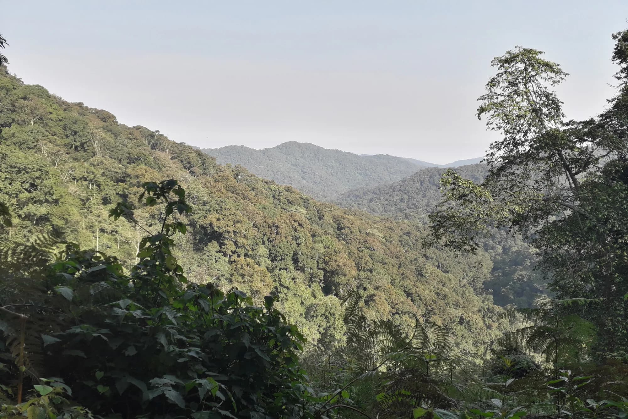
Bwindi has no zones in the Indian sense. It has four trekking sectors around the edge of one forest, and they are a long way apart.
Four sectors, one forest
The forest is continuous; the access is not. Roads run around the outside of Bwindi rather than through it, so moving between sectors means driving the long way round — three to four hours between the northern and southern ends on rough road, for a distance that looks trivial on a map.
The scale is smaller than the driving suggests. UWA gives the park as 321 square kilometres, running from 1,160 to 2,607 metres. That is a forest you could walk across in a long day if there were a path, wrapped in a road network that takes half a day to get around.
What each sector is like
| Sector | Terrain | Suits |
|---|---|---|
| Buhoma | Moderate, well-established trails | First trekkers; most accommodation choice |
| Ruhija | High altitude, cool, misty | Birders — the best in the park by far |
| Rushaga | Varied; most habituated groups | Habituation experience; better permit availability |
| Nkuringo | Steepest and hardest | Fit trekkers; the finest views in Bwindi |
Uganda Wildlife Authority — Bwindi Impenetrable National Park
UWA's own park page. Read 28 September 2026. The source here for the park's area and altitude, the gorilla population figure, the species counts, the number of habituated groups, and UWA's own published road distances and routes.
https://ugandawildlife.org/national-parks/bwindi-impenetrable-national-park/How hard the trek actually is
Trackers locate the group from where it nested the night before, and you walk to them. That can be forty minutes or most of a day, on steep, muddy, densely vegetated ground — the park is called Impenetrable and the name is descriptive rather than poetic. The gorillas move overnight, so the trek length is not predictable and not a function of the sector alone.
Two to seven hours, and UWA says so
This is the one number worth holding on to, because it is UWA's own and it is much wider than most people picture. The activity page gives the whole outing as two to seven hours, of which exactly one is with the gorillas, and describes the trek as requiring moderate fitness. Seven hours on that ground is a full mountain day. Two is a morning. You do not find out which you have until the trackers radio in.
- Porters are available at every trailhead and are worth hiring whether or not you need one — it is direct local income and they are very good at getting people up hills.
- Sedan chairs can be arranged in advance for those who cannot walk it, at significant cost and with several carriers.
- Gaiters, gloves and a waterproof are genuinely useful. Stinging nettles and thorny vines are constant.
Uganda Wildlife Authority — Gorilla tracking
UWA's activity page for gorilla tracking. Read 28 September 2026. The source for the two-to-seven-hour range for the whole activity, the statement that treks require moderate fitness, and the count of roughly eight permits a day at Mgahinga.
https://ugandawildlife.org/activities/gorilla-tracking/Choosing between the four
Nobody chooses a sector on its merits, because by the time most people learn the sectors exist they already hold a permit for one. If you are early enough to choose, this is the decision, and it is mostly a trade between how hard you want to walk and how much choice you want at dinner.
Sector by sector, on the things people actually decide on
| If you want | Go to | Because |
|---|---|---|
| The easiest ground | Buhoma | Established trails, the longest-running sector, and the shallowest average gradient |
| The most lodges and the shortest transfers on arrival | Buhoma | The northern gateway; Kihihi airstrip and the Queen Elizabeth road both feed it |
| Birds, and the Albertine Rift endemics | Ruhija | Highest ground in the park and the Mubwindi Swamp trail; nothing else comes close |
| Permit availability at shorter notice | Rushaga | The most habituated groups of any sector, so the most permits issued per day |
| Four hours instead of one | Rushaga | The gorilla habituation experience runs here and nowhere else in Bwindi |
| The hardest walk and the best view | Nkuringo | Steep ground on the south-western escarpment, and the shortest hop from Kisoro |
| To pair Bwindi with Mgahinga and golden monkeys | Rushaga or Nkuringo | Both are on the Kisoro side, and Kisoro is the Mgahinga gateway |
The two long walks, which almost nobody books
UWA prices two guided walks that cross Bwindi rather than going round it, and they sit in the tariff between a night nature walk and a hike in Kidepo where nobody looks for them. They are the only legitimate way to travel between sectors through the forest instead of on the road, and they are absurdly cheap next to the permit.
Guided long walks in Bwindi, per person, entrance excluded
| Walk | FNR now | FNR from 1 Jan 2027 | FR / EAC |
|---|---|---|---|
| Buhoma to Nkuringo | USD 60 | USD 100 | USD 50 / UGX 50,000 |
| Rushaga to Nyabaremura | USD 60 | USD 80 | USD 50 / UGX 50,000 |
Both are priced in the 2024–2026 tariff at USD 60 and both are repriced upward by the February 2026 circular from 1 January 2027. The foreign resident and EAC rates hold. Entrance for the day is on top, at USD 40 for a foreign non-resident.
The Buhoma to Nkuringo walk is the interesting one, because it solves a real logistical problem: it takes you from the northern sector to the south-western one on foot, through the forest, on a day you would otherwise spend in a vehicle going round. If your itinerary has you moving between those two ends anyway, this is a walk that costs less than the road transfer and is the better day.
Uganda Wildlife Authority — Conservation Tariff 2024–2026
Read 27 September 2026. Read alongside the Executive Director's circular of 26 February 2026, which adds low-season gorilla permits for April, May and November and suspends the seven-day unpaid reservation window. The tariff is printed "subject to change without prior notice".
https://ugandawildlife.org/wp-content/uploads/2024/03/UWA-Conservation-Tariff-July-2024-June-2026.pdfUWA — Introduction of low season gorilla and chimpanzee permit rates, 26 February 2026
The Executive Director's circular, reference TDO 93/04, signed by Dr James Musinguzi. A scanned two-page letter. It introduces the April, May and November rates with immediate effect, publishes the structure taking effect 1 January 2027, and suspends the seven-day reservation window from 1 March 2026. Read 28 September 2026.
https://ugandawildlife.org/wp-content/uploads/2026/03/Tariff-changes-2026-2027.pdfRuhija, the high sector
Ruhija sits at the eastern edge on the highest ground in the park, and it is cold there in a way visitors arriving from Entebbe do not expect. UWA's altitude range for Bwindi tops out at 2,607 metres, and Ruhija is at the upper end of it. That does two things: it makes the nights genuinely cold, and it puts you in the band where the Albertine Rift endemics live.
- The Mubwindi Swamp trail is the target for birders and is the reason Ruhija exists as a destination separate from its gorillas.
- UWA prices a bamboo walk specific to Ruhija at USD 40 for a foreign non-resident, USD 20 for a foreign resident and UGX 10,000 for an EAC citizen — the cheapest guided activity in the park bar the children's walk.
- Birding and day nature walks in Bwindi are USD 40, USD 30 and UGX 30,000, excluding entrance.
- Ruhija has the fewest lodges of the four sectors and the simplest ones. Come for the birds, not the bathroom.
Uganda Wildlife Authority — Conservation Tariff 2024–2026
Read 27 September 2026. Read alongside the Executive Director's circular of 26 February 2026, which adds low-season gorilla permits for April, May and November and suspends the seven-day unpaid reservation window. The tariff is printed "subject to change without prior notice".
https://ugandawildlife.org/wp-content/uploads/2024/03/UWA-Conservation-Tariff-July-2024-June-2026.pdfUganda Wildlife Authority — Bwindi Impenetrable National Park
UWA's own park page. Read 28 September 2026. The source here for the park's area and altitude, the gorilla population figure, the species counts, the number of habituated groups, and UWA's own published road distances and routes.
https://ugandawildlife.org/national-parks/bwindi-impenetrable-national-park/Getting between the sectors, if you must
Sometimes the sector mismatch is unavoidable — a habituation permit at Rushaga and a birding day at Ruhija, say, or two permits in two sectors on consecutive days. These are the road distances UWA itself publishes, and they are the honest scale of the problem.
UWA's published road distances to and around Bwindi
| Route | Distance | UWA's time |
|---|---|---|
| Kabale – Ruhija – Buhoma | 95 km murram | 4 hours |
| Kabale – Nkuringo | 105 km | 4 hours |
| Kisoro – Nkuringo | 35 km | 1 to 1.5 hours |
| Queen Elizabeth (Mweya) – Kihihi – Buhoma | 160 km | Not stated |
| Ishasha – Buhoma | 64 km | Not stated |
Ninety-five kilometres in four hours is 24 km/h, and that is UWA's own figure for its own road. It is the single most useful number on this page for calibrating how long anything takes around Bwindi.
Kisoro is the short hop, Kabale is the long one
Kisoro to Nkuringo is 35 kilometres and an hour to ninety minutes. Kabale to Nkuringo is 105 kilometres and four hours. Both towns are routinely offered as the base for the southern sectors and they are not remotely equivalent. If your permit is for Rushaga or Nkuringo, Kisoro is the town, and Kabale is a compromise you should be told about rather than discover.
Uganda Wildlife Authority — Bwindi Impenetrable National Park
UWA's own park page. Read 28 September 2026. The source here for the park's area and altitude, the gorilla population figure, the species counts, the number of habituated groups, and UWA's own published road distances and routes.
https://ugandawildlife.org/national-parks/bwindi-impenetrable-national-park/