
Uganda / Lake Mburo / Zones — Lake Mburo
Zones — Lake Mburo
Lake Mburo has no numbered zones, no sectors and no quotas. It has one headquarters, a network of named tracks on the eastern side, a forest on the western side, and five lakes in between — and most visitors never cross from one side to the other.
Rwonyo is the park
Where other Ugandan parks divide into sectors with their own gates and their own lodges — Bwindi's four, Queen Elizabeth's north and Ishasha — Lake Mburo organises itself around a single point. Rwonyo is the park headquarters, stated as such on UWA's own park page, and nearly everything UWA runs here starts within a couple of kilometres of it.
What sits at or near Rwonyo, with the distances UWA publishes
| Feature | Where UWA places it |
|---|---|
| Park headquarters | Rwonyo |
| UWA guesthouse rooms, standing tents, dormitory | Rwonyo Rest Camp |
| Lakeside campsite and the boat jetty | On the shore of Lake Mburo, near Rwonyo Rest Camp |
| Salt lick and its timber observation platform | Reached on a guided walk from Rwonyo |
| Best acacia-woodland birding | Around the rest camp at Rwonyo |
| Arcadia Cottages | 1 km south of Rwonyo |
| Lake Mburo Camp | 3 km north of Rwonyo |
| Kigarama Hill viewpoint | Reached by the Lakeside Track, south of Rwonyo |
| Nshara Gate and Sanga Gate | "Both gates are only about 2 kilometers from the park's headquarters at Rwonyo" |
That last line is UWA's park page wording and it is worth reading sceptically. The same page says the access road to Nshara runs about 5 km from the highway and the road to Sanga about 13 km, and the brochure makes the Nshara road 9 km and places the two gates on different stretches of highway 13 km apart. Two gates on roads that diverge like that cannot both be 2 km from the same point. We publish what UWA says and flag it; the practical reading is that Rwonyo is close to both gates by the standards of African parks, not that it is literally 2 km from each.
What this layout means for a one-night visit
You do not need to choose a zone, and you should not try to see both halves of the park. Base at or near Rwonyo, take the eastern tracks for game and the lake for the boat, and treat Rubanga forest in the west as a separate decision rather than a stop on the way to anything. The park is small enough that this is not a compromise — it is the way the park is designed.
Uganda Wildlife Authority — Lake Mburo National Park
UWA's own Lake Mburo park page, read 14 October 2026. Note the path: the page lives at /national-parks/lake-mburo/, and the longer /national-parks/lake-mburo-national-park/ that matches most of UWA's other parks returns a 404. The source here for the park-size infobox, the district, the 50 km wetland system, the three historical causes of wildlife loss, the revenue-share percentage, the species list, the absence of elephants, the bird count of over 315, the two-gate access description and the charter-flight routing.
https://ugandawildlife.org/national-parks/lake-mburo/Uganda Wildlife Authority — Lake Mburo National Park park brochure, 2018
UWA's own two-page park brochure, linked from the download button at the foot of its Lake Mburo page and hosted on ugandawildlife.org. An 11.6 MB file with a text layer; read 14 October 2026. It is the only UWA document that names the third gate, gives the gate road distances, names the tracks and the two viewpoints, describes the salt lick platform and Rubanga forest, sets out the rainfall months, names the lodges, and states who operates horseback riding and mountain biking here. It disagrees with UWA's own park page on the park's area, its bird count, the number of gates and the status of lion — and in one case it disagrees with itself. Every one of those disagreements is published on this page rather than resolved silently.
https://ugandawildlife.org/wp-content/uploads/2024/05/LMNP-2018-4.pdfThree gates, or two — UWA says both
This is the clearest disagreement between UWA's two Lake Mburo documents, and it matters because it changes which gate a reader coming from the east should aim at.
The gates, as each UWA source describes them
| Gate | Brochure, 2018 | Park page, read 14 Oct 2026 |
|---|---|---|
| Nshara | 9 km dirt road turning south from the main road, 500 m west of Akagate | First branch off on the left from Kampala, about 5 km |
| Sanga | 13 km dirt road leaving the main road at Sanga trading centre, 13 km from Akagate and 27 km from Lyantonde | At Sanga Trading Center, about 13 km to the gate |
| Kyanyanshara | 18 km south of Akagate trading centre, which is 14 km west of Lyantonde; lies close to Mihingo Lodge | Not mentioned — the page says the park "can be accessed through two gates" |
The brochure opens its access paragraph with "Three gates enter the park" and names all three. The park page says two and names two. The brochure and the page also disagree on the length of the Nshara access road, 9 km against about 5 km. We have not found a UWA document that resolves either disagreement, and we are not going to average them.
Kyanyanshara is the gate for one specific traveller
UWA's brochure ties it to a single property: Kyanyanshara "lies close to the upmarket Mihingo Lodge", and the accommodation paragraph says Mihingo "is accessed through the easterly Kyanyanshara Gate". So this is the lodge gate. If you are staying at Mihingo, it is your gate and the brochure's 18 km from Akagate is your approach. If you are not, it is probably irrelevant to you — and because Mihingo sits outside the park boundary, arriving through Kyanyanshara is also where the night-drive restriction bites, since UWA restricts night game drives to tourists sleeping within the park.
The landmark that actually matters is Akagate
Every distance in the brochure's access paragraph is measured from Akagate trading centre, which is itself 14 km west of Lyantonde on the main road. Nshara's turning is 500 m west of Akagate; Sanga trading centre is 13 km from Akagate; Kyanyanshara is 18 km south of it. If you are navigating from a map rather than a guide, Akagate is the point to find first. Lyantonde is the larger town and the one road signs will use.
Uganda Wildlife Authority — Lake Mburo National Park park brochure, 2018
UWA's own two-page park brochure, linked from the download button at the foot of its Lake Mburo page and hosted on ugandawildlife.org. An 11.6 MB file with a text layer; read 14 October 2026. It is the only UWA document that names the third gate, gives the gate road distances, names the tracks and the two viewpoints, describes the salt lick platform and Rubanga forest, sets out the rainfall months, names the lodges, and states who operates horseback riding and mountain biking here. It disagrees with UWA's own park page on the park's area, its bird count, the number of gates and the status of lion — and in one case it disagrees with itself. Every one of those disagreements is published on this page rather than resolved silently.
https://ugandawildlife.org/wp-content/uploads/2024/05/LMNP-2018-4.pdfUganda Wildlife Authority — Lake Mburo National Park
UWA's own Lake Mburo park page, read 14 October 2026. Note the path: the page lives at /national-parks/lake-mburo/, and the longer /national-parks/lake-mburo-national-park/ that matches most of UWA's other parks returns a 404. The source here for the park-size infobox, the district, the 50 km wetland system, the three historical causes of wildlife loss, the revenue-share percentage, the species list, the absence of elephants, the bird count of over 315, the two-gate access description and the charter-flight routing.
https://ugandawildlife.org/national-parks/lake-mburo/The eastern hinterland and its named tracks
The game driving at Lake Mburo happens on one side of the park. UWA's brochure puts it plainly: "A network of game tracks explores the eastern hinterland of Lake Mburo, providing the chance to see a variety of savannah animals and birds." Four tracks are named across the brochure's text, and naming them is more useful than any general description of the driving.
The tracks UWA names, and what each is for
| Track | What UWA says about it |
|---|---|
| Acacia Track | One of the two prime birding areas — "the acacia woodland along the Acacia and Research tracks" |
| Research Track | The other prime birding track; also forms the Kazuma/Research Track junction |
| Lakeside Track | South of Rwonyo, climbs onto Kigarama Hill for a panoramic view of Lake Mburo |
| Ruroko Track | Carries the steep access track up to Kazuma Lookout, near the Kazuma/Research junction |
UWA names no others and publishes no map legend beyond "Game Drive", "Main road (surfaced)" and "Main road (unsurfaced)". There is no published length for any of these tracks, no published loop time, and no numbered circuit. Anyone offering you a precise drive time for a named Lake Mburo loop is not quoting UWA.
The lightly wooded valleys east of the lake are the productive ground
The brochure locates the acacia-woodland birds in two places: "around the rest camp at Rwonyo and in the lightly wooded grassland valleys east of Lake Mburo". That is the same ground the game tracks cover, which is the useful part — at Lake Mburo the birding areas and the game-driving areas are not separate trips. On a park where the mammal list is dominated by grazers, the valleys east of the lake are where zebra, impala, topi and eland concentrate, and they are a few minutes from Rwonyo rather than an hour.
Stay on them — the off-track fine is per person
UWA's park rules say "Do not drive off the tracks" and the fines table prices the breach at USD 150, with a parenthesis that most readers miss: "(per Person in the Vehicle, to be incurred by the driver)". A family of four in one vehicle is a USD 600 fine, charged to the driver. On a small park with a dense track network and open country where a short cut looks harmless, this is the most expensive mistake available at Lake Mburo, and it costs more than everything else a two-night visit will spend.
Uganda Wildlife Authority — Lake Mburo National Park park brochure, 2018
UWA's own two-page park brochure, linked from the download button at the foot of its Lake Mburo page and hosted on ugandawildlife.org. An 11.6 MB file with a text layer; read 14 October 2026. It is the only UWA document that names the third gate, gives the gate road distances, names the tracks and the two viewpoints, describes the salt lick platform and Rubanga forest, sets out the rainfall months, names the lodges, and states who operates horseback riding and mountain biking here. It disagrees with UWA's own park page on the park's area, its bird count, the number of gates and the status of lion — and in one case it disagrees with itself. Every one of those disagreements is published on this page rather than resolved silently.
https://ugandawildlife.org/wp-content/uploads/2024/05/LMNP-2018-4.pdfUganda Wildlife Authority — Conservation Tariff 2024–2026
Read page by page on 14 October 2026. The 24-page tariff covering entrance, vehicles, boats, aircraft, game drives, walks, camping, UWA accommodation, sport fishing, research fees, fines and a per-park fees summary. Lake Mburo appears in six separate places in it — the Category A entrance band, the launch-cruise table, the nature-walk band, the sport-fishing permit table, the accommodation table and its own one-page summary on document page 22 — and those six places do not always agree with each other. The tariff is printed "subject to change without prior notice" and its cover period, July 2024 to June 2026, expired on 30 June 2026 without a successor appearing anywhere on UWA's site.
https://ugandawildlife.org/wp-content/uploads/2024/03/UWA-Conservation-Tariff-July-2024-June-2026.pdfRubanga forest, and the western half nobody goes to
The west of Lake Mburo is a different park from the east and it has one named destination. UWA's brochure, under the heading Forest Walk: "This small tract of forest on the western side of Lake Mburo is home to a variety of forest bird species. Rubanga can be explored with a ranger guide." That is the whole of what the authority publishes about it.
- It is on the western side of the lake, which is the side the game tracks do not cover.
- It is a forest, in a park whose other habitats are savanna, acacia woodland, bush, swamp and open water — so it holds species that nothing else here does.
- UWA describes it specifically as forest birding rather than as general game viewing. There is no claim of mammals.
- A ranger guide is named as the way to explore it, which makes it a nature-walk product at USD 25 / 20 / UGX 20,000 rather than something you drive to and wander into.
- UWA's park page separately describes the west of the park as having "rocky ridges and forested gorges", which is the landscape Rubanga sits in.
Who should actually go, and who should not
Rubanga is for birders and for people on a second night. It is a forest-bird site reached by a dedicated trip to the far side of a park whose draw is zebra on open grassland, and on a single-night stop it competes directly with the boat and the salt lick walk for the same few hours. If you have one afternoon, the boat sees more and the salt lick walk is closer. If you have two nights and a bird list, Rubanga is the only habitat at Lake Mburo you cannot sample from the eastern tracks, and that makes it the highest-value addition on the whole park.
Uganda Wildlife Authority — Lake Mburo National Park park brochure, 2018
UWA's own two-page park brochure, linked from the download button at the foot of its Lake Mburo page and hosted on ugandawildlife.org. An 11.6 MB file with a text layer; read 14 October 2026. It is the only UWA document that names the third gate, gives the gate road distances, names the tracks and the two viewpoints, describes the salt lick platform and Rubanga forest, sets out the rainfall months, names the lodges, and states who operates horseback riding and mountain biking here. It disagrees with UWA's own park page on the park's area, its bird count, the number of gates and the status of lion — and in one case it disagrees with itself. Every one of those disagreements is published on this page rather than resolved silently.
https://ugandawildlife.org/wp-content/uploads/2024/05/LMNP-2018-4.pdfUganda Wildlife Authority — Lake Mburo National Park
UWA's own Lake Mburo park page, read 14 October 2026. Note the path: the page lives at /national-parks/lake-mburo/, and the longer /national-parks/lake-mburo-national-park/ that matches most of UWA's other parks returns a 404. The source here for the park-size infobox, the district, the 50 km wetland system, the three historical causes of wildlife loss, the revenue-share percentage, the species list, the absence of elephants, the bird count of over 315, the two-gate access description and the charter-flight routing.
https://ugandawildlife.org/national-parks/lake-mburo/Five lakes, eight lakes, and a 50-kilometre wetland
Lake Mburo is not a lake with a park around it. It is one lake in a chain, and the arithmetic of how many is worth getting right because UWA gives two different numbers for two different things.
The water, as UWA counts it
| Claim | Source | What it actually says |
|---|---|---|
| Five lakes inside the park | Park page and brochure, in agreement | "swamps and five lakes within the park's borders"; "Hippos and crocodiles live in the park's five lakes" |
| Lake Mburo is the largest of the five | Ramsar Site 1634, Government of Uganda | A system of wetlands and "five lakes, of which Lake Mburo is by far the largest" |
| Fourteen lakes in the wider chain | Not a UWA figure | Widely repeated elsewhere; we found no UWA document stating it and do not publish it as fact |
| Eight lakes visible from one viewpoint | Brochure, Kazuma Lookout | "This lake and seven more can also be seen from the equally dramatic Kazuma Lookout" |
| A 50 km wetland system | Park page | Wetlands "forming part of a 50km-long wetland system connected by swamps and five lakes within the park's borders" |
| Wetland share of the park | Park page and brochure, in agreement | 20% of the park's surface |
The five and the eight are not in conflict: five lakes lie inside the park boundary, and from the high ground at Kazuma you can see eight, three of which are outside it. That is a useful thing to know at the viewpoint, because the view is explaining the geography rather than just being a view.
Why 20 per cent wetland changes the game viewing
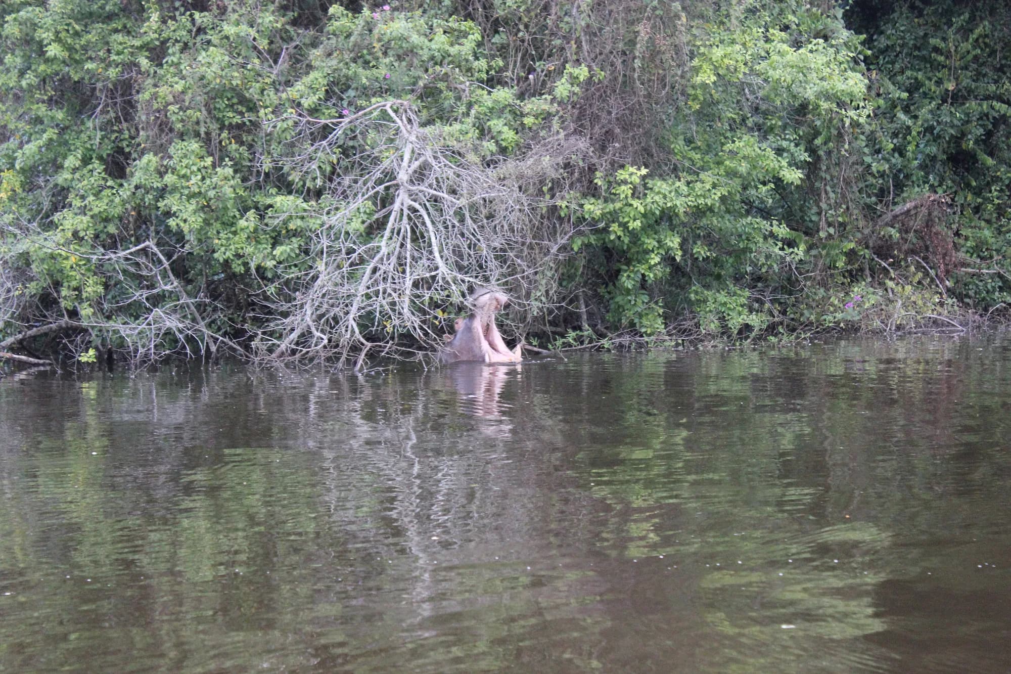
A fifth of this park is swamp or open water, in a park UWA's own page calls the country's smallest savanna park. That is the reason the species list reads oddly for a savanna reserve — sitatunga in the fringing swamps, papyrus gonolek and papyrus yellow warbler in the reeds, shoebill on the northern fringe — alongside zebra and impala on dry grassland a few hundred metres away. It is also why the boat is not an optional extra here in the way a launch trip is at some parks: a fifth of the habitat is only reachable from the water.
Ramsar Site 1634 — Lake Mburo-Nakivali Wetland System, designated by the Government of Uganda, 15 September 2006
The Ramsar Information Sheet filed by the Government of Uganda for the wetland system this park sits in, read 14 October 2026. The source here for Lake Mburo being by far the largest of the park's five lakes, and for the impala claim as it stood at designation in 2006.
https://rsis.ramsar.org/ris/1634Uganda Wildlife Authority — Lake Mburo National Park
UWA's own Lake Mburo park page, read 14 October 2026. Note the path: the page lives at /national-parks/lake-mburo/, and the longer /national-parks/lake-mburo-national-park/ that matches most of UWA's other parks returns a 404. The source here for the park-size infobox, the district, the 50 km wetland system, the three historical causes of wildlife loss, the revenue-share percentage, the species list, the absence of elephants, the bird count of over 315, the two-gate access description and the charter-flight routing.
https://ugandawildlife.org/national-parks/lake-mburo/Uganda Wildlife Authority — Lake Mburo National Park park brochure, 2018
UWA's own two-page park brochure, linked from the download button at the foot of its Lake Mburo page and hosted on ugandawildlife.org. An 11.6 MB file with a text layer; read 14 October 2026. It is the only UWA document that names the third gate, gives the gate road distances, names the tracks and the two viewpoints, describes the salt lick platform and Rubanga forest, sets out the rainfall months, names the lodges, and states who operates horseback riding and mountain biking here. It disagrees with UWA's own park page on the park's area, its bird count, the number of gates and the status of lion — and in one case it disagrees with itself. Every one of those disagreements is published on this page rather than resolved silently.
https://ugandawildlife.org/wp-content/uploads/2024/05/LMNP-2018-4.pdfThe salt lick, and the two viewpoints
Three named places at Lake Mburo are not game tracks and are not the lake, and all three are things you walk to. They are the park's answer to the question of what you do between drives.
The three walked destinations UWA names
| Place | How UWA describes it | How you get there |
|---|---|---|
| The salt lick | "Guided walks explore the park around Rwonyo, culminating in a visit to a natural salt lake where wildlife can be viewed from a timber observation platform" | Guided walk from Rwonyo |
| Kigarama Hill | "Provides a panoramic view of Lake Mburo" | The Lakeside Track, south of Rwonyo |
| Kazuma Lookout | "Equally dramatic"; this lake and seven more are visible from it | A rather steep track from the Ruroko Track, near the Kazuma/Research junction |
Note UWA's own wording on the first: the heading in the brochure is "Salt Lick Walk" but the text calls the destination "a natural salt lake". The platform is described as timber. This is the only built wildlife-viewing structure UWA names at Lake Mburo.
The salt lick is the reason the walking here is worth paying for
A nature walk at USD 25 is, at most parks, a way of seeing less game more slowly. The salt lick inverts that. It is a fixed point that animals come to rather than a route you hope to intercept them on, it has a platform that puts you above them, and it is reached on foot from the headquarters — so the walk is the delivery mechanism rather than the product. On a park without elephants, where UWA permits you out of the vehicle at all, this is the single most distinctive hour Lake Mburo sells, and it costs a fifth of what the boat costs a couple.
Kazuma is a drive and a climb, not a stroll
Read the access carefully before planning it into a tight afternoon: the brochure routes you off the Ruroko Track onto "a rather steep track" to reach the top. That is a vehicle track, so Kazuma is a drive to a trailhead and then a climb, and it is on the opposite side of the track network from the Lakeside Track that reaches Kigarama. The two viewpoints are not a pair you do in one loop. Kigarama is the one that fits into an ordinary evening drive from Rwonyo; Kazuma is the one that needs its own slot and pays you back with the eight-lake view.
Uganda Wildlife Authority — Lake Mburo National Park park brochure, 2018
UWA's own two-page park brochure, linked from the download button at the foot of its Lake Mburo page and hosted on ugandawildlife.org. An 11.6 MB file with a text layer; read 14 October 2026. It is the only UWA document that names the third gate, gives the gate road distances, names the tracks and the two viewpoints, describes the salt lick platform and Rubanga forest, sets out the rainfall months, names the lodges, and states who operates horseback riding and mountain biking here. It disagrees with UWA's own park page on the park's area, its bird count, the number of gates and the status of lion — and in one case it disagrees with itself. Every one of those disagreements is published on this page rather than resolved silently.
https://ugandawildlife.org/wp-content/uploads/2024/05/LMNP-2018-4.pdfUganda Wildlife Authority — Conservation Tariff 2024–2026
Read page by page on 14 October 2026. The 24-page tariff covering entrance, vehicles, boats, aircraft, game drives, walks, camping, UWA accommodation, sport fishing, research fees, fines and a per-park fees summary. Lake Mburo appears in six separate places in it — the Category A entrance band, the launch-cruise table, the nature-walk band, the sport-fishing permit table, the accommodation table and its own one-page summary on document page 22 — and those six places do not always agree with each other. The tariff is printed "subject to change without prior notice" and its cover period, July 2024 to June 2026, expired on 30 June 2026 without a successor appearing anywhere on UWA's site.
https://ugandawildlife.org/wp-content/uploads/2024/03/UWA-Conservation-Tariff-July-2024-June-2026.pdf