
Kenya / Lake Nakuru / Sightings log — Lake Nakuru
Sightings log — Lake Nakuru
Most sightings pages on this site have to manage expectations downwards. This one has to do it in both directions at once: the flamingos are not what you were sold, and the rhino are better than you were told.
What you will actually see
Honest odds on a full day in the park
| Animal | Odds | Why |
|---|---|---|
| White rhino | Very high | Grazers on open ground in a fenced 135 km2 of land. This is the most reliable rhino viewing in Kenya |
| Black rhino | Good, with a guide who knows the thickets | Browsers in cover. Present in numbers, harder to find, and a guide question rather than a luck question |
| Giraffe | Very high | In the fever tree woodland, which is 67 per cent of their diet here |
| Buffalo, zebra, waterbuck, impala, warthog, baboon | Very high | Density inside the fence is at least 20 per cent above the land outside it |
| Lion | Moderate | Present, and a park this size makes them findable, but not a given |
| Leopard | Low | Woodland and escarpment. As everywhere, a matter of luck |
| Lesser flamingo | Variable and much reduced | The section below sets out exactly what the evidence supports |
These are editorial judgements built on what the sources establish about density, habitat and behaviour. No published sighting-rate data exists for this park and we have not implied any.
The single sentence a first-time visitor should carry in: Lake Nakuru is a rhino park with a large lake in it, and the lake is scenery rather than the show. Reverse those two and you will be disappointed by a genuinely good day.
Wilkinson, McInturff, Kelly and Brashares — "Quantifying wildlife responses to conservation fencing in East Africa", Biological Conservation 256, 109071 (2021)
Read 28 September 2026 from the University of California eScholarship copy. A year of camera trapping on the Lake Nakuru perimeter fence itself, and the single best source on what the fence here actually does. Findings used: the park is 188 square kilometres, the lake covers nearly a third of it and the land area is about 135 square kilometres; the park lies directly west of the 190-square-kilometre Soysambu Conservancy, a partly fenced private reserve and working ranch carrying 10,000 sheep, goats and cattle; Nakuru city sits directly north and had a population of 570,000 in 2019; four rivers enter the park, three from the south and one from the north-west; and wildlife density inside the park is at least 20 per cent higher than on the community land outside it. On the fence: 19 cameras recorded 65,560 photographs of mammals and 3,626 crossings over 2,818 trap nights, 38 wild mammal species approached known weak points, 27 of them were recorded crossing, every large carnivore species in the park crossed, and repaired gaps were breached again within days.
https://doi.org/10.1016/j.biocon.2021.109071Rhino: how to actually find them
Both species are here and they behave completely differently, which is why one is nearly guaranteed and the other is a skill test. White rhino are grazers: they want open short grass, they are large, pale and gregarious, and they are usually visible from a track. Black rhino are browsers: they want thicket, they are solitary and smaller, and they are found by people who know which thickets they use.
- Be inside the fence at 06:00. Both species are most active in the cool, and the gates open at exactly the hour you want to be driving.
- For white rhino, work the open grazing on the flats. This is a looking-across-country problem, not a searching-cover problem.
- For black rhino, work the woodland and thicket margins, slowly, with the engine off as often as you can manage it. This is the part of the day a good local guide earns their fee.
- Keep the speed down. The park limit is 40 km/h and it is also the speed at which you will see anything in cover.
- Twenty metres is the minimum viewing distance KWS sets. At a black rhino in thicket, twenty metres is close.
Why there is no number to give you
KWS publishes no rhino population for this park and does so deliberately: site-level rhino counts are poaching intelligence. The department describes the park as holding "one of the country's largest populations of black rhinos, and white rhinos" and stops there. What we can tell you, from the founding history, is the scale of the undertaking: the sanctuary opened in 1987 with 17 animals translocated from Solio joining the two already here, and it has been a protected breeding population for the thirty-nine years since.
Lever — "Lake Nakuru Black Rhinoceros Sanctuary", Oryx 24(2), 90-94 (April 1990)
Read 28 September 2026. A contemporary account of how the sanctuary was founded, by a trustee of the trust that funded it. The Rhino Rescue Charitable Appeal Trust was formed in England in 1985; work on the first sanctuary, at Lake Nakuru, began within a year; the sanctuary opened in 1987, when 17 rhinos from Courtland Parfet's private ranch at Solio joined the two animals already in the park, with a further 11 females due to follow. The article is 36 years old and is used here for the founding history only. No current population figure is taken from it or from anywhere else.
https://doi.org/10.1017/s0030605300034736Kenya Wildlife Service — Lake Nakuru National Park
Read 28 September 2026. This is the department's own park page, and on this date it answered — which is worth recording, because kws.go.ke refuses automated requests often enough that other Kenyan parks on this site carry their figures as "read failed, carried from record". The page gives the park history to the year, the gate list, the distance from Nairobi, the accommodation list, the gate hours and the in-park rules, and it prints the same four-band conservation fee as the national schedule. It does not give a rhino population, a flamingo count or a drive time, and neither does this page.
https://kws.go.ke/park/lake-nakuru-national-park/What a flamingo sighting looks like now
You may see flamingos at Lake Nakuru. You will almost certainly not see the photograph. The difference between those two sentences is the whole of the honest answer, and it is worth being precise about it, because both overstatement and understatement are common.
- They are not gone. Both lesser and greater flamingo occur at this lake and birds are present at times.
- They are massively reduced against the historic spectacle, which the literature records as more than a million birds at a time.
- They are highly variable. Lesser flamingos are nomadic and follow food across a network of lakes; presence at any one of them changes week to week.
- Nobody can forecast it. No authority publishes a Nakuru flamingo count or an expectation for a given month, and any operator who tells you what will be there is guessing.
- The cause is in the water, not in the birds. Mean chlorophyll-a at Nakuru has fallen from more than 400 to less than 200 mg per cubic metre against a high-quality feeding threshold of 355.
How to look, given all that
Treat flamingos here as weather rather than as an attraction. Scan the shallows and the shoreline edges from the lakeshore track and from the escarpment lookouts, where distance and elevation make a thin scatter of birds visible that you would drive past at water level. Bring binoculars and no expectations. If there is a band of pink on the water, you have had a good piece of luck at a lake that used to make it a certainty.
Byrne, Tebbs, Njoroge, Nkwabi, Chadwick, Freeman and Norris — "Productivity declines threaten East African soda lakes and the iconic Lesser Flamingo", Current Biology 34, 1786-1793 (22 April 2024)
Read 28 September 2026 from the open-access version of record. This is the paper that settles the flamingo question, and it is the reason this park's wildlife page reads the way it does. The authors combined satellite Earth observation with flamingo count data across 22 East African soda lakes from 1999 to 2022. Findings used here: lake surface areas across the 22 lakes rose by an average of 0.32 square kilometres a year; chlorophyll-a — the measure of the phytoplankton the birds eat — fell by 3.9 mg per cubic metre a year; 18 of the 22 lakes were at their least productive when their surface area was greatest; Lake Nakuru grew in surface area by 90.7 per cent between 2009 and 2022 and its mean chlorophyll-a fell from more than 400 mg per cubic metre to less than 200; the threshold the authors use for high-quality feeding water is 355 mg per cubic metre, which corresponds to an Arthrospira fusiformis density of 50 mg dry weight per litre; and at Bogoria and Nakuru the loss of high-quality feeding habitat since 2010 coincided with declining flamingo numbers. The paper describes Nakuru as "one of the most important Flamingo feeding lakes in East Africa, historically supporting over one million birds at a time". It does not give a current Nakuru count, and neither do we.
https://doi.org/10.1016/j.cub.2024.03.006The drowned forest, which is a sighting in itself
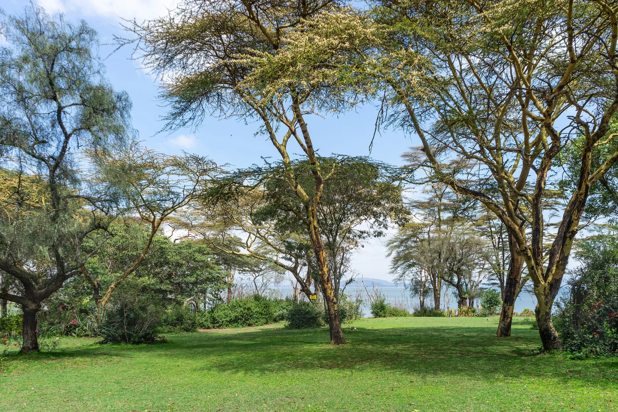
The most distinctive thing you will photograph at Lake Nakuru is not an animal. It is the stands of dead trees standing in open water along the drowned shoreline — acacia and fever tree that were on dry land fifteen years ago and are now bleached skeletons with water round their trunks.
This is not decoration and it should not be read as one. Inside the park boundary, the dominant land-cover change measured between 1987 and 2016 was a 51 per cent increase in the area covered by lake water, taking shoreline vegetation and infrastructure with it. Flood inundation put roads out of use to the point where around 60 per cent of the park was assessed as inaccessible after the 2013 event, and the damage extended to buildings including the main administrative block.
What it means for your drive
Two practical things. First, the lakeshore track network is not the one on older maps, and sections can be closed after rain — ask at the gate rather than assuming. Second, the shoreline you are driving is a new one. The pale dead timber standing in water marks where the old shore was, which makes the scale of the change legible from the car in a way very few environmental stories are.
"Mapping vegetation status at Lake Nakuru National Park and surrounds, Kenya" — Miami University thesis, OhioLINK ETD Center (2017)
Read 28 September 2026, and flagged as a graduate thesis rather than a peer-reviewed paper — it is used here because it is the only source we could find that maps what happened to the vegetation inside the boundary, and nothing in it is quoted that a lodge brochure would have any reason to dispute. Using Landsat imagery from 1987 to 2016 and a Random Forest classifier at 85.5 per cent accuracy, it reports that the major land-cover change inside the park was a 51 per cent increase in the area covered by lake water, destroying shoreline vegetation types and infrastructure; that the euphorbia forest was completely destroyed following a fire; and that the acacia woodland declined overall.
https://etd.ohiolink.edu/acprod/odb_etd/ws/send_file/send?accession=miami1498015331943846&disposition=inlineHerrnegger, Stecher, Schwatke and Olang — "Hydroclimatic analysis of rising water levels in the Great Rift Valley Lakes of Kenya", Journal of Hydrology: Regional Studies 36, 100857 (25 June 2021)
Read 28 September 2026 from the open-access copy deposited on EarthArXiv, the published paper being behind a paywall at the publisher. Findings used here: Lake Nakuru's surface area in December 2020 was 70 per cent larger than its 1984-2009 mean; its largest mean annual area over the record was 62.3 square kilometres at a level of 1766.2 metres, in 2020; the total range between its lowest and highest recorded water level is 6.40 metres; the catchment is 1,471 square kilometres with a mean annual rainfall of 1,013 mm over 1981-2020, rising by about 20 per cent, or 193 mm, in the eleven years after 2009; the lake is fed by the Baharini spring on its eastern shore, the permanent Ngosur river and four seasonal rivers — the Njoro, Nderit, Makalia and Lamudhiak, all rising in the Eastern Mau forest. The paper states that the rise "changed the water quality of the normally alkaline-saline lake, leading to loss of the algae abundance. In consequence, a vast number of Flamingos have left." It also records, citing Onywere and others (2013), that flood inundation left about 60 per cent of the park inaccessible, and, citing Obando and others (2016), that the main administrative block was flooded.
https://doi.org/10.1016/j.ejrh.2021.100857Giraffe, cats and the fence line
The giraffe here are the park's second-best sighting and the easiest to plan for, because their diet is documented. Vachellia xanthophloea, the yellow-barked fever tree, accounts for 67 per cent of their foraging records in this park. Find the pale-trunked stands along the old shoreline and the woodland belt and you have found the giraffe.
Lions are present and are a genuine part of this park's ecology rather than a footnote — the 2009 giraffe study implicated them directly in that population's failure to recruit young, which is what predation does in a fenced system where nothing can walk away. Leopard are in the woodland and on the escarpment and are, as everywhere, a matter of luck. We publish no population figure for either species because none is published.
The fence line is a wildlife feature
A year of camera trapping on the perimeter recorded 38 wild mammal species approaching known weak points and 27 of them crossing, including every large carnivore in the park, with baboons and vervets crossing daily. You are not being asked to go and watch a fence. But if you find yourself driving a boundary section, it is worth knowing that it is one of the busiest pieces of ground in the park.
Gitau, Mbau, Ngugi, Ngumbi and Muneza — "Activity budget and foraging patterns of Nubian giraffe in Lake Nakuru National Park, Kenya", Ecology and Evolution 14(6), e11463 (30 May 2024)
Read 28 September 2026 from the abstract of record; the publisher refused the full text to an automated request on the same day. The study recorded 11,280 giraffe activities in the park, 4,560 in the dry season and 6,720 in the wet. Foraging took 53 per cent of the dry-season budget and 57 per cent of the wet-season one. The figure quoted on these pages is the diet: Vachellia xanthophloea, the yellow-barked fever tree, accounted for 67 per cent of foraging records, 4,136 out of 6,215. Note also the name the paper uses. The animal this park is famous for is still widely sold as Rothschild's giraffe; current taxonomy treats it as the Nubian giraffe, Giraffa camelopardalis camelopardalis, and this paper is written that way.
https://doi.org/10.1002/ece3.11463Brenneman, Bagine, Brown, Ndetei and Louis — "Implications of closed ecosystem conservation management: the decline of Rothschild's giraffe in Lake Nakuru National Park, Kenya", African Journal of Ecology 47(4), 711-719 (2009)
Read 28 September 2026. The paper records that Kenya Wildlife Service queried a fall in the park's giraffe from 153 individuals in 1995 to 62 in 2002, together with a failure to recruit young over those years. Genetic analysis found the population in good health with respect to inbreeding, so that explanation was ruled out. The authors link the decline instead to the drought attributed to the 1994 El Nino, and suggest that heavily concentrated tannins from forced over-consumption of the park's declining acacias may have compromised young animals and made them easy prey for the park's lions. The paper lists five viable Rothschild's populations at the time: Murchison Falls in Uganda, and Lake Nakuru, Ruma, Giraffe Manor and Mwea in Kenya.
https://doi.org/10.1111/j.1365-2028.2008.01029.xThe rules at a sighting, as KWS writes them
- View wildlife from a minimum distance of 20 metres.
- Remain in your vehicle unless in a designated area, and keep the doors closed at all times.
- Observe the 40 km/h speed limit. KWS states plainly that speeding attracts penalties.
- Stay on established roads and trails. Off-road driving is strictly prohibited.
- Move slowly and quietly — animals can react dangerously if startled — and use phones and sound devices sparingly.
- No hooting, and no driving under the influence.
- Adhere to gate times: open 6:00 am, close 6:00 pm, unless you are staying overnight.
- The park is a single-use-plastic-free zone, as is every KWS park, reserve and sanctuary. Carry out all your rubbish.
- Feeding wildlife is prohibited.
These are KWS's own words from its Lake Nakuru page and the national schedule, reproduced rather than paraphrased, because at a fenced park with a rhino population they are enforced rather than advisory. The two that catch visitors are the 20-metre distance at a black rhino sighting, where the temptation is obvious, and the off-road rule on a track network that now has water where it used to have road.
Kenya Wildlife Service — Lake Nakuru National Park
Read 28 September 2026. This is the department's own park page, and on this date it answered — which is worth recording, because kws.go.ke refuses automated requests often enough that other Kenyan parks on this site carry their figures as "read failed, carried from record". The page gives the park history to the year, the gate list, the distance from Nairobi, the accommodation list, the gate hours and the in-park rules, and it prints the same four-band conservation fee as the national schedule. It does not give a rhino population, a flamingo count or a drive time, and neither does this page.
https://kws.go.ke/park/lake-nakuru-national-park/What we could not establish about sightings
The gaps, named
No population figure for rhino, lion, leopard, giraffe or buffalo in this park is published by any source we read on 28 September 2026, and none appears here. No flamingo count for 2025 or 2026 exists in any source we could reach. No sighting-rate data of any kind is published, so the odds table at the top of this page is judgement built on habitat and density rather than on counted encounters, and is labelled as such. And we could not establish which parts of the lakeshore track network are currently open, because that changes with the water and is a question for the gate on the morning.