
Kenya / Amboseli / Zones — Amboseli
Zones — Amboseli
There are no numbered zones here, no gate quota and no allocated blocks. There is one circuit of about 392 square kilometres, and knowing the shape of it is most of what a visitor needs.
Not zones — one circuit
A reader arriving from the Indian parks on this site will look for a zone map, a gate allocation and a permitted route. None exists. Amboseli is small enough that a full day's driving will take you over most of it twice, the track network is a loop with spurs off it, and you drive where the tracks go. What replaces the zone system as a planning problem is the shape of the loop and the time of day you are on each part of it.
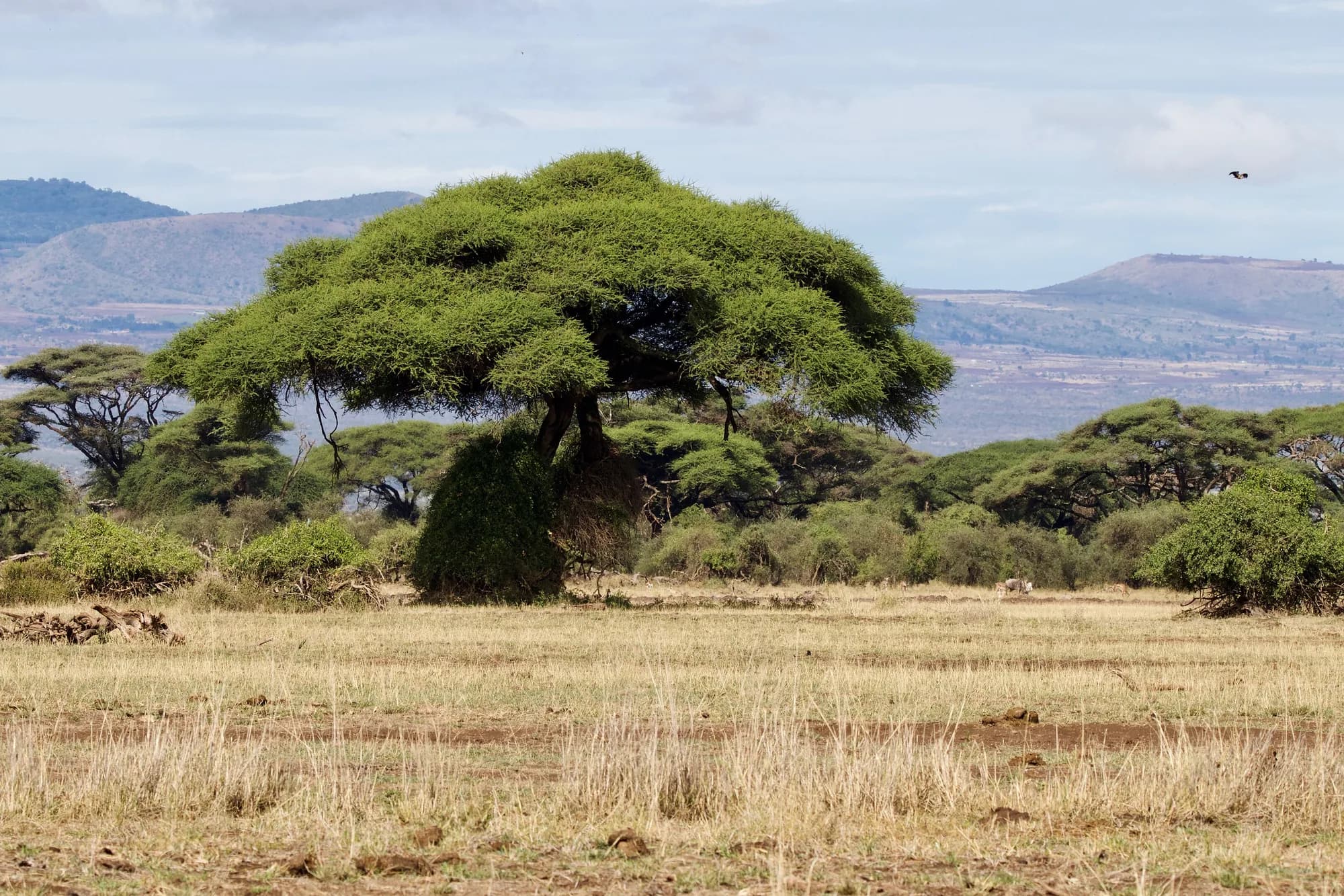
The organising fact is water. Meltwater from Kilimanjaro runs underground through porous volcanic rock and surfaces on the Kenyan side as permanent springs, which is why a park in semi-arid country has marsh in the middle of it. Those springs are the whole park. Everything else — the dust flats, the fever tree stands, the bare pan to the west — takes its character from being near that water or far from it.
This is the smallest park on this site that people plan a week in
About 392 square kilometres — a fraction of the Maasai Mara National Reserve and a rounding error beside the Tsavos next door. Size is the thing to internalise before booking: Amboseli is an intense two or three days rather than a week, and its scale is exactly why the circuit rather than the zone is the right mental model. We could not confirm the area figure against KWS on 28 September 2026, because its site refused our requests; it is the figure this site carries for the park.
The swamps, and why they run the day
Enkongo Narok and Olokenya are the two large spring-fed marshes in the centre of the park, with the Longinye system beside them. They hold water when everything for fifty kilometres around is dust, and the consequence for a visitor is unusual: the middle of the day is productive here. In most savanna parks the hours between ten and four are dead. In Amboseli the elephants are standing in the swamp, feeding, with water to their bellies, and they are there because there is nowhere else to be.
The parts of the circuit
| Area | What it is | What it gives you |
|---|---|---|
| Enkongo Narok and Olokenya | Permanent spring-fed marsh at the park's centre | Elephant, hippo, buffalo and waterbirds, through the middle of the day |
| Longinye | The eastern arm of the same swamp system | Elephant families, and the Trust's collared animals range here |
| Ol Tukai Orok | The fever tree grove at the park's heart | Shade, giraffe and the park's most photographed stand of trees |
| Observation Hill | A small volcanic cone beside the swamps | The one place on the circuit you routinely get out and walk |
| Lake Amboseli bed, west | A seasonal pan — dust most of the year, shallow water after rain | Open sightlines, almost no cover, flamingo when it floods |
| The eastern flats and fever tree woodland | Acacia xanthophloea stands and open grassland | Giraffe, plains game and the better odds on a cat |
The practical routing that follows is simple and almost nobody is told it: go out to the open ground for first light, work back to the swamps as the morning heats up, stay with them through the middle of the day rather than returning to camp, and be back out on open ground for the last hour. It inverts the standard safari day and it suits this park exactly.
Observation Hill
A short stepped path up a small volcanic cone beside the swamps, and the one moment in a Kenyan national-park day when you are on your own feet with elephants in sight below you. From the top the whole geometry of the park becomes obvious in a way no map manages: the green of the marsh, the pale dust of the pan to the west, the fever trees, and the mountain filling the southern sky if it is out.
- Go in the first hour of light. The swamps still hold mist, the mountain has not clouded over, and the hill is empty.
- It is a climb rather than a stroll, on steps, in heat, at altitude. It is short, but it is not nothing.
- Take the camera off the vehicle mount. This is a wide-angle place, not a long-lens one.
- Do not go up at midday in August. There is no shade on it whatsoever.
Everywhere else, you stay in the vehicle
Observation Hill and the designated picnic sites are the exceptions, not the rule. Getting out elsewhere in the park is prohibited, and in a park with nineteen hundred elephants and no cover it is also a genuinely bad idea. Visitors who have come from a conservancy where walking is normal need to reset on the way through the gate.
The lake bed, and what the rains do to the map
Lake Amboseli, west of the swamps, is a lake in the sense that it occasionally holds water. For most of the year it is a pale, flat, shadeless pan of fine volcanic dust, and it is where the park's famous dust devils come from. After good rain it floods shallowly, flamingo appear on it, and the tracks across it stop being tracks.
This is the part of Amboseli that changes most between visits. In August the western pan is drivable, brutally hot and produces the mirage shots the park is known for. In April the same ground is under water and the usable circuit shrinks to the eastern and central tracks. The park does not close; it gets smaller.
What we could not verify
We hold no current KWS statement of which tracks close in the wet, gate opening hours, or the rule on overstaying past closing — all of which would normally come from the department's own park page, and all of which were unavailable to us on 28 September 2026. Ask at the gate on the way in; the answer changes with the state of the ground anyway.
The rules that apply inside the boundary
- Stay in the vehicle, except at Observation Hill and designated picnic sites.
- No off-road driving. The tracks are the tracks, and in a park where the ground is fine dust and seasonal marsh, the rule protects the surface as much as the animals.
- No night driving. The park operates to gate hours and does not run after dark.
- No walking safaris. There is no version of this available inside the national park.
- Give elephants room. Families with small calves in a small park with a busy circuit are the most common cause of a vehicle being charged.
Every one of those five is reversed on the conservancies immediately outside the boundary. That is not a detail of etiquette — it is the single largest difference between a photograph taken inside Amboseli and one taken on the group ranches next door, and it is very rarely made explicit in marketing. If you have seen an Amboseli picture taken at night, or one clearly shot from off the track, it was almost certainly not taken in the national park.
The park is the core, not the ecosystem
UNESCO's biosphere reserve over this ground runs to 798,298 hectares and was designated in 1991. That is the ecosystem. The national park is a small core inside it, and the elephants treat the boundary as the administrative line it is. The Trust's collared females spend a considerable part of the year on community-owned land rather than inside the park, and its collared young males range well into Tanzania.
For a visitor this has a direct consequence. The elephants you photograph beside Enkongo Narok at nine in the morning may have spent the night eight kilometres outside the boundary on somebody's grazing, and will be back out there tomorrow. The park is where they drink; it is not where they live. A trip that never leaves the gazetted 392 square kilometres has seen the smallest part of the thing.
UNESCO Man and the Biosphere Programme — Amboseli Biosphere Reserve
Read 28 September 2026. Designated 1991; total area 798,298 hectares. UNESCO describes the reserve as containing "natural dry mountain forest, mountains, savannah rangelands, wetlands and swamps" over "basement plains, saline plains with freshwater swamps, and the volcanic slopes of Kilimanjaro", with the Maasai as the predominant population and group ranching the dominant land use. That figure is the biosphere reserve, which is the whole ecosystem — the national park is a small core inside it, and the two are routinely confused in travel writing.
https://www.unesco.org/en/mab/amboseliAmboseli Trust for Elephants — Annual Report 2024
Read 28 September 2026. Population, family, birth and mortality figures are the Trust's own, from the long-term monitoring section of its annual report for 2024. Because every elephant in this population has been identified individually since 1972, the numbers are stated to the animal rather than as a survey estimate — which is why they can be quoted the way they are here and cannot be quoted that way for any other elephant population on this site.
https://www.elephanttrust.org/wp-content/uploads/2025/05/amboseli-trust-for-elephants-annual-report-2024.pdfThe conservancies and the corridors
The community land around the park
| Area | Position | What it permits that the park does not |
|---|---|---|
| Kitirua | South-west, against the park boundary | Night drives, guided walking, off-road |
| Selenkay | North, on Eselenkei group-ranch land | Night drives, guided walking, off-road |
| Kimana Sanctuary | East, on the corridor towards Chyulu and Tsavo | Night drives, guided walking, off-road |
| Kitenden corridor | South-east, towards the Tanzanian border | A movement corridor rather than a visitor product |
Each is community land with its own conservancy fee, normally inside a camp rate rather than payable at a barrier. None of them is Amboseli National Park and none is on the KWS tariff.
Kimana is a corridor before it is a destination
Big Life Foundation describes Kimana Sanctuary — 5,700 acres — as a critical connector between the Tsavo and Amboseli ecosystems. That is the honest way to read all of these places: they exist to keep the elephants able to leave, and visitor access is part of what pays for that. Kitenden matters for the same reason from the other direction: the Trust's own conflict records cluster slightly there, which is exactly why keeping that corridor open matters.
So the planning distinction is real rather than a marketing gloss. The park sells you a landscape and a guarantee of elephants. The conservancies sell you permissions the park cannot grant, on the land the same elephants use when they are not in the park, with the money going to the households living alongside them.
Big Life Foundation — Big Life protects Kimana Sanctuary
Read 28 September 2026. The sanctuary is given as 5,700 acres and as a critical connector between the Tsavo and Amboseli ecosystems. The page carries no date for when that protection began, so none is stated here.
https://biglife.org/who-we-are/timeline/big-life-protects-kimana-sanctuary