
Zambia / South Luangwa / Zones — South Luangwa
Zones — South Luangwa
Nine thousand and fifty square kilometres, and almost everything a visitor sees happens within a few kilometres of one river. The sectors are named after where the camps are; the ecology is named after where the water goes.
The river is the zoning, and it moves
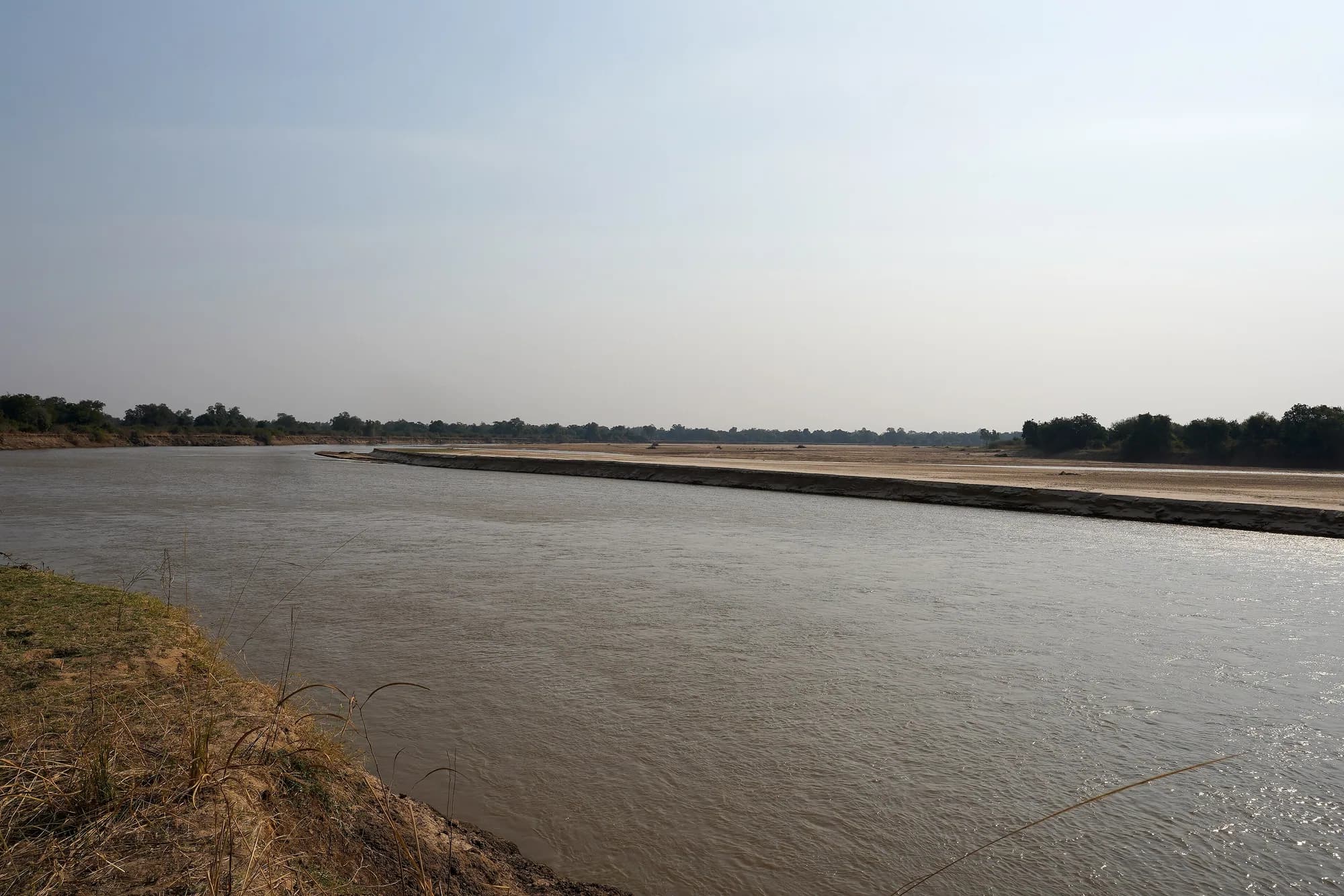
The Luangwa forms most of the eastern boundary of the National Park and the western boundary of Lupande Game Management Area, and the 2016 leopard study calls it "the largest perennial water source in the region", noting that wildlife and human activity alike are centred on the river boundaries of the park and the adjoining GMAs, particularly in the dry season. The park is bounded to the west by the Muchinga Escarpment and the valley itself is the southern end of the East African Rift.
It is a meandering river on a soft bed, and it rebuilds its own channel. When a meander loop is cut off, the abandoned bend is left as a standing ox-bow lagoon, and those lagoons hold water into the dry season after the ephemeral tributaries have stopped. zambiatourism.com puts the consequence plainly: "The concentration of animals around the Luangwa River, and its oxbow lagoons, is among the most intense in Africa." That sentence is the zoning logic of this park. Game is where the last water is, and the last water is in the bends the river has finished with.
What we will not claim about the channel
Our own park record says the river "changes course every few years". A meandering alluvial river on this scale does migrate, cut off bends and leave ox-bows, and the lagoons are there to prove that it has done so. But we found no published measurement of the rate at which the Luangwa migrates — no cutoff frequency, no metres per year — and "every few years" is a specific claim that needs a specific source. Treat the mechanism as established and the tempo as unmeasured.
Rosenblatt, Creel, Becker, Merkle, Mwape, Schuette and Simpamba — "Effects of a protection gradient on carnivore density and survival: an example with leopards in the Luangwa valley, Zambia", Ecology and Evolution 6(11): 3772-3785 (5 May 2016)
Read 28 September 2026, in full, from the PubMed Central copy. Open access, peer reviewed, and co-authored with an officer of Zambia's own department. Camera traps on two matched grids either side of the Luangwa River across five dry seasons from 2012 to 2014, analysed with closed robust-design capture-recapture. It is the only rigorous leopard density estimate for this park that we could find, and the paper says as much about itself: these are "the first methodologically and statistically rigorous estimates of leopard density and survival" in the population. It is also the source for the park's area as the researchers state it (9,050 km2), the Lupande GMA area (5,660 km2) and the snare-occurrence comparison.
https://pmc.ncbi.nlm.nih.gov/articles/PMC4864144/zambiatourism.com — South Luangwa National Park
Read 28 September 2026, along with its activities and accommodation pages. A large and long-standing Zambian travel portal, and the source here for the 9,050 square kilometre area, the 1972 founding, the "60 different animal species and over 400 different bird species" line, the camp list and the statement that on a walk "a qualified walking guide and armed ranger will accompany you". We checked who publishes it and could not establish that: the site carries no ownership or publisher statement, and the only attribution in its footer is to the agency that built it. Treat it as a well-informed trade source rather than an authority, which is how it is labelled everywhere it appears on these pages.
https://www.zambiatourism.com/destinations/national-parks/south-luangwa-national-park/The four areas a booking actually chooses between
"Sector" in South Luangwa is not a gazetted management unit in the way a Yala block or a Bwindi trekking sector is. It is the trade's shorthand for four bits of geography with different access, different road density and different camp economics. Three of them are inside the National Park. One of them is not, and it is where a great many visitors sleep.
The four areas
| Area | Side of the river | In the park? | Character |
|---|---|---|---|
| Mfuwe sector | West bank, around the main gate | Yes | The all-weather core. The airport, the bridge, the densest road network, most of the lodges, and the busiest game-viewing in Zambia |
| Nsefu sector | East bank | Yes — the leopard study describes it as "a small portion of the park situated on the eastern side of the Luangwa River" | The park's slice across the water. Riverine forest, ebony groves, floodplain and hot springs |
| The remote north and south | West bank, up and down river from Mfuwe | Yes | Seasonal bush camps, roadless walking country, closed for the rains |
| Lupande Game Management Area | East bank, adjoining the park | No — 5,660 km2 of IUCN Category VI buffer | Settled, used, hunted historically, and the address of a large share of the valley's beds |
Areas are as the 2016 leopard study states them: 9,050 km2 for the National Park and 5,660 km2 for Lupande GMA. The park figure matches the one zambiatourism.com publishes.
Rosenblatt, Creel, Becker, Merkle, Mwape, Schuette and Simpamba — "Effects of a protection gradient on carnivore density and survival: an example with leopards in the Luangwa valley, Zambia", Ecology and Evolution 6(11): 3772-3785 (5 May 2016)
Read 28 September 2026, in full, from the PubMed Central copy. Open access, peer reviewed, and co-authored with an officer of Zambia's own department. Camera traps on two matched grids either side of the Luangwa River across five dry seasons from 2012 to 2014, analysed with closed robust-design capture-recapture. It is the only rigorous leopard density estimate for this park that we could find, and the paper says as much about itself: these are "the first methodologically and statistically rigorous estimates of leopard density and survival" in the population. It is also the source for the park's area as the researchers state it (9,050 km2), the Lupande GMA area (5,660 km2) and the snare-occurrence comparison.
https://pmc.ncbi.nlm.nih.gov/articles/PMC4864144/The Mfuwe sector, and why everyone is in it
Mfuwe is the gateway in every sense: the airport, the main gate, the bridge over the Luangwa, and a road network that survives rain well enough to be used when the bush camps have shut. It is also the stretch where the river frontage is most heavily lodged. The trade-off is unusually clean. You get reliability, an easy first day, all-weather access to a night drive every evening, and the highest chance of a leopard on a five-night trip. You also get vehicles at sightings.
Mfuwe against the rest
| Mfuwe sector | Remote bush camps | |
|---|---|---|
| Access | All-weather road, short road transfer from the airport | A transfer, and a season |
| Road density | The densest in the park | Minimal by design; some areas roadless |
| Night drives | Standard, every evening | Where a camp runs vehicles, yes; on a pure walking leg, no |
| Vehicles at a sighting | Several, in peak season | Usually yours |
| Open in the green season | Largely | Largely not |
| Suits | A first trip, a short trip, a trip with children, a photographic trip | A second trip, a walking trip, a longer trip |
We publish no vehicle counts, no visitor numbers and no distance from the airstrip to the gate, because we could not source any of them from an authority.
The crowding argument, kept honest
South Luangwa is not Maasai Mara and the comparison flatters nobody. But within Zambia, the Mfuwe riverfront in September is the most heavily used photographic ground in the country, and a reader who has been told that Zambia means empty parks should know that the sentence stops being true along the stretch of riverbank the lodges share, in the peak two months. We publish no length for that stretch because no authority publishes one.
The Nsefu sector, and the chief who made it
Nsefu is the part of the National Park on the wrong side of its own boundary river, and it exists because of a 1950 arrangement rather than a surveyor's line. Norman Carr petitioned Senior Chief Nsefu, paramount chief of the Kunda people in the Luangwa Valley, to set aside part of tribal land as a game reserve, and built there the first game-viewing camp open to the public in Northern Rhodesia, with the proceeds going back to the community. Whatever else Nsefu is, it is the place where the idea that a community could be paid to keep animals alive was first tried in this country.
Ecologically it is mature riverine forest, ebony groves, mopane woodland, seasonally flooded plain and natural hot springs — and the leopard study's eastern grid, which covered part of Nsefu and part of Lupande, came out at 5.08 leopards per 100 km2 against 8.50 on the park side. That eastern figure is a blend of protected sector and buffer, not a Nsefu number, and it should not be read as one.
Crossing the river is a seasonal question
Nsefu sits on the far bank from the main gate and the main road network. Access depends on a crossing, and a crossing on the Luangwa depends on the water. This is the reason Nsefu camps and Mfuwe camps do not simply substitute for each other in a wet-shoulder month, and it is worth asking a camp on the east bank exactly how you reach it in the week you are travelling.
Rosenblatt, Creel, Becker, Merkle, Mwape, Schuette and Simpamba — "Effects of a protection gradient on carnivore density and survival: an example with leopards in the Luangwa valley, Zambia", Ecology and Evolution 6(11): 3772-3785 (5 May 2016)
Read 28 September 2026, in full, from the PubMed Central copy. Open access, peer reviewed, and co-authored with an officer of Zambia's own department. Camera traps on two matched grids either side of the Luangwa River across five dry seasons from 2012 to 2014, analysed with closed robust-design capture-recapture. It is the only rigorous leopard density estimate for this park that we could find, and the paper says as much about itself: these are "the first methodologically and statistically rigorous estimates of leopard density and survival" in the population. It is also the source for the park's area as the researchers state it (9,050 km2), the Lupande GMA area (5,660 km2) and the snare-occurrence comparison.
https://pmc.ncbi.nlm.nih.gov/articles/PMC4864144/Wikipedia — South Luangwa National Park (article and wikitext)
Read 28 September 2026, including the raw wikitext. Relevant because it is where most repetitions of the leopard-density claim ultimately lead. Its Nsefu Sector section states that the area "supports some of the highest recorded densities of leopards in southern Africa" and hangs that on two references. We could not verify either: the first, given as Thirgood et al., "The Dynamics of Wildlife in South Luangwa National Park", African Journal of Ecology 45.4 (2007): 676-685, returns nothing in Crossref, and Crossref's own index of that journal issue contains no article by those authors at those pages. The second is a 2012 Zambian Carnivore Programme report for which we found no public copy. The article's founding dates — a 1904 game reserve and a 1938 one — both carry citation-needed tags.
https://en.wikipedia.org/wiki/South_Luangwa_National_ParkLupande GMA — the zone nobody calls a zone
Most visitors will sleep at least one night in Lupande Game Management Area and will not be told that they have. It is 5,660 square kilometres of IUCN Category VI land on the east bank, intended as a buffer allowing a variety of natural-resource uses, with permitted and increasing human settlement. It is not the National Park, it is not managed like it, and the difference shows up in the numbers rather than in the view from the deck.
The same river, two management regimes
| Measure | Inside the National Park | Adjoining partially protected land |
|---|---|---|
| Leopard density, 2012-2014 camera trapping | 8.50 per 100 km2 (95% CI 7.52-9.48) | 5.08 per 100 km2 (95% CI 3.83-6.34) |
| Difference | 67 per cent higher inside the park | |
| Median probability of a wire snare being present | 0.14 (range 0.01-0.70) | 0.74 (range 0.01-0.99) — 5.2 times greater |
| Impala, puku, zebra and warthog density, 2012-2015 | Reference | Between 4.5 and 13.2 times lower, depending on species |
| Leopard annual survival | No detectable difference between the two areas | No detectable difference |
Leopard and snare figures from the 2016 study; ungulate figures from the 2019 study by an overlapping team on the same gradient. The survival result is the interesting one: the leopards are not dying faster outside the park, there are simply fewer of them, which the authors read as prey depletion from bushmeat snaring rather than direct killing of leopards.
This is not an argument against sleeping in the GMA
Many of the valley's best camps are there, the river frontage is the same water, and your activities happen inside the park anyway. It is an argument for knowing which side of the line your bed is on, for understanding why the ground immediately around a GMA camp can feel quieter than the drive you are about to take, and for taking seriously the conservation levies that GMA camps add to a bill.
Rosenblatt, Creel, Becker, Merkle, Mwape, Schuette and Simpamba — "Effects of a protection gradient on carnivore density and survival: an example with leopards in the Luangwa valley, Zambia", Ecology and Evolution 6(11): 3772-3785 (5 May 2016)
Read 28 September 2026, in full, from the PubMed Central copy. Open access, peer reviewed, and co-authored with an officer of Zambia's own department. Camera traps on two matched grids either side of the Luangwa River across five dry seasons from 2012 to 2014, analysed with closed robust-design capture-recapture. It is the only rigorous leopard density estimate for this park that we could find, and the paper says as much about itself: these are "the first methodologically and statistically rigorous estimates of leopard density and survival" in the population. It is also the source for the park's area as the researchers state it (9,050 km2), the Lupande GMA area (5,660 km2) and the snare-occurrence comparison.
https://pmc.ncbi.nlm.nih.gov/articles/PMC4864144/Rosenblatt et al. — "Do protection gradients explain patterns in herbivore densities? An example with ungulates in Zambia's Luangwa Valley", PLOS ONE 14(10): e0224438 (30 October 2019)
Read 28 September 2026. The prey-side companion to the leopard study, by an overlapping team on the same protection gradient. Distance sampling on 15 vehicle transects totalling 120.5 km, 2012 to 2015, for impala, puku, plains zebra and warthog. It is the source for the statement that all four species sit between 4.5 and 13.2 times denser inside the park than in the adjoining partially protected land, and for the 2013-2014 national hunting moratorium.
https://journals.plos.org/plosone/article?id=10.1371/journal.pone.0224438The remote north and south, and what seasonal means
Upriver and downriver of the Mfuwe cluster the road network thins and then stops. This is where the walking circuits run, between small camps on seasonal tributaries, and it is the part of South Luangwa that most closely resembles what Norman Carr was selling. It is also the part that does not exist for four or five months of the year.
The scale of the inaccessibility is not a brochure claim. The 2016 leopard study set out to sample the population year round and could not: "Wet season data collection was not possible because portions of both study areas were inaccessible." A research team with vehicles, a permit, a budget and Zambian departmental co-authorship could not get into ground within six kilometres of the Luangwa in the rains. Nor could they always finish the shoulder season — one camera section was dropped from a 2013 survey "due to early rains", leaving that season's estimate based on 76 per cent of the usual camera-days.
The useful way to read that
When a camp tells you it closes in November, it is not managing occupancy. The ground it stands on becomes unreachable, and the people who study this park for a living have said so in print.
Rosenblatt, Creel, Becker, Merkle, Mwape, Schuette and Simpamba — "Effects of a protection gradient on carnivore density and survival: an example with leopards in the Luangwa valley, Zambia", Ecology and Evolution 6(11): 3772-3785 (5 May 2016)
Read 28 September 2026, in full, from the PubMed Central copy. Open access, peer reviewed, and co-authored with an officer of Zambia's own department. Camera traps on two matched grids either side of the Luangwa River across five dry seasons from 2012 to 2014, analysed with closed robust-design capture-recapture. It is the only rigorous leopard density estimate for this park that we could find, and the paper says as much about itself: these are "the first methodologically and statistically rigorous estimates of leopard density and survival" in the population. It is also the source for the park's area as the researchers state it (9,050 km2), the Lupande GMA area (5,660 km2) and the snare-occurrence comparison.
https://pmc.ncbi.nlm.nih.gov/articles/PMC4864144/Nine thousand square kilometres, and the strip you will see
The park is 9,050 square kilometres. The two research grids that produced the only rigorous leopard estimate for it covered 172 square kilometres on the west bank and 141 on the east, both defined as land within six kilometres of the Luangwa, because that is where the animals and the activity are. Between them, 313 square kilometres — about three and a half per cent of the park — is the ground that a visitor's South Luangwa is drawn from.
The park, and the part of it in play
| Area | Size | What it is |
|---|---|---|
| South Luangwa National Park | 9,050 km2 | The gazetted park, escarpment to river |
| Lupande GMA | 5,660 km2 | The east-bank buffer, Category VI |
| Western research grid, inside the park | 172 km2 | Between the seasonal Katete and Luwi rivers, within 6 km of the Luangwa |
| Eastern research grid | 141 km2 | Between the seasonal Mwangazi and the spring-fed Chichele stream, part Nsefu sector and part Lupande GMA |
The grids are research units, not visitor zones, and their boundaries are not the ones a camp will use. They are quoted here because they are the only published statement we could find of how narrow the working strip of this park really is.
What is behind the strip
Two woodland savannah ecoregions stacked by altitude: miombo on the higher slopes of the valley, mopane on the valley floor, with grassland patches and floodplain close to the river. The escarpment side of the park is not roaded for visitors and is not what anyone is selling. Nobody should book South Luangwa expecting to see a meaningful fraction of 9,050 square kilometres.
Rosenblatt, Creel, Becker, Merkle, Mwape, Schuette and Simpamba — "Effects of a protection gradient on carnivore density and survival: an example with leopards in the Luangwa valley, Zambia", Ecology and Evolution 6(11): 3772-3785 (5 May 2016)
Read 28 September 2026, in full, from the PubMed Central copy. Open access, peer reviewed, and co-authored with an officer of Zambia's own department. Camera traps on two matched grids either side of the Luangwa River across five dry seasons from 2012 to 2014, analysed with closed robust-design capture-recapture. It is the only rigorous leopard density estimate for this park that we could find, and the paper says as much about itself: these are "the first methodologically and statistically rigorous estimates of leopard density and survival" in the population. It is also the source for the park's area as the researchers state it (9,050 km2), the Lupande GMA area (5,660 km2) and the snare-occurrence comparison.
https://pmc.ncbi.nlm.nih.gov/articles/PMC4864144/Wikipedia — South Luangwa National Park (article and wikitext)
Read 28 September 2026, including the raw wikitext. Relevant because it is where most repetitions of the leopard-density claim ultimately lead. Its Nsefu Sector section states that the area "supports some of the highest recorded densities of leopards in southern Africa" and hangs that on two references. We could not verify either: the first, given as Thirgood et al., "The Dynamics of Wildlife in South Luangwa National Park", African Journal of Ecology 45.4 (2007): 676-685, returns nothing in Crossref, and Crossref's own index of that journal issue contains no article by those authors at those pages. The second is a 2012 Zambian Carnivore Programme report for which we found no public copy. The article's founding dates — a 1904 game reserve and a 1938 one — both carry citation-needed tags.
https://en.wikipedia.org/wiki/South_Luangwa_National_Park