
Kenya / Tsavo West / How to reach — Tsavo West
How to reach — Tsavo West
Tsavo West is the easiest big Kenyan park to reach from Nairobi and the only one with a gate on the main road to the coast — which is why so many people pass through it in four hours and think they have been.
Where it is, and what it touches
Tsavo West lies in Taita-Taveta county, west of the A109 Nairobi-Mombasa road and of the standard gauge railway, which together form its eastern boundary and separate it from Tsavo East. To the north-west the Chyulu Hills adjoin, as a separate national park of 741 square kilometres gazetted in 1983. To the south-west the park runs down to Lake Jipe and the Tanzanian border, with Mkomazi opposite. Amboseli is further west again, beyond the Chyulus and the Kimana corridor.
That position is the whole of Tsavo West's accessibility story and its central problem at once. The main road from Kenya's capital to Kenya's port runs along its edge, with a gate on it. Nothing else on this site is that convenient. And convenience of that kind produces the four-hour visit — in at Mtito Andei, out at Chyulu, Mzima in the middle — which is a drive through a park rather than a visit to one.
The corridor is a conservation issue as well as a road
WRTI's December 2025 census release recommends creating wildlife corridors between major ecosystems and names the Tsavo-Amboseli link specifically. That link crosses the country on Tsavo West's western side. The road and railway you arrive on are part of what the eastern corridors have to cross, and the underpasses and fencing along the A109 are not scenery.
Wikipedia — Chyulu Hills
Read 28 September 2026, and flagged as an encyclopaedia rather than an authority. It gives the Chyulus as a 100-kilometre-long volcanic field running north-west to south-east, with volcanism beginning about 1.4 million years ago in the north and propagating south-east over time; Chyulu Hills National Park as 741 square kilometres, gazetted in 1983 and run by Kenya Wildlife Service; Leviathan Cave, also called the Kisula caves, as about 11 kilometres long and one of the longest caves in Africa; montane forest above roughly 1,800 metres with grassland and thicket below; and rainfall on the hills feeding the Tsavo and Galana rivers and Mzima Springs.
https://en.wikipedia.org/wiki/Chyulu_HillsWildlife Research and Training Institute — Wildlife census shows elephant recovery but alarming drop in rare species
Read 28 September 2026. WRTI's release on the National Wildlife Census covering June 2024 to August 2025 and published on 12 December 2025. National totals: elephants 41,952 against 36,280 in 2021; rhino 2,102 against 1,812; giraffe 43,002 against 35,355; hirola 245; Grevy's zebra 2,465; sable antelope 40 against 51 in 2021. The release carries national figures and does not break out a Tsavo West count for any species, which is why no park-level animal number appears on these pages. It recommends wildlife corridors between major ecosystems and names the Tsavo-Amboseli link specifically.
https://wrti.go.ke/?p=8259The six gates
Tsavo West has substantially more gates than Tsavo East and they are spread around three sides of it, which is unusual and useful. Which one you use is decided by where you are coming from, and in this park the choice also decides which half of it you are in.
The gates and what they serve
| Gate | Position | Arrive from | Puts you in |
|---|---|---|---|
| Mtito Andei | North-east, on the A109 | Nairobi or Mombasa by road, and the SGR station | The northern triangle; the main gate and the busy one |
| Chyulu | North-west | The Chyulu Hills side and the Amboseli direction | The northern triangle, near the Shetani flow |
| Tsavo | East, on the river | The A109 further south | The northern sector, towards the river |
| Maktau | South-east | The Voi-Taveta road | The southern sector and the open plains |
| Ziwani | South-west | The Taveta direction | The far south-west, above Jipe |
| Jipe | South | The lake road | Lake Jipe itself |
The top three serve the part of the park almost everybody visits. The bottom three serve the part almost nobody does, and they are reached from the Voi-Taveta road rather than from the A109 — a different journey entirely, and not a short detour from the main road.
Mtito Andei is the name to hold on to, and it is also the name most likely to mislead. It is on the Nairobi-Mombasa road and on the railway, it is the main gate for Tsavo West, and it is not a Tsavo East gate — Tsavo East's how-to-reach page puts it in its own gate table precisely to warn people off arriving there for the wrong park. Coming the other way, Tsavo West's equivalent warning is Voi: Voi is the Tsavo East town and it is the turn for Taveta, but it is not where you enter this park from the north.
Mtito Andei, the train and the one distance we can state
Mtito Andei is a station on the Nairobi-Mombasa standard gauge railway as well as a junction on the road, which makes an arrival without a car genuinely practical here. Tsavo East's how-to-reach page carries Kenya Railways' own list of the scheduled stops and the caveats about fares, and none of that is repeated. The point for this park is that the station and the main gate share a name and a place.
And from that station there is one distance this site will state, because Tsavo Trust publishes it: Mzima Springs is around 48 kilometres from Mtito Andei. That is the only internal figure anywhere on these ten pages, and it is here because a source printed it rather than because we needed a number.
- A train arrival only works if your camp or operator will collect you at the station. Confirm that in writing before you book a train.
- It removes the transit drive and it also removes your vehicle, so you depend entirely on the camp's fleet — and at this park, on the camp's guides, which matters more than usual.
- It suits a Tsavo West-only trip better than a circuit, because you cannot drive on to Amboseli from a train.
- It is the obvious way to put this park between a Nairobi start and a coast finish without driving the A109 twice.
Tsavo Trust — Four of the Tsavo Conservation Area's most spectacular topographical phenomena
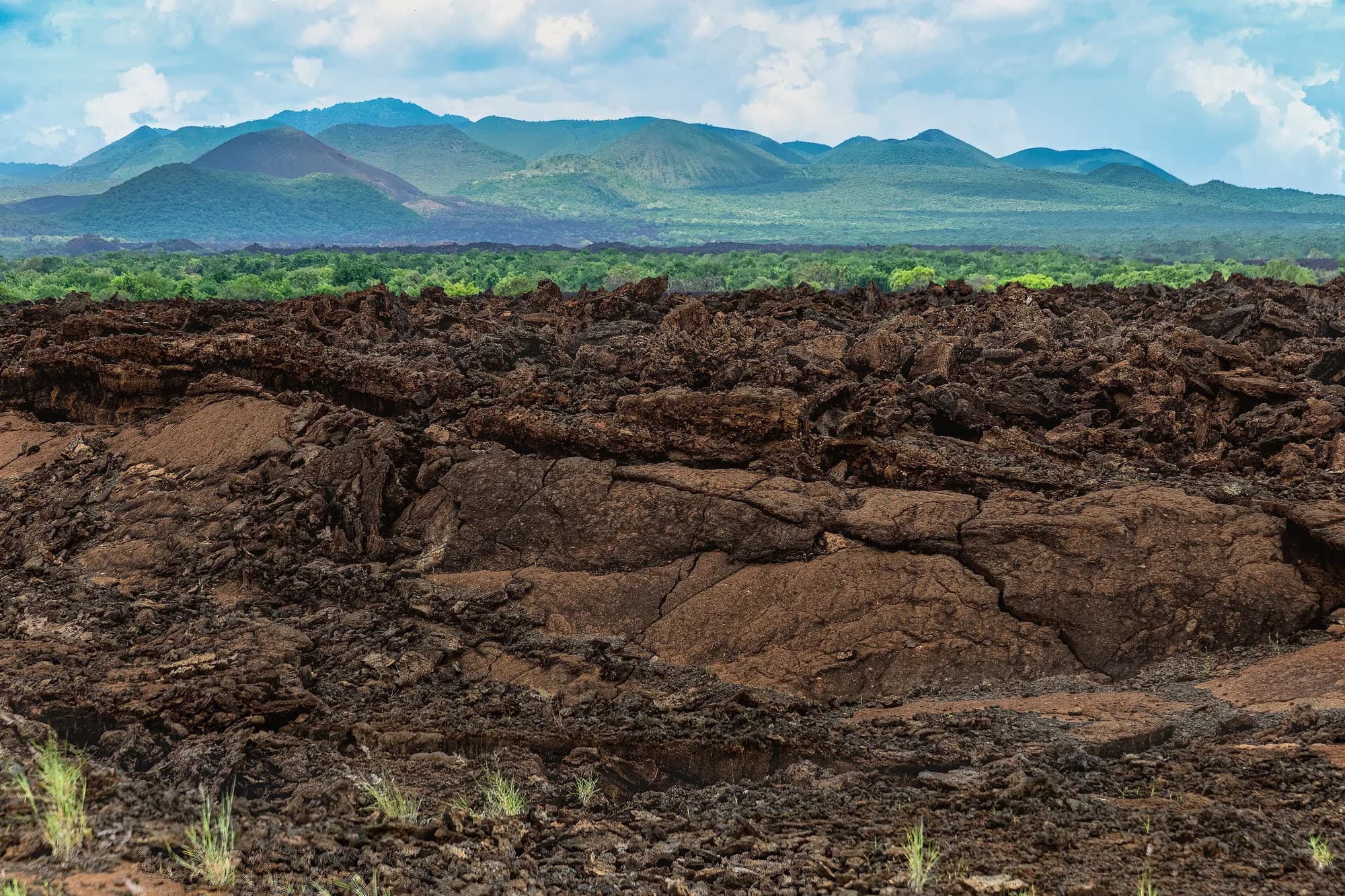
Read 28 September 2026. The Shetani lava flow is given as 8 kilometres long, 1.6 wide and 5 metres deep, formed 240 years ago, with shetani given as the Swahili for devil. Mzima Springs is given as around 48 kilometres from Mtito Andei, fed from an underground reservoir beneath the Chyulu Hills, with the water running two kilometres downstream before going underground again. The Yatta Plateau, which is Tsavo East's, is given as a ridge running 290 kilometres from Ol Doinyo Sabuk and is described as the world's longest lava flow. Lugard Falls, also Tsavo East's, is the Galana's passage over volcanic rock worn into flattened ledges.
https://tsavotrust.org/four-of-the-tsavo-conservation-areas-most-spectacular-topographical-phenomena/From Amboseli, which is the journey this park is built around
The single most common approach to Tsavo West that is not off the main road is from Amboseli, east through the Kimana corridor and round or through the Chyulu country to Chyulu gate. It is the journey the KWS package rate is quietly pricing — the schedule carries Tsavo West and Amboseli as a pair at USD 150 for a non-resident adult, and does not carry a pair for any other combination involving this park.
Leaving the corridor, from the north
| Turn off at | For | Note |
|---|---|---|
| Emali | Amboseli | An SGR station as well as a road junction |
| Mtito Andei | Tsavo West | SGR station and the main gate; Mzima is around 48 km from here |
| Manyani | Tsavo East | The direct Nairobi entrance to the other park |
| Voi | Tsavo East, and the Taveta road | SGR station; also how you reach Tsavo West's southern gates |
The last row is the one that catches people. Voi is a Tsavo East gate town, and it is also the turn for the Voi-Taveta road, which is the only sensible way to Maktau, Ziwani and Jipe. Tsavo West's two halves are reached from two entirely different points on the map.
The classic southern circuit runs Nairobi, Amboseli, Tsavo West, Tsavo East and finishes on the coast, and Tsavo West sits in the middle of it as the transition — from the open dusty plain of Amboseli to the broken volcanic country here, and then out into the flat red scrub of Tsavo East. Doing it in that order is the right order, because the landscape changes at every step and nothing repeats.
Kenya Wildlife Service — Conservation Fees, October 2025 schedule
Carried from the verified fee record this site holds against KWS's own published schedule, taken from the PDF above on 27 September 2026. We tried the department again on 28 September 2026 and the read failed at the same wall: the fee PDF returned a TLS certificate that could not be verified, and so did the department's own December 2025 press release on the rhino sanctuary. The figures here are therefore carried as recorded rather than re-read live, and no operator's copy of the tariff has been substituted for the department's — an operator's fee table is not a source, however confidently it is laid out. One caveat belongs on the face of the page rather than in a footnote: the schedule bands parks rather than naming a rate park by park, and Tsavo West sits in the band printed "WILDERNESS PARKS (A)", given on the document as "Tsavo East and Tsavo West National Parks". The mapping from that band to this park is the single step between the document and these tables.
https://kws.go.ke/wp-content/uploads/2026/05/KWS-Conservation-Fee-October-2025.pdfTsavo Trust — Four of the Tsavo Conservation Area's most spectacular topographical phenomena
Read 28 September 2026. The Shetani lava flow is given as 8 kilometres long, 1.6 wide and 5 metres deep, formed 240 years ago, with shetani given as the Swahili for devil. Mzima Springs is given as around 48 kilometres from Mtito Andei, fed from an underground reservoir beneath the Chyulu Hills, with the water running two kilometres downstream before going underground again. The Yatta Plateau, which is Tsavo East's, is given as a ridge running 290 kilometres from Ol Doinyo Sabuk and is described as the world's longest lava flow. Lugard Falls, also Tsavo East's, is the Galana's passage over volcanic rock worn into flattened ledges.
https://tsavotrust.org/four-of-the-tsavo-conservation-areas-most-spectacular-topographical-phenomena/From the coast, from Taveta, and the self-drive question
From Mombasa and the south coast, Tsavo West is the further of the two Tsavos and the less commonly sold, which is why a coast beach holiday almost always ends up in Tsavo East. It is entirely reachable — up the A109 to Mtito Andei, or via Voi and the Taveta road for the southern gates — and it is a longer day than the Tsavo East version.
- From Diani, factor in the Likoni crossing at Mombasa in both directions. It is the most variable part of the journey and it is in nobody's quoted timing.
- The Taveta road from Voi is the approach to the southern sector and to Lake Jipe, and it also connects to the Tanzanian border post at Taveta.
- The park has airstrips and scheduled light aircraft serve the region from Nairobi's Wilson airport. Flying removes the transit and removes your vehicle with it.
- Light-aircraft baggage limits are strict and are normally a soft bag. Check the figure rather than assuming it.
- Self-driving is legal and, in the northern triangle, straightforward — the features are close together and signposted, and the distances are short by Tsavo East standards.
- Self-driving the southern sector is not the same proposition: rough ground, black cotton in the wet, very little traffic and an international border. Take a guide or do not go.
- A self-driver pays the conservation fee plus the vehicle charge, which for an under-six-seat car is KSh 600 a day.
The honest recommendation on self-driving
Tsavo West is a better park to self-drive than Tsavo East, because a mistake in the north costs you an hour rather than an afternoon, and because the features are findable. But it is a much worse park to self-drive if seeing animals is the object, because the cover means an unguided visitor will drive past most of what is there. Self-drive it for the landscape; hire a guide for the wildlife. Those are two different trips and it is fine to want the first one.
Why we publish no drive times
There is exactly one distance on these ten pages — Tsavo Trust's around 48 kilometres from Mtito Andei to Mzima Springs — and not a single driving time in hours. That is a decision rather than an oversight, and the reasoning is the same as on Tsavo East's pages.
- We hold no official KWS figure for any internal distance, and kws.go.ke refused automated requests on 28 September 2026.
- Published times from operators for the same two points vary by more than the honest margin of error, and we will not average other people's guesses into an authoritative-looking figure.
- Inside the park the time depends on the season, the state of the tracks, the vehicle and how often you stop. A game drive is not a transfer.
- In this park specifically, the northern and southern halves are reached from different roads, so a single figure for the park would be meaningless even if we had one.
What to do instead
Ask the person meeting you for their own figure for your specific route, in their vehicle, in the month you are travelling, and then add an hour. That is a worse-sounding answer than a number on a page and a much better one to plan against. Where this site can state a distance with a source, it does, which is why the Mzima figure is here and nothing else is.
Tsavo Trust — Four of the Tsavo Conservation Area's most spectacular topographical phenomena
Read 28 September 2026. The Shetani lava flow is given as 8 kilometres long, 1.6 wide and 5 metres deep, formed 240 years ago, with shetani given as the Swahili for devil. Mzima Springs is given as around 48 kilometres from Mtito Andei, fed from an underground reservoir beneath the Chyulu Hills, with the water running two kilometres downstream before going underground again. The Yatta Plateau, which is Tsavo East's, is given as a ridge running 290 kilometres from Ol Doinyo Sabuk and is described as the world's longest lava flow. Lugard Falls, also Tsavo East's, is the Galana's passage over volcanic rock worn into flattened ledges.
https://tsavotrust.org/four-of-the-tsavo-conservation-areas-most-spectacular-topographical-phenomena/